Snorkelling
Destination NSW

Details

Curated selection of points
Fast chargers available along the route

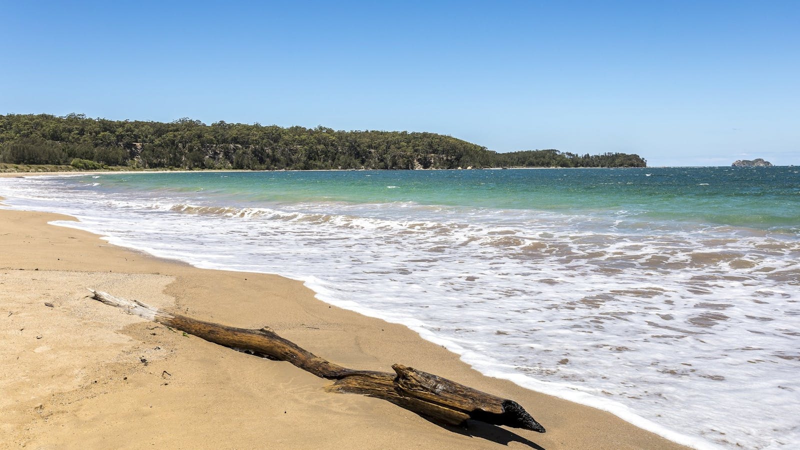
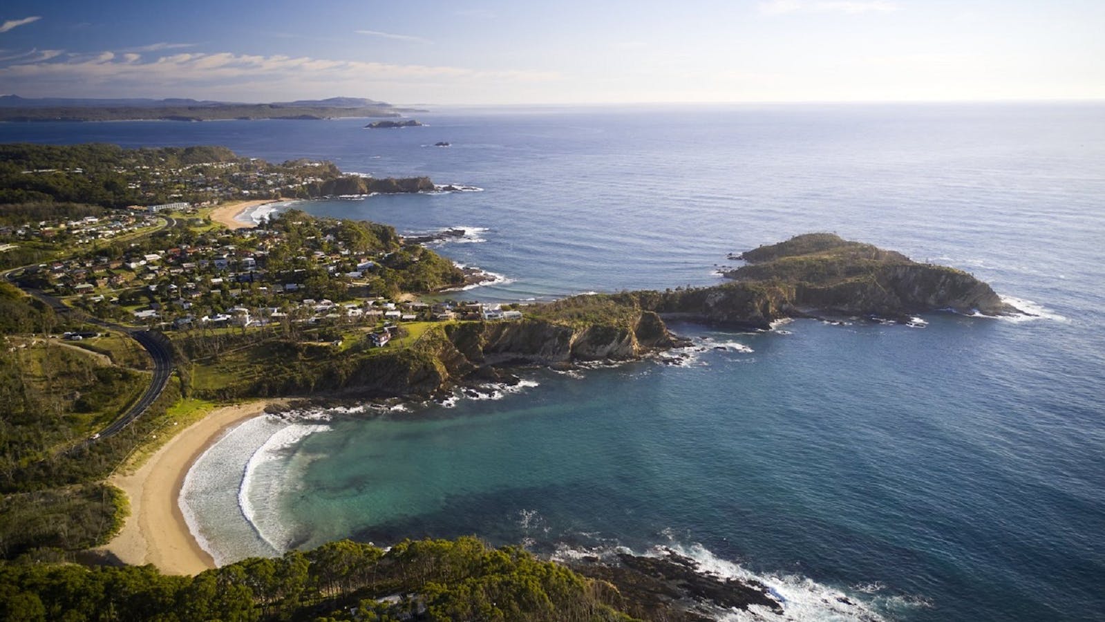
Explore sealife and pristine waters of the Batemans Marine Park. More than 20 islands dot Eurobodalla's coastline including Montague Island!

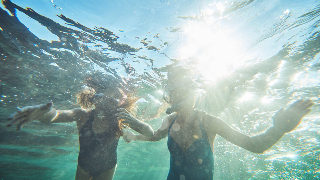
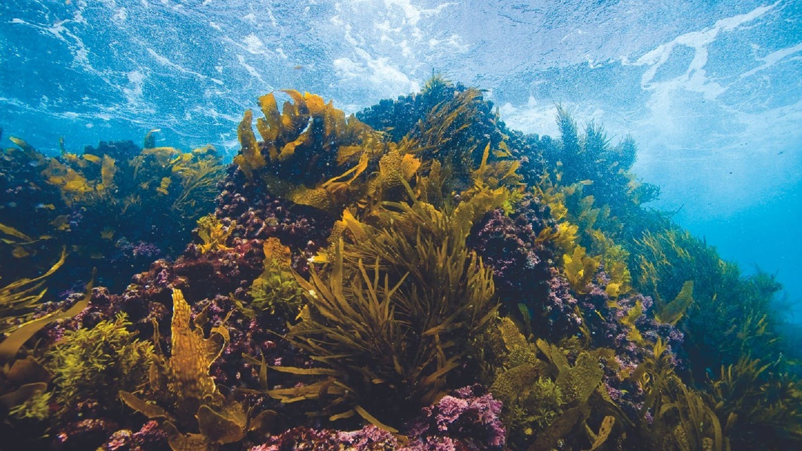
The pristine waters of the Batemans Bay Marine Park are home to exotically coloured fish, glowing jellyfish, big cruising rays, waving sponge beds and lush green kelp forests. Swimming and snorkelling with the seals at Montague Island is a 'must do' experience. Our snorkelling trails can be enjoyed by everyone with family friendly snorkelling in calm shallow water to more adventurous trails.
Open in mobile
1
Snorkelling Chain Bay to Acheron Ledge - Maloneys Beach

Snorkel from the calm and shallow beach to the left toward the rocks.
Open in mobile
Maloneys Beach, New South Wales, Australia, 2536
1800 802 528
info@eurobodalla.com.au
Get Directions
Snorkel from the calm and shallow beach to the left toward the rocks. Not far from shore you will find amazing rocky formations with plenty of nooks and crannies where sea creatures hide. Take the time to explore and spot abundant fish life in small groups and larger schools, rays, starfish and shell fish. Keep your eyes peeled for abalone and crayfish - hard to spot but great to eat (note that a fishing licence is required and bag limits and size restrictions apply).
How to get there: Head North from Batemans Bay eight kilometres on the Princes Highway. Turn right into Cullendulla Drive, Northcove Road to Maloneys Beach and onto Chain Bay. There is a sandy track down to the beach car park and a basic boat ramp.

Sights & Activities

Maloneys Beach
Eurobodalla Shire Council
Maloneys Beach, New South Wales, Australia, 2536
Get Directions

Maloneys beach is ideal for family outings with a wide grassy reserve, toilets, boat ramp, free electric barbecues and covered picnic tables.

Maloneys Beach is approximately 14 kilometres north of Batemans Bay township. Situated on the northern shore of Batemans Bay and adjacent to Murramarang National Park, the beach is enclosed by headlands and chain-like rock formations. Featuring protected coves, rockpools, visiting pods of dolphins, an expansive grass reserve which attracts lots of kangaroos, toilets and picnic area, it is an ideal family beach. Maloneys Beach is a recommended location for snorkelling, swimming and walking.
2
Snorkelling Sunshine Cove Beach

Sunshine Cove Beach is ideal for families keen to try some snorkelling in relatively calm waters.

Open in mobile
Sunshine Bay, New South Wales, Australia, 2536
1800 802 528
info@eurobodalla.com.au
Get Directions
How to get there: Sunshine Cove Beach is only five kilometres south of Batemans Bay along Beach Road at Sunshine Bay.
Sunshine Cove Beach is ideal for families keen to try some snorkelling in relatively calm waters. It's a picturesque location, protected from southerly swells and enclosed by two prominent headlands. The beach is a mixture of pebbles and sand and is a real getaway close to town.
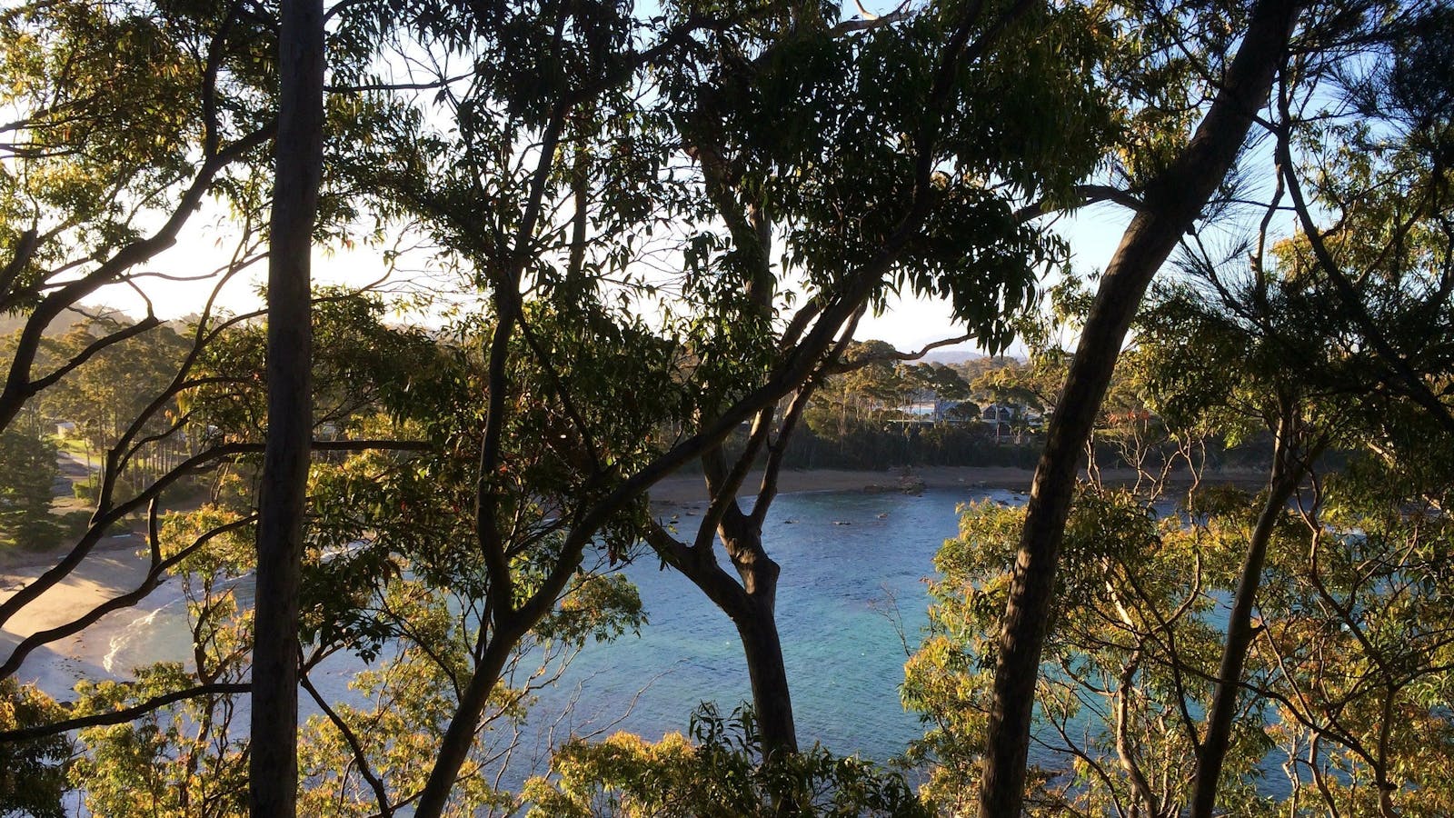
There is a mixture of rocky reef, sandy bottom and seaweed beds. Novices and experienced snorkellers are likely to see endemic fish such as red morwong, luderick, bream and groper as well as lobsters and abalone. It is a Habitat Protection Zone of the Batemans Marine Park, so certain rules apply. Please check the zoning plan available from visitor centres and most bait and tackle stores in the area.
3
Snorkelling McKenzies Beach

McKenzies Beach is a small, beautiful, undeveloped beach that should only be tackled by more experienced snorkelers.
Open in mobile
Malua Bay, New South Wales, Australia, 2536
1800 802 528
info@eurobodalla.com.au
Get Directions
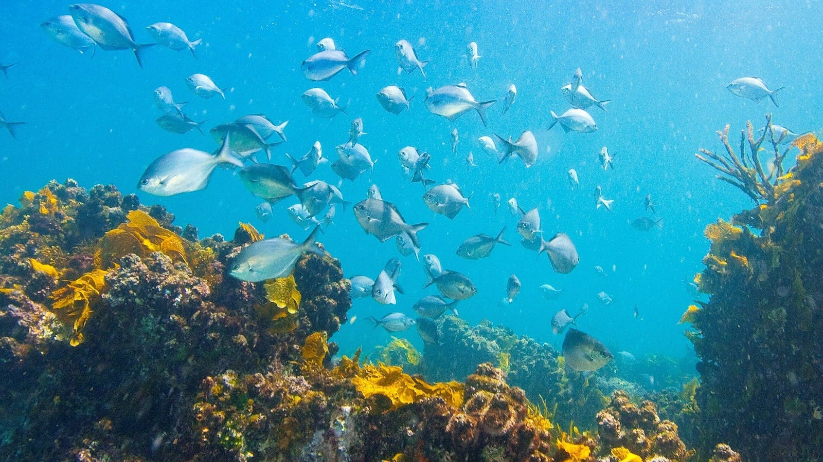
McKenzies Beach is a small, beautiful, undeveloped beach that should only be tackled by more experienced snorkelers. Enclosed by two headlands with rocks that ease down to greet the ocean and form natural reefs, conditions must be perfect if you're entering the water to snorkel. The beach is known for its rugged surf and is open to the swell, which can impact visibility.
Places to explore for experienced and fit snorkelling enthusiasts include the amphitheatre around the rocks at the southern end of the beach. Enter the water round the corner facing Jimmy's Island - the water depth is from five to eight metres deep. The amphitheatre is a special world of its own with spectacular rock formations and marine life such as baby cuttlefish. At the northern end of the beach, the wave and current movements have led to an exposed long reef to explore - the reef system is shallower and, in a nor-easter, is well protected.
How to get there: Drive south from Batemans Bay, to the end of Beach Road and then left onto George Bass Drive. Just past Malua Bay, watch out for a turnoff on the left into a small car park.

Sights & Activities

McKenzies Beach
Malua Bay, New South Wales, Australia, 2536
1800 802 528
info@eurobodalla.com.au
Get Directions
Free Entry

McKenzies Beach is a small, beautiful, undeveloped beach, popular with locals and visitors alike.

McKenzies Beach is a small, beautiful, undeveloped beach, popular with locals and visitors alike. It is a great spot for surfing or body boarding and snorkelling when the conditions allow. McKenzies Beach is located 14 kilometres South of Batemans Bay. Watch for the turn off from George Bass Drive as it is not signposted. Access to the beach is via a carpark next to the beach and there are no amenities.
4
Snorkelling Guerilla Bay

The water at Guerilla Bay is clear and inviting and provides different experiences for different levels of snorkellers.
Open in mobile
Guerilla Bay, New South Wales, Australia, 2536
1800 802 528
info@eurobodalla.com.au
Free Entry
Picnic Area
Picnic Area
Snorkelling
Get Directions
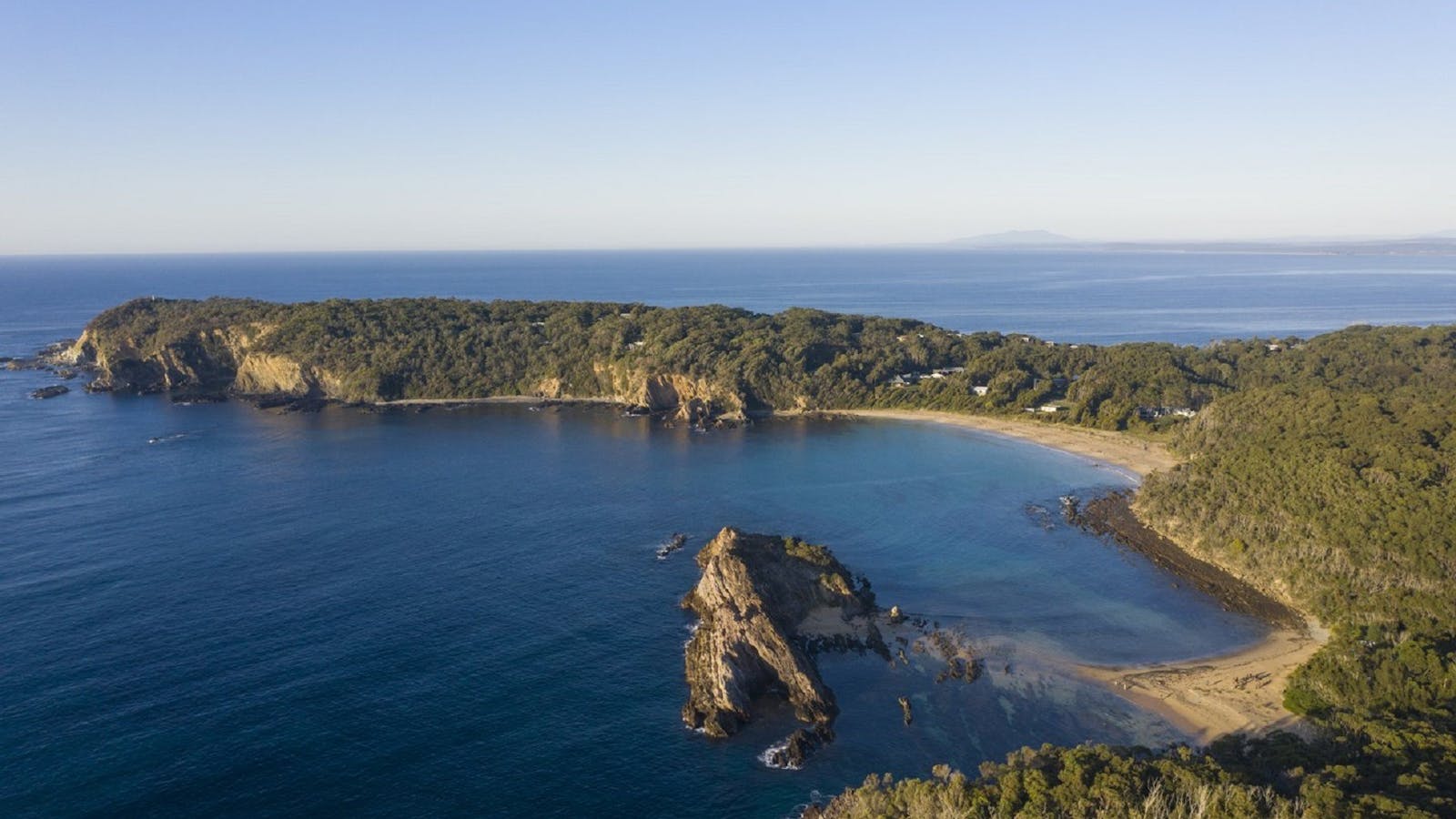
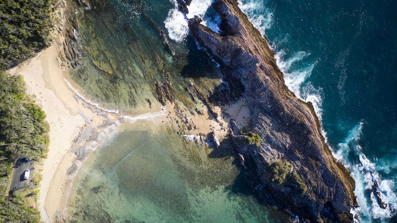
The water at Guerilla Bay is clear and inviting and provides different experiences for different levels of snorkellers. A prominent small rocky island is a feature of the bay and divides the safer more comfortable snorkelling waters to the south of the gravel spit and the more adventurous and dangerous waters to the north of the spit.
On this northern side is the pot. Depending on the tide this can be difficult to access as some jagged rocks need to be negotiated to get to the water - but for more experienced snorkellers, in the right conditions, it is worth the effort.
The sheltered bay on the southern side is rocky with a flat reef extending up in walls on a roughly 35-degree angle and sheer walls that stretch up to ten metres. The seaweed-covered rocks and the crevices between them offer shelter to a wide variety of fish species such as blue groper, wrasse, luderick and more.
How to get there: Turn into Guerilla Bay from George Bass Drive onto Burri Point Road, then left onto Beach Parade and right into to the beach car park.
Burrewarra Point Banksia Walk
Guerilla Bay, New South Wales, Australia, 2536
1800 802 528
info@eurobodalla.com.au
Get Directions
Free Entry
Birdwatching, Hiking, Walks

Burrewarra Point has a charming walk through a mature banksia forest with views of the coast and hinterland.

Burrewarra Point has a charming walk through a mature banksia forest with views of the south coast and hinterland. It is a fine place to spot whales from September to November. In autumn, the large grey-green flower spikes of the banksias open, attracting a variety of nectar-eating birds. The cliff edges are not fenced making the walk unsuitable for toddlers and small children.
Length: 1.5 kilometres return Time: 50 minutes Grade: Easy Start: Carpark at end of Burri Point Road, Guerilla Bay, off George Bass Drive, south of Batemans Bay
5
Snorkelling Tomakin Cove

Tomakin Cove is a protected, sandy cove with shallow lagoon-like qualities making it popular with novice snorkellers, groups and parents with young children.
Open in mobile
Tomakin, New South Wales, Australia, 2537
1800 802 528
info@eurobodalla.com.au
Get Directions
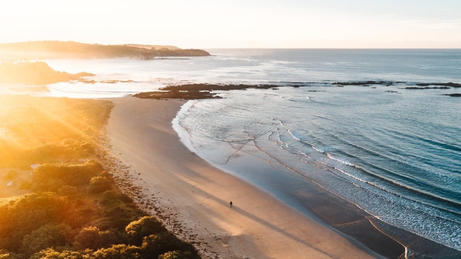
Tomakin Cove is a protected, sandy cove with shallow lagoon-like qualities making it popular with novice snorkellers, groups and parents with young children. The cove is in Broulee Bay and is almost completely surrounded by rocky outcrops and reefs - on its southern side rocky platforms extend out into the bay, while to the north the cove is sheltered by Melville Point.
Above the water, the rocks at Tomakin Cove are known for their beautiful afternoon hues, while below the water snorkellers commonly see stingray species such as stingarees and eagle rays buried in the seabed floor, as well as schools of small whiting, mullet and baitfish feeding over the sand. On the seaward side of the cove the dense cover of kelp shelters many small fish, and garfish are common in the deeper gutters near Melville Point.
How to get there: Turn off George Bass Drive onto Ainslie Parade, follow this to the end and turn right onto Red Hill Parade. Park in the Barlings Beach car park below Melville Point, cross the road and use the track going down to the cove.

Sights & Activities

Tomakin
Tomakin, New South Wales, Australia, 2537
Get Directions
Birdwatching, Boating, Camping, Canoeing/Kayaking, Cycling, Fishing, Scenic Drives, Scuba Diving, Snorkelling, Surfing, Swimming, Walks

With three picturesque beaches and a winding clear river, Tomakin provides enticing options for swimming, snorkelling and walking.

Tomakin sits on one of the most stunning little patches of coast in New South Wales.
Head to Melville Point Lookout for sweeping views in either direction and to help decide where to go next. To the north are the wide soft sands of Barlings Beach, which curves gently up the coast to Barlings Island. This small rocky island protects the far end of the beach, creating an idyllic place to swim, picnic and snorkel.
At the bottom of the lookout to the south is Tomakin Cove, one of the prettiest little beaches anywhere. Sheltered on both sides, the water here is calm and almost always crystal clear. It’s a fantastic spot to swim and snorkel. The cove leads on to the larger Tomakin Beach, which runs to the mouth of the Tomaga River. The entire area is flanked by stunning rocky outcrops which change colour as the sun moves across the sky, and sit in deep contrast to the clear blues of the surrounding water. The wooden jetties of Mossy Point project temptingly across the river, and often call the more adventurous for a quick swim across.
Tomaga River itself is sandy-banked, clean and inviting. Towards its mouth the running tide carves small drop-offs, ideal for jumping from the banks into the water (check the depth first). At low tide, thousands of soldier crabs can be found feeding along the wide sandy flats. From its opening into the sea, the river curls back behind the beaches making an interesting and scenic walk. Pelicans and large stingrays are often around the ramp, and the river shore in this area is a popular place to swim and fish.
Tomakin doesn’t have a shopping strip however, the Rivermouth General Store (cafe) is within walking distance of the beaches and has a great surf vibe. There is an IGA supermarket and bottle shop on George Bass Drive. Dining options include Smokey Dan's Restaurant, Bar and Grill which has a relaxed eclectic feel, and the Tomakin Sports and Social Club. Both of these offer entertainment and dining, particularly during holidays.
6
Snorkelling Candlagan Creek

Candlagan Creek is an estuary that extends from the northern end of Broulee Beach to approximately five kilometres inland.
Open in mobile
Broulee, New South Wales, Australia, 2537
1800 802 528
info@eurobodalla.com.au
Get Directions
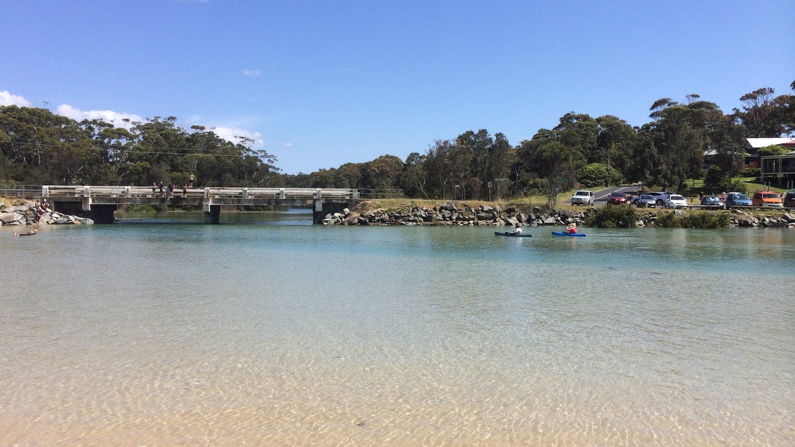
Candlagan Creek, Mossy Point is a favourite spot for children and families in the Eurobodalla and plays an important part in the marine ecosystem with juvenile fish hidden amongst the seagrass beds and mangroves. The estuary extends from the northern end of Broulee Beach to approximately five kilometres inland.
At its mouth, Candlagan Creek is quite shallow and sheltered from adverse ocean conditions by a wide sandbar. On its northern edge, there is a grassy bank with shady trees and picnic tables. Being a shallow estuary type environment, it is a good snorkelling spot for beginners with weedy rocky outcrops, marine molluscs, small fish, and small rays common sights.
Be aware that the current can be very strong where the creek meets the sea, especially on an outgoing tide, while sharp oysters attached to the rocks can be hazardous to feet.
How to get there: Turn off the Princes Highway at Mogo onto Tomakin Road. Follow Tomakin Road to George Bass Drive, and turn right. Shortly after the Tomago River bridge, turn left onto Annetts Parade. Follow Annetts Parade through Mossy Point until it turns onto Beach Road. You'll see a small carpark on the left just before you cross the bridge over Candlagan Creek.
7
Snorkelling Broulee Island

Broulee Island is regarded as one of the best snorkelling spots along the Eurobodalla coastline.
Open in mobile
Broulee, New South Wales, Australia, 2537
1800 802 528
info@eurobodalla.com.au
Snorkelling
Get Directions
How to get there: To get to Broulee Island follow the signs from George Bass Drive, turn on to Broulee Road which becomes Grant Street. Turn right onto Heath Street, left onto Bayside Street and finally right onto Harbour Drive, where you'll find a carpark at the end.
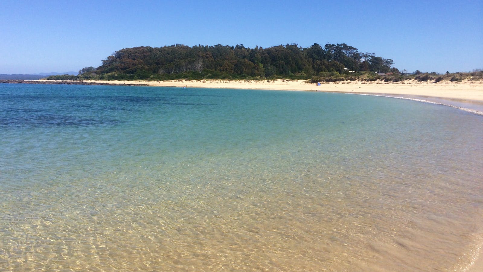
Broulee Island is regarded as one of the best snorkelling spots along the Eurobodalla coastline. Two areas on the island are sought by snorkellers - one is at the bay near Pink Rocks which is the north eastern point of the island. The bay is about two to four metres deep and is protected in terms of swell. It's home to seagrass meadows, with stingrays and banjo sharks sometimes seen. The site is good for beginners in the calm conditions, as is the southern side of the island which is also protected in terms of swell.
The southern side is an extremely productive area, with different habitats around the reef system such as sand flats, big reef walls and shallow reefs, all combining to make it a superb spot for snorkelling. You may be lucky enough to spot a green turtle, or the endangered weedy sea dragon and eastern blue devil fish.
Broulee Beach
Broulee, New South Wales, Australia, 2537
1800 802 528
info@eurobodalla.com.au
Get Directions
Free Entry
Public Toilet
Public Toilet
Fishing, Surfing, Swimming, Walks
Parking

Situated 20 kilometres south of Batemans Bay, Broulee is a long sweeping beach protected by Broulee Island.
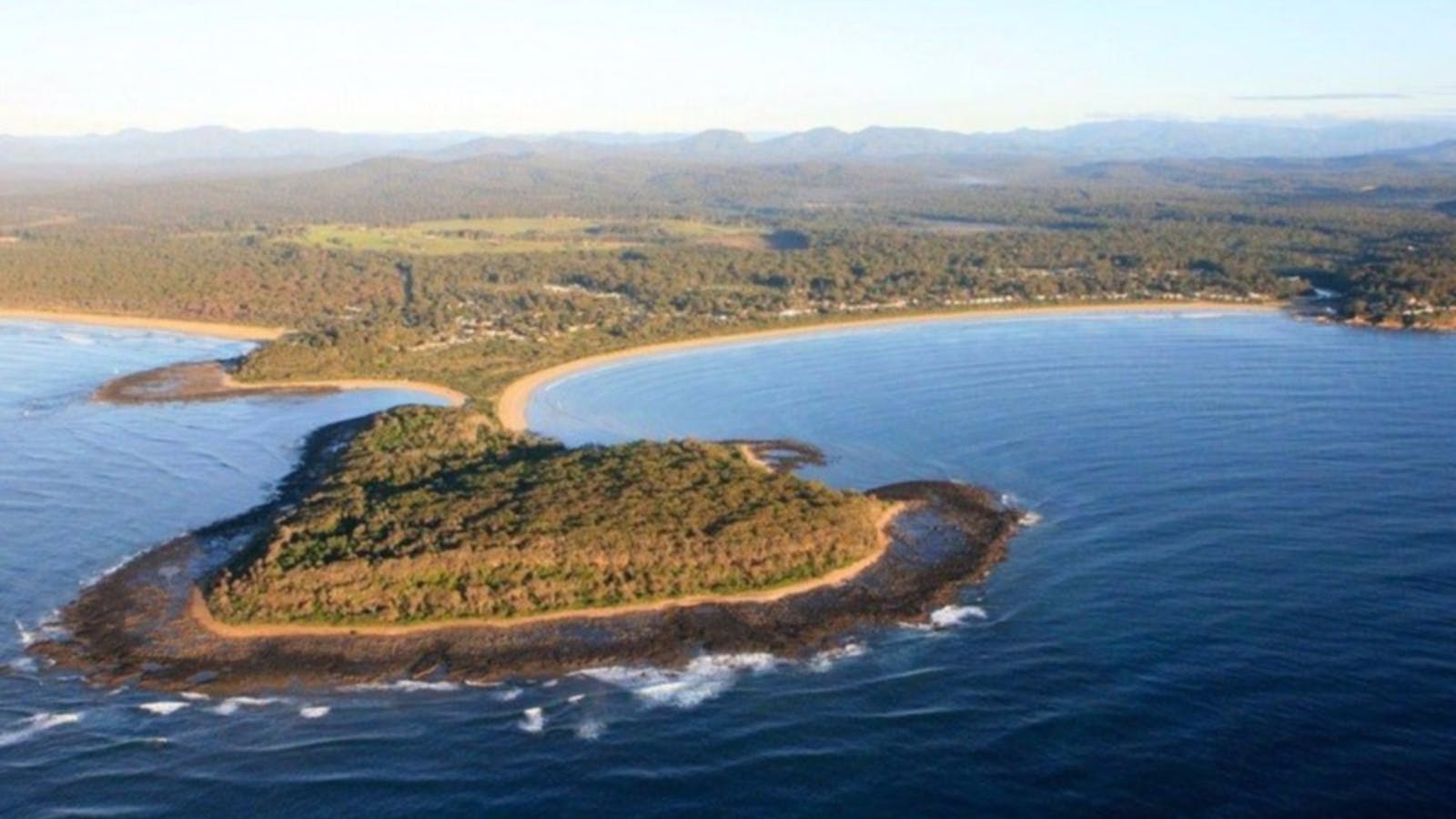
Situated 20 kilometres south of Batemans Bay, Broulee is a long sweeping beach protected by Broulee Island. This is a favourite beach with tourists, and is ideal for families.
The fishing is great at Broulee, there's good diving and snorkelling in the area and the surfing is some of the best on the South Coast. Broulee Beach is well protected and the sand dips gradually, which makes it a family favourite. Explore Broulee Island, a nature reserve with outstanding views along the coast.
Broulee Island Nature Reserve Walk
Broulee, New South Wales, Australia, 2537
1800 802 528
info@eurobodalla.com.au
Get Directions
Free Entry
Public Toilet, Picnic Area
Picnic Area, Barbeque
Public Toilet
Birdwatching, Fishing, Swimming
Parking

The four kilometre Broulee Island Walk begins south of the main beach at Broulee, across a permanent sand bar.

Broulee Island is joined to the mainland by a permanent sandbar and is always accessible. Find it at the southern end of North Broulee Beach or park at Broulee Surf Club and head north around the rocks to Shark Bay, where a short beach walk leads you to the island. Photographers will enjoy the ocean vistas across pristine rock pools. The walk features native plants and is known for birdlife, including the superb fairy wren and white-bellied sea eagle.
Length: four kilometres return Time: one hour, two hours including the beach walk Grade: ModeratebrStart: Walk north from Broulee Surf Club, or south along North Broulee Beach
8
Snorkelling Potato Point

Potato Point is nine kilometres east of Bodalla. At Potato Point, snorkellers can find themselves suddenly enveloped in a school of kingfish or salmon.
Open in mobile
Potato Point, New South Wales, Australia, 2545
1800 802 528
info@eurobodalla.com.au
Get Directions
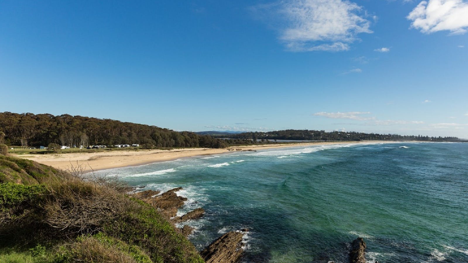
Potato Point is nine kilometres east of Bodalla. Follow Potato Point Road to the end, then turn left onto Long Street, left again on to Short Street, then right back on to Long Point Street. On the left of the street you'll find the beach reserve and a small drive to the boat ramp.
At Potato Point, snorkellers can find themselves suddenly enveloped in a school of kingfish or salmon. It's not an area for novices, and even experienced snorkellers need to be aware of a few important tips to make exploring this diverse and exciting marine habitat a safe and rewarding experience.
On the northern side of the point facing Potato Point Beach is a concrete boat ramp which is a good entry and exit point from the water, but there is a slight rip near the boat ramp which needs to be considered. The southern side of the point is more exposed and can be dangerous.
Marine life you might encounter at Potato Point includes wobbegongs, Port Jackson sharks and stingrays. The rocky reefs and sandy gutters also contain sea squirts and sea urchins.
9
Snorkelling Bar Beach South

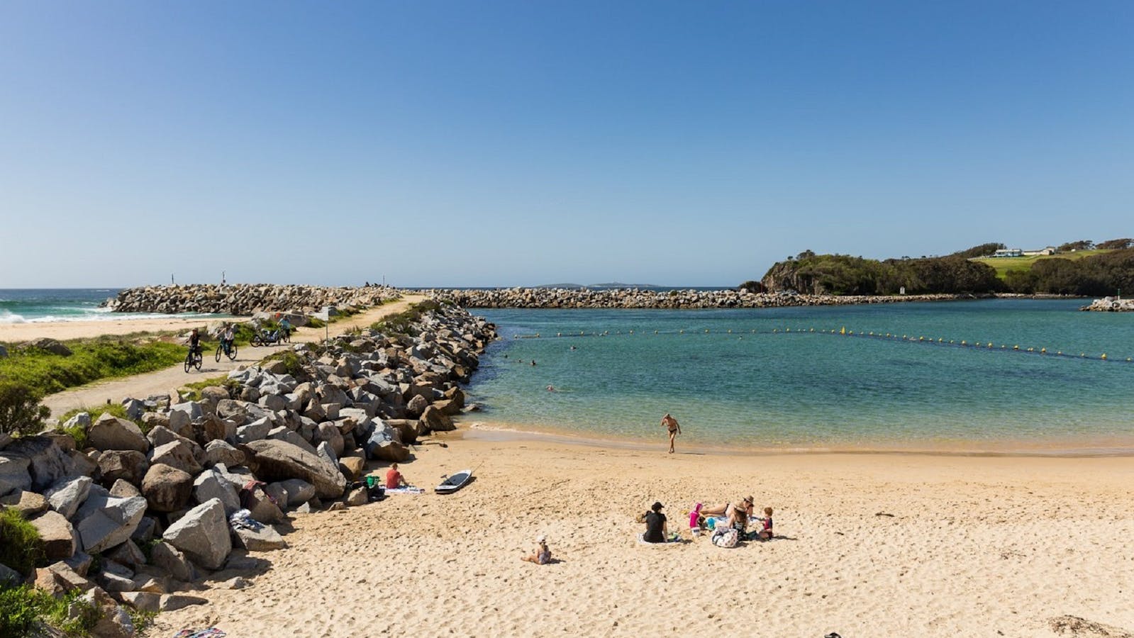
One of the safest beaches for children to learn to snorkel along the Eurobodalla coastline is Narooma's Bar Beach South.
Open in mobile
Narooma, New South Wales, Australia, 2546
1800 802 528
info@eurobodalla.com.au
Get Directions
Head north on the Princes Highway across Narooma Bridge and turn right into Dalmeny Drive. After 1km turn right onto Centenary Drive and continue to the Apex Park carpark.
One of the safest beaches for children to learn to snorkel along the Eurobodalla coastline is Narooma's Bar Beach South. Its naturally enclosed and protected position near the mouth of the Wagonga Inlet is further enhanced by the break wall at its northern end.
The marine habitat includes juvenile fish, squid and jellyfish. It's also possible to occasionally see small seahorses which will be sure to give young naturalists a fun and rewarding introduction to the marine world.
The beach is enclosed by netting and its sheltered position makes it popular not only with novice snorkellers but with divers as well.
Close to Bar Beach South is Apex Park which has all the necessary amenities for families making a day of it, including a playground, covered picnic tables, barbecues and plenty of parking.
Apex Park Picnic Area Narooma
Narooma, New South Wales, Australia, 2546
1800 802 528
info@eurobodalla.com.au
Get Directions
Free Entry
Public Toilet, Picnic Area
Picnic Area
Public Toilet
Birdwatching, Scenic Drives, Walks
Parking

If you are looking for that perfect picnic area then look no further. Sit back and take in the stunning views of the Wagonga Inlet.
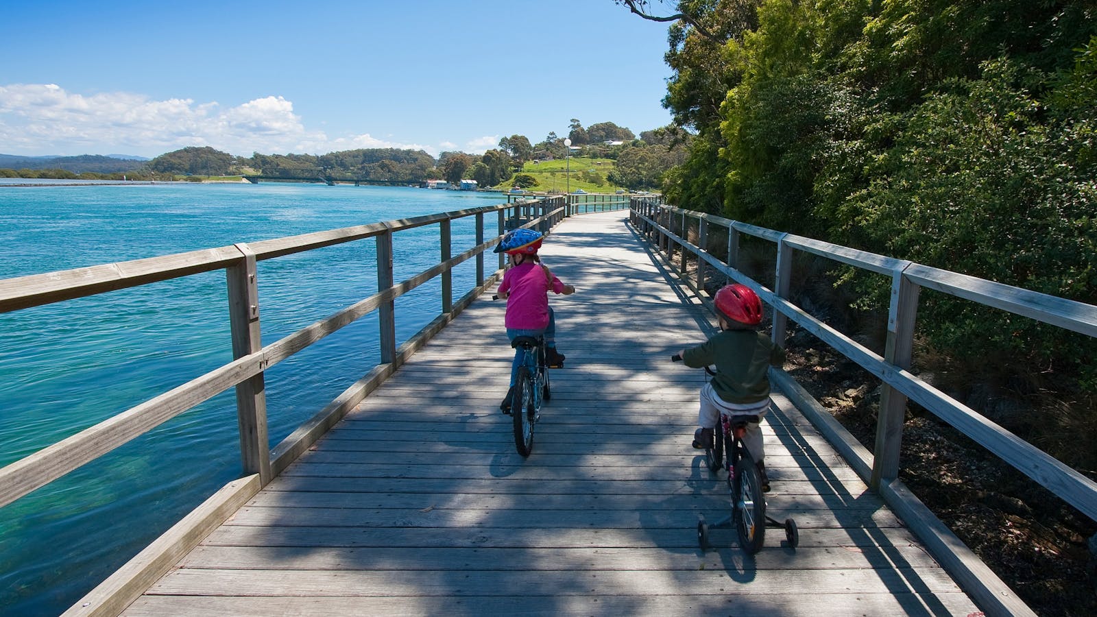
If you are looking for that perfect picnic area then look no further. Sit back and take in the stunning views of the Wagonga Inlet whilst enjoying a picnic or barbecue lunch. After lunch take your pick from a number of walks which start from the picnic area including the picturesque Mill Bay Boardwalk, Narooma Breakwall or the Narooma-Kianga-Dalmeny shared walkway/cycleway. If you would prefer a swim you don't need to walk far and you will find the beautiful Bar Beach.
Toilet facilities, fresh water, boat ramp and playground available.
Mill Bay Boardwalk Narooma
Eurobodalla Tourism
North Narooma, New South Wales, Australia, 2546
1800 802 528
info@eurobodalla.com.au
Get Directions
Free Entry
Picnic Area
Picnic Area
Birdwatching, Cycling, Fishing, Walks
Parking

Along the scenic Mill Bay Boardwalk, gaze out on the beautiful emerald water and see that it is teeming with life.

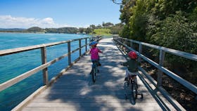
The 350 metre Mill Bay Boardwalk from Apex Park (on the northern side of the inlet) is the perfect way to appreciate the natural beauty of Narooma and watch the many activities on its expansive waterway. Look out for large schools of fish and stingrays as you walk. Continue your walk over the bridge and wind your way along Riverside Drive past mangroves to the seafood eateries and cafés at Forsters Bay. Or follow the foreshore in front of the caravan park around past the jetty to Rotary Park, on to Australia Rock and the break wall at the Wagonga Inlet entrance.
The distance is 700 metres to four kilometres return, Approximate walking time is 30 minutes to two hours. The grade is easy, level, wheelchair access on boardwalk. The start is located at Apex Park/Boat ramp off Centenary Drive on the northern side of the inlet.
10
Snorkelling Montague Island

One of the greatest snorkelling adventures in the Eurobodalla is a trip out to Montague Island to snorkel and swim with the seals.

Open in mobile
Montague Island, New South Wales, Australia, 2546
1800 802 528
info@eurobodalla.com.au
Get Directions
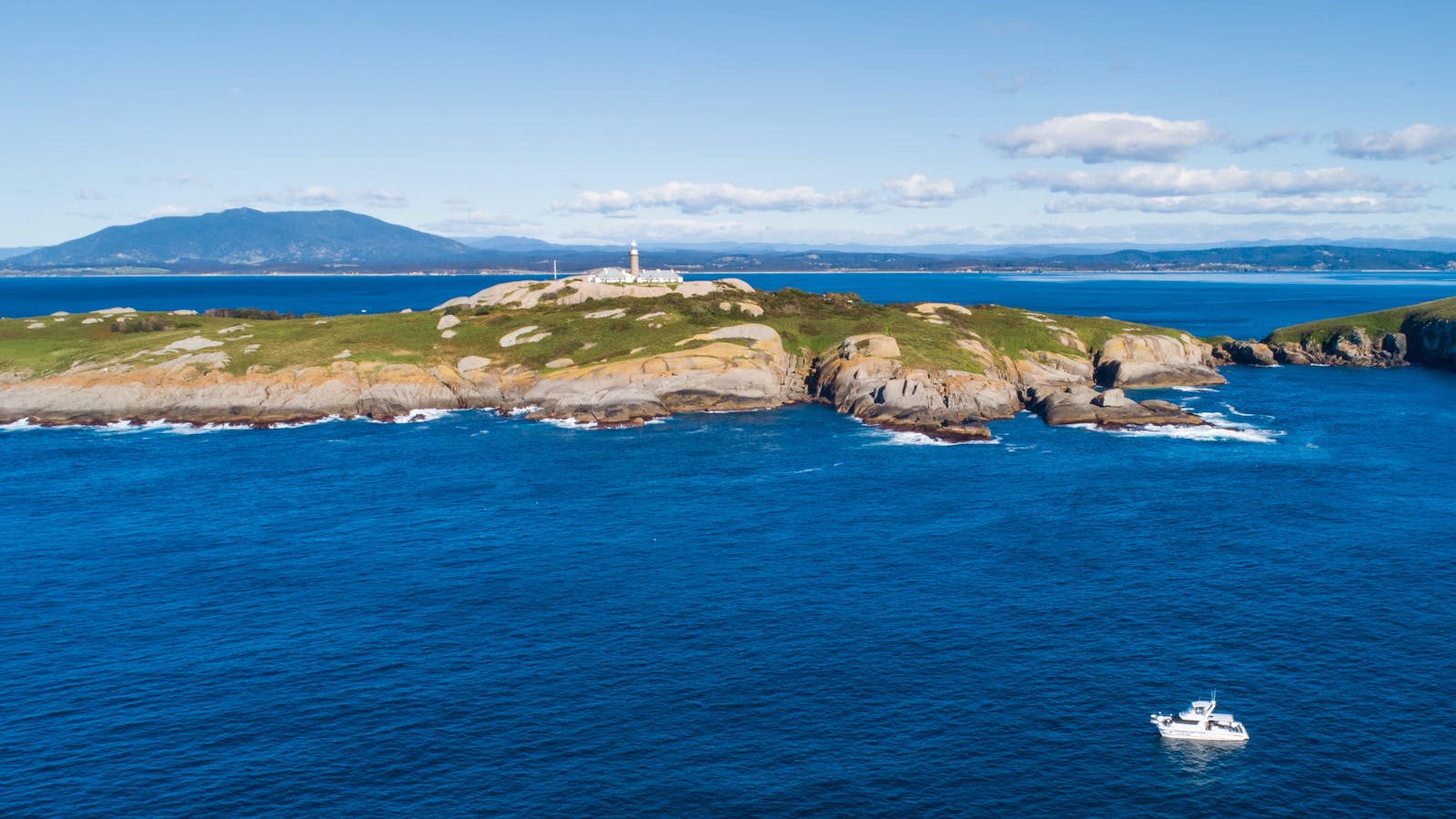
One of the greatest snorkelling adventures in the Eurobodalla is a trip out to Barunguba Montague Island to snorkel and swim with the seals. Depending on the season, between 400 and 2000 New Zealand and Australian fur seals inhabit the iconic granite rocks that distinguish this special wildlife sanctuary, looked after by the NSW National Parks and Wildlife Service. The island is a destination for eco-tourists, whale watchers, lighthouse history buffs and divers looking for the endangered Grey Nurse Shark.
Less well-known is the unique opportunity to snorkel with the playful and curious island seals. Much of the water around the island is deep, so experience and confidence are a must, as is good weather, but the encounter with nature and the surreal view of the underwater kelp forest makes this a once-in-a-lifetime experience.
How to get there: Charter boats go out to the island from Narooma regularly. Tours can be booked for just snorkelling or combined with a tour of Barunguba Montague Island as a day trip or for a two-night stay in the refurbished lighthouse keeper's quarters.
Montague Island Adventures & Charter Fish Narooma
Narooma, New South Wales, Australia, 2546
0407 487 702
book@montagueislandadventures.com.au
Get Directions

Narooma Tours and Charter Fish Narooma offer fully catered trips ranging from two to 10 hours. Go fishing, diving, snorkelling or whale watching.

Montague Island Adventures and Charter Fish Narooma offer trips ranging from two to nine hours. Go fishing, diving, snorkelling, whale watching or enjoy a Barunguba Montague Island Tour or Evening Penguin tour - or a mix of all tour options.
The team specialises in small groups from shared charters to private charters with personalized service.
They have two purpose-built boats - Playstation, a 9.8-metre purpose-built fishing and tour boat, with toilet and cooking facilities, and Nitro, a 13.4-metre Noosa catamaran and the largest vessel in Narooma.
Montague Island Discovery Tours and Lighthouse Charters Narooma
Get Directions

Narooma Charters and Montague Island Tours
D Stuart
Narooma, New South Wales, Australia, 2546
0407 909 111
info@naroomacharters.com.au
Get Directions
Public Toilet
Public Toilet

Narooma Charters and Montague Island tours are one of the most experienced charter operators in Narooma, having over 32 years experience since starting in 1983.
Narooma Charters and Barunguba Montague Island Tours are some of the most experienced charter operators in Narooma, having over 40 years of experience since starting in 1983.
Experience the magic of Barunguba Montague Island, voted Tourism Australia’s top eco-tourism destination and wildlife hotspot for whale watching, seal viewing, penguin tours, scuba diving, snorkelling, seal dives, grey nurse shark dives, wildlife cruises and bird watching trips.
Their large and comfortable vessels are fully licenced and surveyed by the Maritime Authority.
'Sea Eagle' is a 42-foot Steber with a forward cabin giving maximum space at the rear for passengers. She gives a smooth comfortable ride and has a good reputation for reliability and seaworthiness.
'Dreamtime' is one of the most awesome charter boats in Australia. The ride is superb, the amount of room on the boat is incredible. Add to this the ability to stand on the bow and watch dolphins swimming through the tunnel makes 'Dreamtime' one of the best dive boats around. You can also venture up on the flybridge and join the captain for the journey to the island or help find the whales.
Underwater Safaris
Narooma, New South Wales, Australia, 2546
0415 805 479
hello@underwatersafaris.com.au
Get Directions
Pets Allowed, Public Toilet
Parking

Montague Island awaits you! Underwater Safaris can take you scuba diving, PADI courses, whale watching, wreck dives, dive with seals, free dive, entertain kids at

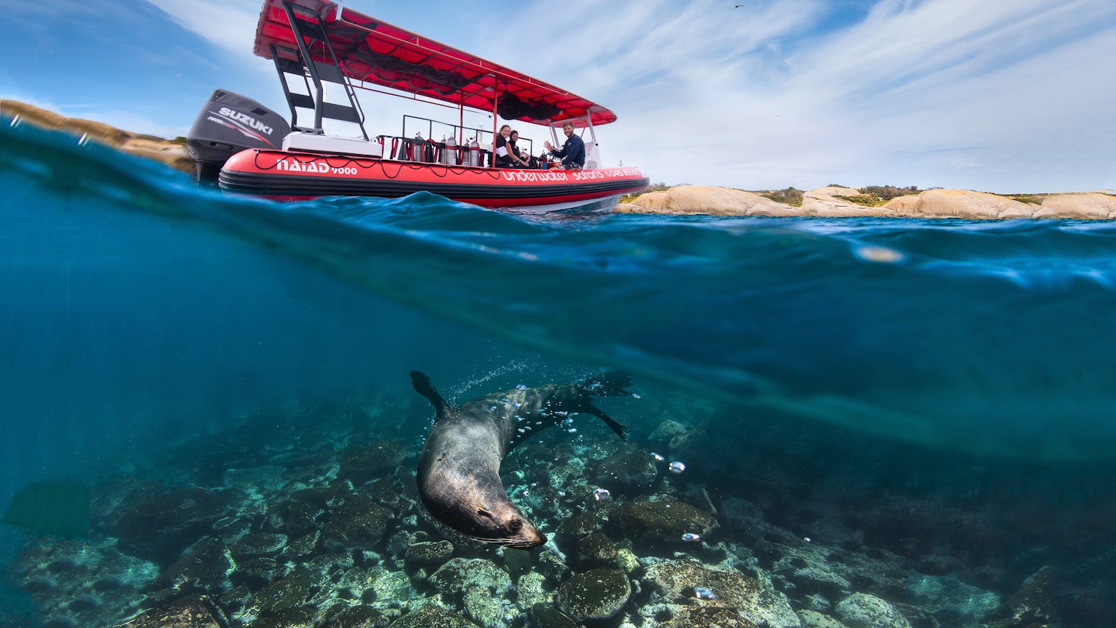
Get whisker to whisker snorkelling and scuba diving with the seals at Barunguba Island (Montague Island).
Get ready for one of the best experiences you can do on the South Coast!
The seals are not shy at all and will often jump in the water in large numbers to come and play with you. This is super fun and interactive experience.
Avoid the crowds, Underwater Safaris offers adventures specialising in smaller, more personalised groups. From Narooma travel by boat to the Island and snorkel/dive in the sheltered bays of the Batemans Marine Park. On your journey lookout for flying fish, dolphins, migratory birds and whales (September-November).
Get the kids into 'Squid Squad' snorkelling school! A fantastic holiday activity.
Why Underwater Safaris? Single use plastic free!
Underwater Safaris is proud as punch that they are the only operator in Narooma that don't offer fishing tours! Underwater Safaris think this is important and hope you do too!
The team is passionate about the ocean and are involved in local community groups and national research organisations.
Encouraging ethical interactions with all wildlife they encounter. Their awesome Instructors and guides will take excellent care of you.
Underwater Safaris love what they do, even diving on their days off!
All ages can enjoy snorkelling with the seals. This is an amazing experience and so much fun!
11
Snorkelling Mystery Bay

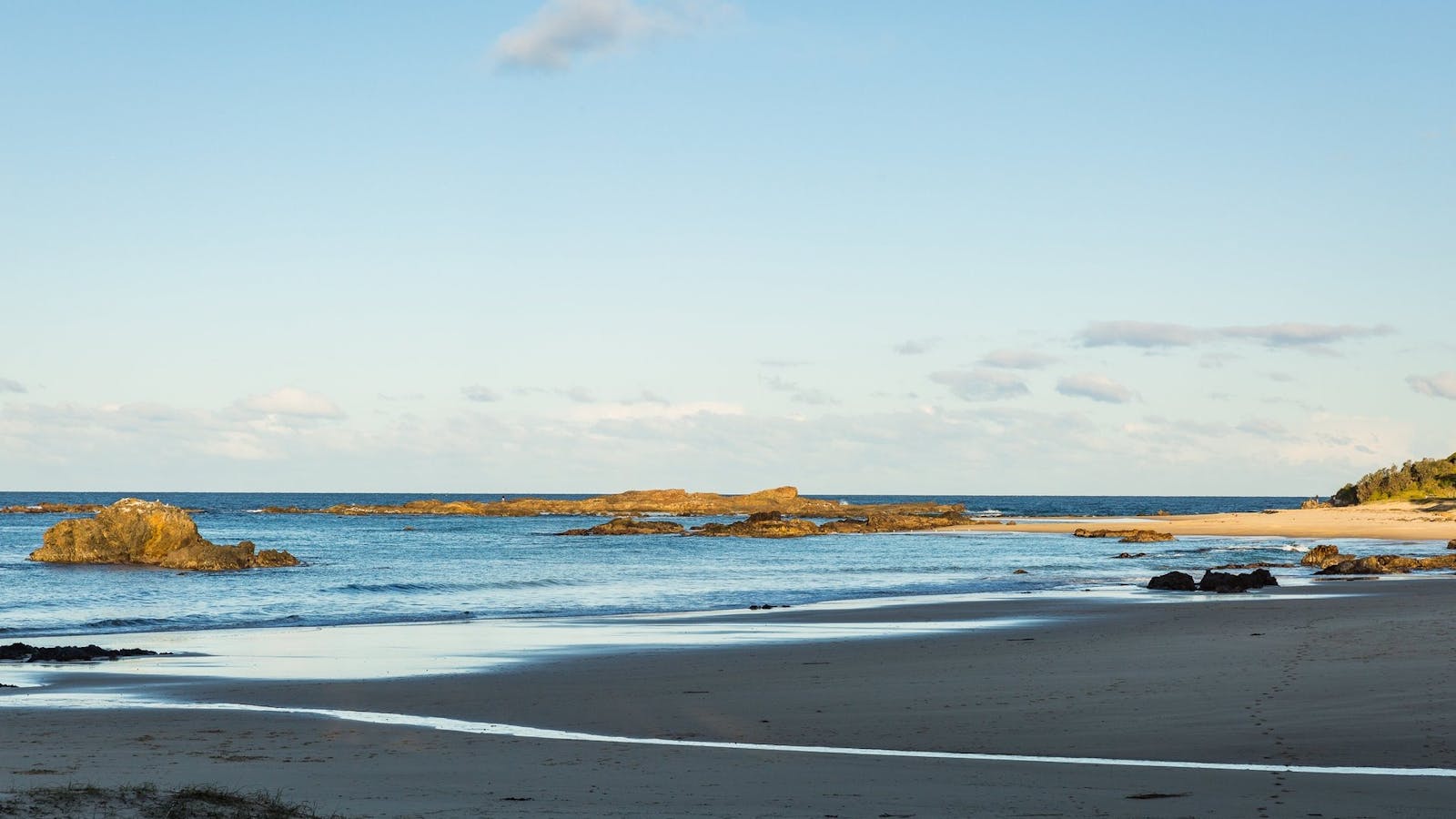
Mystery Bay boasts an array of stunning beaches and rock formations, ideal for snorkellers seeking to build skills and confidence.
Open in mobile
Mystery Bay, New South Wales, Australia, 2546
1800 802 528
info@eurobodalla.com.au
Get Directions
How to get there: Follow the Princes Highway south from Narooma for approximately 10 kilometres, then turn left onto Mystery Bay Road. There's a wonderful diving area around the rocks, or try the huge, sheltered rock pool a little north of Mystery Bay Beach. Head north through the primitive camp ground. You'll find a track that heads right. This will descend quite steeply as it gets to the pool.
Mystery Bay boasts an array of stunning beaches and rock formations, ideal for snorkellers seeking to build skills and confidence. The beach is split into two areas, the northern section and the smaller southern beach. The southern area is protected from large waves and is perfect for beginners to swim around the rock bars. For the adventurous, there are also deep channels around Mystery Bay with fantastic snorkelling areas.
Mystery Bay
Mystery Bay, New South Wales, Australia, 2546
Get Directions

The crystal-clear water, rock pools, caves and sandy beaches make this small yet stunning hamlet a must to explore.
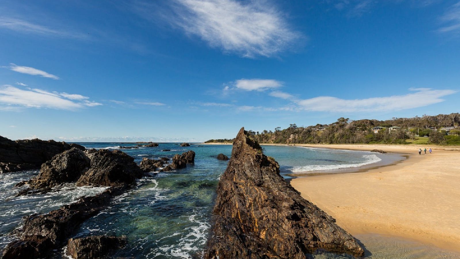
The small seaside hamlet of Mystery Bay is 15 kilometres south of Narooma. It is a quiet, geologically interesting and scenically stunning location. Visitors enjoy exploring rock pools, caves and expansive sandy beaches. The exceptionally clear water is perfect for swimming, diving and fishing.
The primitive campground is perfectly set within the coastal forest, adding to the sense of blissful isolation. Walking tracks, a look out, historical information (Aboriginal and European) and a perfect geological example of a kink zone combine to make this a fascinating destination.
Mystery Bay Short Walk
Mystery Bay, New South Wales, Australia, 2546
1800 802 528
info@eurobodalla.com.au
Get Directions

From Mystery Bay camping area follow the bush track north to Billy's Beach, an important Aboriginal site and great for families.

From Mystery Bay campground follow the bush track north to Billy’s Beach, an important Aboriginal site and great for families. This small beach is enclosed by headlands and protected from the wind by the surrounding bushland. At the northern end of the beach explore the rock pools, full of marine life. You’ll be captivated by magnificent views of Montague Island along the way.
Length: one kilometre return Time: 40 minutes Grade: Easy Start: Campground at Mystery Bay

Using QR Codes

Open your Camera App or download a QR reader

Point your camera at the QR Code which will launch the correct app

Access websites and features such as maps and directions

Optional Downloads

GPX File

For use in apps such as GPS Navigation and wearable devices

KML File

For use in offline mapping products, such as maps.me and Google Maps

PDF File

A link to this document

Build your own itineraries

Alpaca provides a way for you to build your own itineraries. Visit https://alpaca.travel

Terms of Service and Attribution

Copyright Alpaca.travel, Mapbox.com and OpenStreetMaps openstreetmaps.com.
Terms of Service https://alpaca.travel/terms