Walks and trails
Eurobodalla Coast Tourism

Details

Curated selection of points
Fast chargers available along the route

Eurobodalla offers all sorts of walks. Long or short, fast-paced or leisurely, easy or difficult, bushwalks, beach, mountain or island treks

Open in mobile
1
Murramarang South Coast Walk

The Murramarang South Coast Walk is a new 34 kilometre, three-day coastal walking adventure in Murramarang National Park. Starting at Pretty Beach, south of Ulladulla

Open in mobile
DPE
1 Pretty Beach Rd, Pretty Beach, New South Wales, Australia, 2539
1300 072 757
Walks
Get Directions
2
Pretty Beach to Durras Mountain Walking Track

The views along the Pretty Beach to Durras Mountain Walking Track are sure to take your breath away.

Open in mobile
Photo: John Yurasek/NSW Gov
Pretty Beach Road, Kioloa, New South Wales, Australia, 2539
Walks, Hiking
Get Directions
3
Pebbly Beach to Snake Bay walking track

If you're keen to get off the beaten track then Pebbly Beach to Snake Bay walking track is a great way to explore.

Open in mobile
Mount Agony Road, East Lynne, New South Wales, Australia, 2536
Walks, Hiking
Get Directions
4
Depot Beach Rainforest Walk

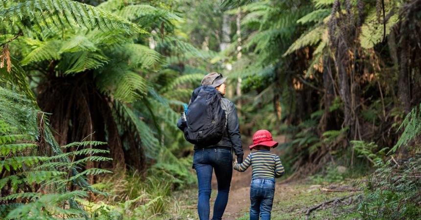
Depot Beach is a beautiful white-sand beach backed by a towering green rainforest that marks the beginning of the Depot Beach Rainforest walk.

Open in mobile
Photo: Michael Jarman
Depot Beach Road, Depot Beach, New South Wales, Australia, 2536
Canoeing/Kayaking, Walks, Hiking
Get Directions
5
Durras Lake Discovery Trail

If you’re spending some quality family time on the South Coast, the Durras Lake Discovery trail is an easy walk within Murramarang National Park.

Open in mobile
Photo: John Yurasek/NSW Government
Lake Road, Durras North, New South Wales, Australia, 2536
Walks, Hiking
Get Directions
6
Wasp Head Walk

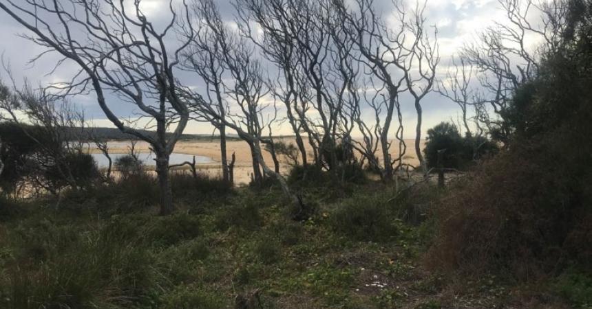
This short, scenic walk in Murramarang National Park, south of Durras Lake, is a delightful easy walk taking in coastal views and golden beaches.

Open in mobile
Photo: John Yurasek/NSW Government
Wasp Head Road, South Durras, New South Wales, Australia, 2536
Walks, Hiking
Get Directions
Cookies Beach Picnic Area - South Durras
Banyandah Street, South Durras, New South Wales, Australia, 2536
1800 802 528
info@eurobodalla.com.au
Get Directions
Free Entry
Picnic Area
Picnic Area
Birdwatching
Parking

With spectacular beach views you will be sure to spot one of the many eastern grey kangaroos basking in the sun.

Wasp Head Picnic Area
Wasp Head Road, South Durras, New South Wales, Australia, 2536
1300 072 757
parks.info@environment.nsw.gov.au
Get Directions
Accessible
Non-smoking, Picnic Area
Picnic Area
Fishing, Swimming
Parking
Accessible

If you enjoy a remote spot for a relaxing lunch, then head to the Wasp Head picnic area near South Durras in Murramarang National Park.

Bay and Beyond Sea Kayak Tours
38 Lakeside Drive, South Durras, New South Wales, Australia, 2536
0404 477 288
bayandbeyond@ozemail.com.au
Get Directions

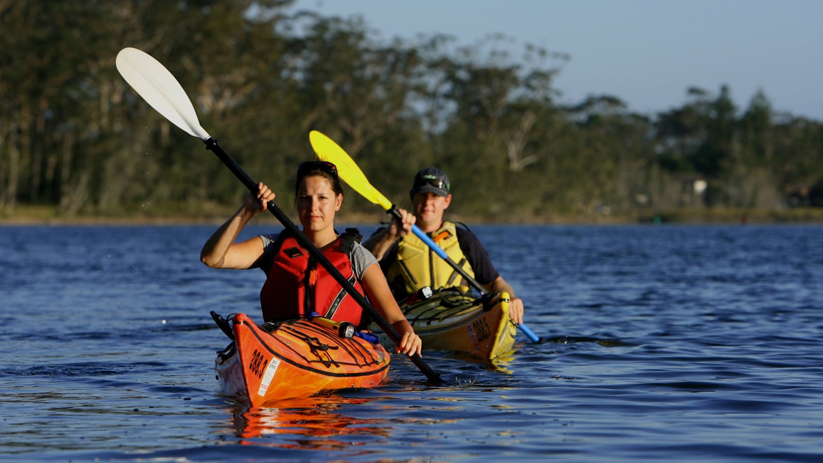
Come and explore pristine coastal lakes, tidal estuaries and open coastline of the Batemans Marine Park in the Eurobodalla Shire.

7
Batemans Bay Sculpture Walk

A seaside walk past beautiful sculptures and bayside vistas. Batemans Bay Sculpture Walk was created from the acquisitive award winning sculptures.

Open in mobile
no copyright
Mia Murra Walkway, Batemans Bay, New South Wales, Australia, 2536
info@sculptureforclyde.com.au
Picnic Area
Picnic Area, Cafe
Get Directions
8
Walks in the Eurobodalla Regional Botanic Garden

There are five tracks from 500 metres to two kilometres, six kilometres in total to choose from.

Open in mobile
Deep Creek Dam Road, Mogo, New South Wales, Australia, 2536
(02) 4471 2544
contact@erbg.org.au
Accessible, Free Entry
Public Toilet, Picnic Area
Picnic Area, Cafe, Barbeque
Public Toilet
Parking, Coach Parking
Accessible
Get Directions
Walks in the Eurobodalla Regional Botanic Garden
Deep Creek Dam Road, Mogo, New South Wales, Australia, 2536
(02) 4471 2544
contact@erbg.org.au
Get Directions
Accessible, Free Entry
Public Toilet, Picnic Area
Picnic Area, Cafe, Barbeque
Public Toilet
Parking, Coach Parking
Accessible

There are five tracks from 500 metres to two kilometres, six kilometres in total to choose from.

9
Burrewarra Point Banksia Walk

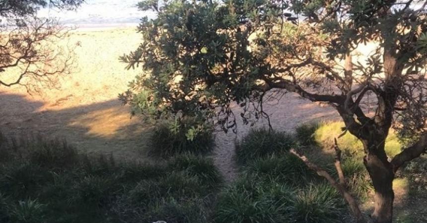
Burrewarra Point has a charming walk through a mature banksia forest with views of the coast and hinterland.

Open in mobile
Burri Point Road, Guerilla Bay, New South Wales, Australia, 2536
1800 802 528
info@eurobodalla.com.au
Free Entry
Birdwatching, Hiking, Walks
Get Directions

Sights & Activities

Burrewarra Point Lookout
Burri Point Road, Guerilla Bay, New South Wales, Australia, 2536
1800 802 528
info@eurobodalla.com.au
Get Directions

The lookout is a charming 10 minute walk from the carpark on Burri Point

10
Broulee Island Nature Reserve Walk

The four kilometre Broulee Island Walk begins south of the main beach at Broulee, across a permanent sand bar.

Open in mobile
Broulee Island, Broulee, New South Wales, Australia, 2537
1800 802 528
info@eurobodalla.com.au
Free Entry
Public Toilet, Picnic Area
Picnic Area, Barbeque
Public Toilet
Birdwatching, Fishing, Swimming
Parking
Get Directions
Broulee Beach
Coronation Drive, Broulee, New South Wales, Australia, 2537
1800 802 528
info@eurobodalla.com.au
Get Directions
Free Entry
Public Toilet
Public Toilet
Fishing, Surfing, Swimming, Walks
Parking

Situated 20 kilometres south of Batemans Bay, Broulee is a long sweeping beach protected by Broulee Island.

Broulee Surf School
BSS
77 Coronation Drive, Broulee, New South Wales, Australia, 2537
(02) 4471 7370
info@brouleesurfschool.com.au
Get Directions
Parking

Broulee Surf School is the original NSW South Coast Surf School, a family owned business established in 1996. For over 18 years they have delivered

Surf the Bay Surf School
47 Coronation Drive, Broulee, New South Wales, Australia, 2537
Get Directions

11
Bingi Dreaming Track

Follow in the footsteps of the Brinja-Yuin people as you walk the Bingi Dreaming track.

Open in mobile
Destination NSW
Tuross Boulevard, Tuross Head, New South Wales, Australia, 2537
Accessible
Walks, Hiking
Accessible
Get Directions
Minga Cultural Experiences
Corner Princes Highway and Bingie Road, Bergalia, New South Wales, Australia, 2537
0407 076 511
mingaaboriginalculturalservice@gmail.com
Get Directions
Camping, Walks

Share genuine aboriginal cultural experiences and the rich diversity of aboriginal heritage with culture camps, walking tours, or a range of cultural activities.

Congo
Congo, New South Wales, Australia, 2537
Get Directions
Birdwatching, Camping, Canoeing/Kayaking, Fishing, Snorkelling, Surfing, Swimming, Walks

Just to the south of Moruya lie glorious beaches and rock fishing locations where the only footprints on the sand belong to you.

Congo Crafts Gallery
Jim Simms
721 Congo Road, Congo, New South Wales, Australia, 2537
(02) 4474 2931
congosponger@gmail.com
Get Directions
Accessible, Ambulant Access, Wheelchair Access, Free Entry
Ambulant Access
Accessible, Ambulant Access, Wheelchair Access, Accessible for Hearing Impairment, Caters for people with sufficient mobility to climb a few steps but who would benefit from fixtures to aid balance. (This includes people using walking frames and mobility aids) Caters for people who use a wheelchair. Caters for people who are deaf or have hearing loss. Welcomes and assists people who have challenges with learning, communication, understanding and behaviour. (includes people with autism, intellectual disability, Down syndrome, acquired brain injury (ABI), dyslexia and dementia)

Here in this delightful coastal village, Jim Simms creates and sells his wood and gas-fired stoneware ceramics and paintings.

Congo campground
DPIE
Camping Area Road, Congo, New South Wales, Australia, 2537
1300 072 757
parks.info@environment.nsw.gov.au
Get Directions
5 rooms
Non-smoking
Cycling, Surfing, Swimming
Accessible

Congo campground is a popular camping area for families - with room for kids to play and ride, there's a choice of two beaches.

Bingie Beach North
Mullimburra Point Road, Bingie, New South Wales, Australia, 2537
1800 802 528
info@eurobodalla.com.au
Get Directions
Free Entry
Birdwatching, Hiking, Surfing, Swimming, Walks
Parking

Hidden away from the water are evidence of shell middens, stone working areas and quarries providing strong links to Aboriginal culture.

Cathedral Rocks: Bingie
Mullimburra Point Road, Bingie, New South Wales, Australia, 2537
1800 802 528
info@eurobodalla.com.au
Get Directions
Free Entry
Birdwatching, Hiking, Walks
Parking

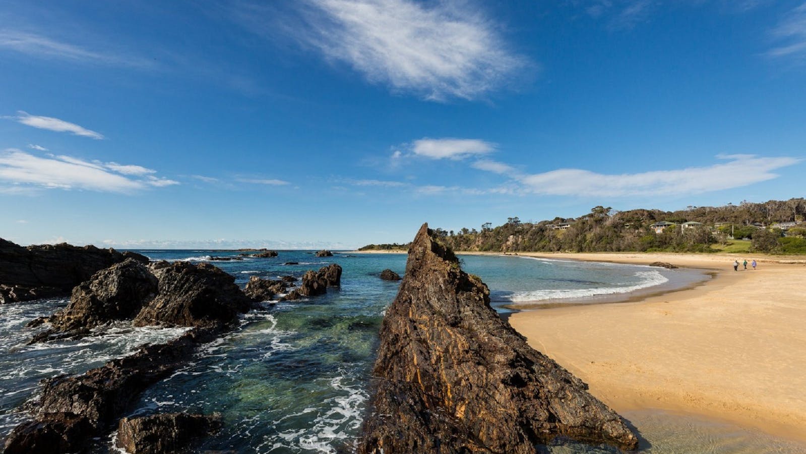
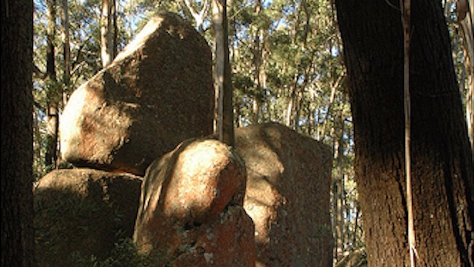
An excellent photo opportunity with the best time being in late afternoon light when the setting sun gives the rocks an incandescent-like glow.

One Tree Point Lookout and Picnic Area
Eurobodalla Shire Council
Tuross Boulevard, Tuross Head, New South Wales, Australia, 2537
1800 802 528
info@eurobodalla.com.au
Get Directions
Free Entry
Picnic Area
Picnic Area
Birdwatching, Canoeing/Kayaking, Cycling, Fishing, Scenic Drives, Surfing, Swimming, Walks, Lookouts
Parking

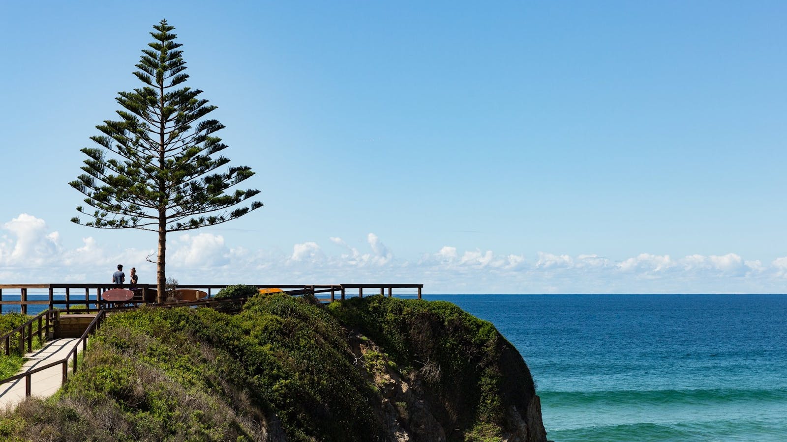
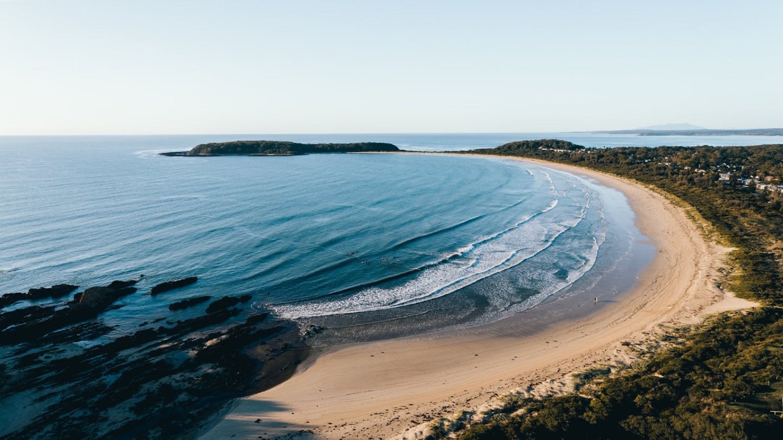
A paved path leads to a lone Norfolk Island Pine, marking the Tuross headland lookout with glorious ocean views.

Tuross Head
Tuross Head, New South Wales, Australia, 2537
Get Directions
Birdwatching, Boating, Canoeing/Kayaking, Cycling, Fishing, Scenic Drives, Surfing, Swimming, Walks

Tuross Head is set on a low-lying headland perched between twin lakes, with stunning ocean beaches stretching north and south.

12
Bodalla Historic Town Walk

Take a walk back in time through Bodalla to ponder the village as it was.

Open in mobile
Princes Highway, Bodalla, New South Wales, Australia, 2545
1800 802 528
info@eurobodalla.com.au
Get Directions
Bodalla Dairy - Cheese, Milk and Ice Cream Factory and Cafe
n/a
52 Princes Highway, Bodalla, New South Wales, Australia, 2545
(02) 4473 5234
office@bodalladairy.com.au
Get Directions
Accessible, Ambulant Access, Wheelchair Access
Pets Allowed, Ambulant Access, Non-smoking, Outdoor Dining
Australian, Brunch, Dessert, High Tea or Afternoon Tea, Native Australian, Lunch, Takeaway
Pets Allowed
Entertainment, Live Music
Parking, Coach Parking
Accessible, Ambulant Access, Wheelchair Access, Caters for people with sufficient mobility to climb a few steps but who would benefit from fixtures to aid balance. (This includes people using walking frames and mobility aids) Caters for people who use a wheelchair. Caters for people with allergies and intolerances.

Bodalla Dairy is a family-owned cheese, ice cream, and yoghurt maker with a cafe and milk bar.

13
Mummuga Lake Walk

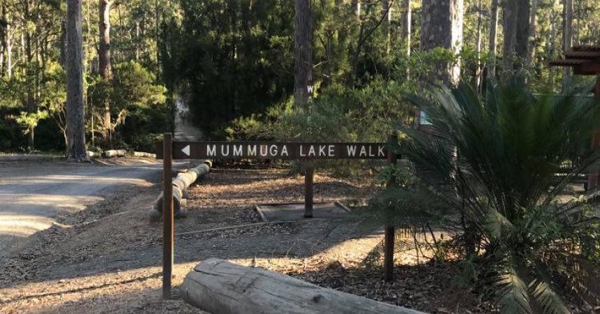
Starting at the Bodalla Park Rest Area there is a well marked walk track to Mummaga Lake.

Open in mobile
Free Entry
Get Directions
A level grade well-signposted track winds through forest of Spotted Gums and cycads to the northern shore of Mummuga Lake and returns to the rest area where facilities include toilets and picnic tables. Local wildlife is a feature of this area; birds, reptiles and marsupials call this forest home.
Length: 2km loop
Time: 1 hour
Grade: Easy
Start: Bodalla Forest Park rest area, Princes Highway, 10km north of Narooma, 11km south of Bodalla

Sights & Activities

Bodalla Forest Rest Area
Forestry Corporation of NSW
Princes Highway, Bodalla, New South Wales, Australia, 2545
1300 655 687
visit@fcnsw.com.au
Get Directions
Accessible, Free Entry
Public Toilet, Picnic Area
Picnic Area
Public Toilet
Birdwatching, Camping, Walks
Parking
Accessible

Surrounded by tall spotted gums, Bodalla Forest Rest Area offers picnic tables, toilets and access to a walking track around Mummaga Lake.

14
Box Cutting Rainforest Walk

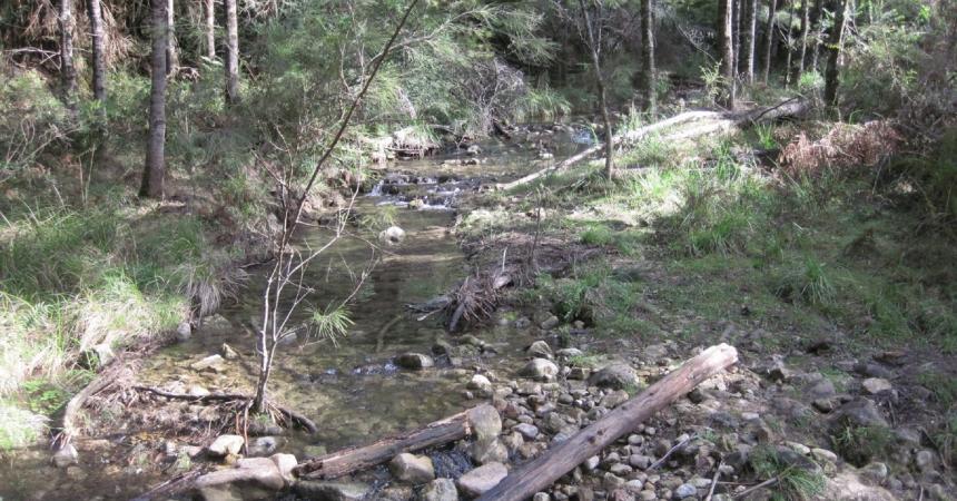
The beautiful Box Cutting Rainforest Walk takes 35 minutes of easy walking, although there are some steep sections.

Open in mobile
Kianga Road, Kianga, New South Wales, Australia, 2546
1800 802 528
info@eurobodalla.com.au
Free Entry
Picnic Area
Picnic Area
Birdwatching, Hiking, Walks, Lookouts
Parking
Get Directions
15
Mill Bay Boardwalk Narooma

Along the scenic Mill Bay Boardwalk, gaze out on the beautiful emerald water and see that it is teeming with life.

Open in mobile
Eurobodalla Tourism
Centenary Drive, North Narooma, New South Wales, Australia, 2546
1800 802 528
info@eurobodalla.com.au
Free Entry
Picnic Area
Picnic Area
Birdwatching, Cycling, Fishing, Walks
Parking
Get Directions
Southbound Escapes Narooma Electric Mountain Bike and Mountain Bike Hire and ToursSouthbound Escapes Narooma Electric Mountain Bike and Mountain Bike Hire
Shop A, 44 Princes Highway, Narooma, New South Wales, Australia, 2546
0407 106 392
bookings@southboundescapes.com
Get Directions
Pets Allowed
Pets Allowed
$40 ~ $150 AUD*
Parking
* Electric -Bike - AUD20 per hour minimum two hours Child Seat - AUD10 per hour minimum two hours Child Buggy AUD10 per hour minimum two hours

Southbound Escapes has E-Bike pedal-assist bikes and mountain bikes for hire in Narooma.

Apex Park Picnic Area Narooma
Centenary Drive, Narooma, New South Wales, Australia, 2546
1800 802 528
info@eurobodalla.com.au
Get Directions
Free Entry
Public Toilet, Picnic Area
Picnic Area
Public Toilet
Birdwatching, Scenic Drives, Walks
Parking

If you are looking for that perfect picnic area then look no further. Sit back and take in the stunning views of the Wagonga Inlet.

Narooma Bar Beach South
Eurobodalla Shire Council
1 Bar Rock Road, Narooma, New South Wales, Australia, 2546
1800 802 528
info@eurobodalla.com.au
Get Directions
Free Entry
Public Toilet, Picnic Area
Picnic Area, Barbeque
Public Toilet
Birdwatching, Scuba Diving, Snorkelling, Swimming, Walks, Boating Facilities
Parking, Coach Parking

A netted beach protected by the Narooma Bar breakwalls, its sheltered position makes it perfect for families with young children.

16
Ringlands Rotary Walk Narooma

Ringland's Rotary Walk is a picturesque self guided walk which follows a bush track from Shell Point to Flying Fox Bay along the foreshore of

Open in mobile
Flying Fox Road, Narooma, New South Wales, Australia, 2546
1800 802 528
info@eurobodalla.com.au
Free Entry
Picnic Area
Picnic Area
Parking
Get Directions
17
Mystery Bay to 1080 Beach Walk

A ten minute stroll from the entrance to Eurobodalla National Park will find you at Pooles Beach.

Open in mobile
Mystery Bay, Mystery Bay, New South Wales, Australia, 2546
1800 802 528
info@eurobodalla.com.au
Walks
Get Directions
Mystery Bay lookout
Mystery Bay lookout, Mystery Bay, New South Wales, Australia, 2546
1300 072 757
parks.info@environment.nsw.gov.au
Get Directions
Accessible
Non-smoking
Barbeque
Sailing, Lookouts, Boating Facilities
Parking
Accessible

Mystery Bay lookout is in the most southern part of Eurobodalla National Park not far from the picturesque hamlet of Mystery Bay.

1080 Beach
1080 Beach Road, Mystery Bay, New South Wales, Australia, 2546
1300 072 757
parks.info@environment.nsw.gov.au
Get Directions
Picnic Area
Picnic Area
Surfing, Swimming

If you’re looking for a spot to surf the turquoise waters of the far south coast, head to 1080 Beach near Mystery Bay.

18
Mystery Bay Short Walk

From Mystery Bay camping area follow the bush track north to Billy's Beach, an important Aboriginal site and great for families.

Open in mobile
Mystery Bay Campground, Mystery Bay, New South Wales, Australia, 2546
1800 802 528
info@eurobodalla.com.au
Get Directions
Mystery Bay Camping Area
Mystery Bay Road, Mystery Bay, New South Wales, Australia, 2546
0428 622 357
mysterybay@belgraviapro.com.au
Get Directions
500 rooms
Pets Allowed
Pets Allowed, Fireplace
$15 ~ $25 AUD*
* Subject to change and availability

Mystery Bay campground fronts the ocean and is one of the few natural camping areas remaining on the New South Wales South Coast.

Historic Mystery Bay Velodrome
Mystery Bay Road, Mystery Bay, New South Wales, Australia, 2546
1800 802 528
info@eurobodalla.com.au
Get Directions
Free Entry
Public Toilet, Picnic Area
Picnic Area, Barbeque
Public Toilet
Mountain Biking, Birdwatching, Camping, Cycling, Walks
Parking

A scenic track takes you on a loop from Mystery Bay, through the camping ground, and to the historic Velodrome.

Mystery Bay
Mystery Bay, New South Wales, Australia, 2546
Get Directions

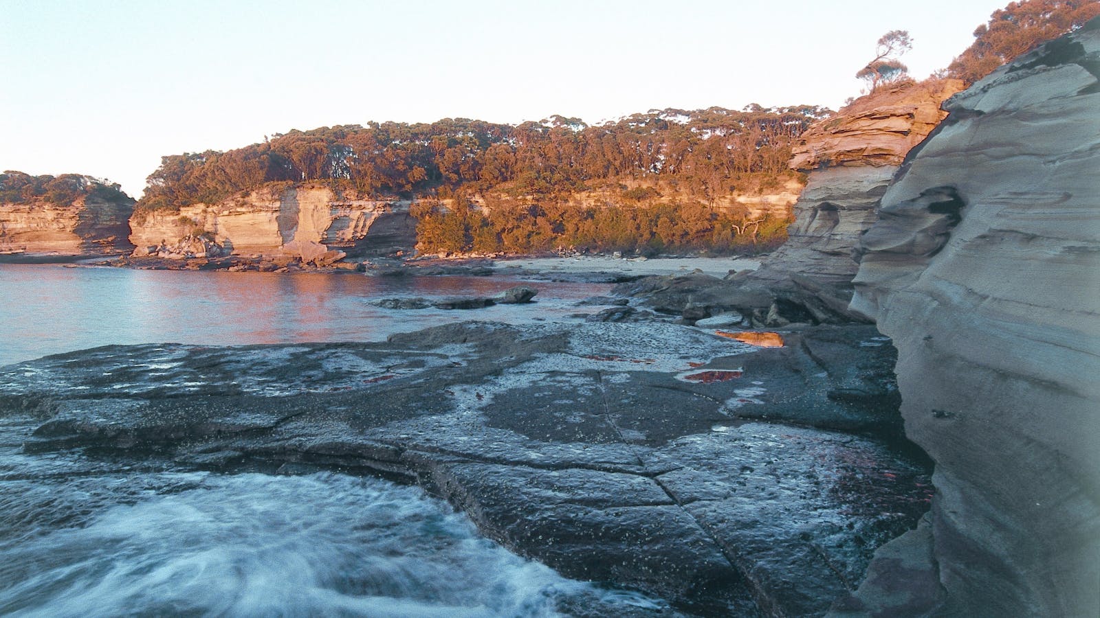
The crystal-clear water, rock pools, caves and sandy beaches make this small yet stunning hamlet a must to explore.

19
Bellbrook Farm Loop Walk

Enjoy a scenic two-kilometre walk around the foothills of Gulaga (Mount Dromedary).

Open in mobile
Eurobodalla Shire Council
Station Street, Central Tilba, New South Wales, Australia, 2546
info@eurobodalla.com.au
Picnic Area
Picnic Area
Birdwatching, Walks
Get Directions
Central Tilba
Central Tilba, New South Wales, Australia, 2546
Get Directions
Birdwatching, Hiking, Scenic Drives, Walks

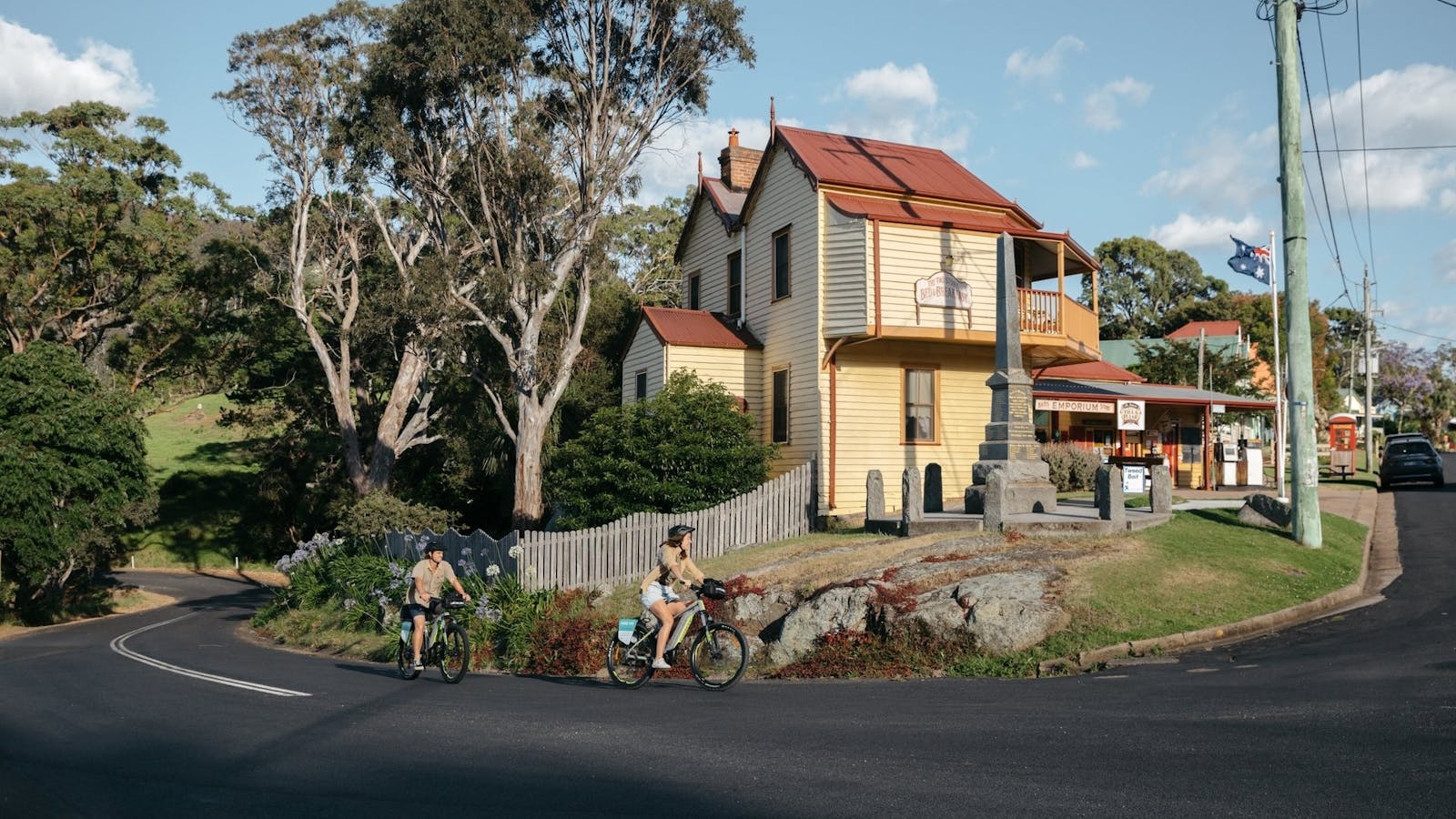
Central Tilba is an historic clutch of weatherboard buildings perched on a rippling green ridge, below Gulaga Mountain.

Tilba Talks Heritage Walks, Walking Tours
Tilba walks
Corkhill Drive, Central Tilba, New South Wales, Australia, 2546
0433 114 374
tilbatalks@gmail.com
Get Directions

Tapping into this fascinating history is Tilba Walks Heritage Talks Walking Tours. This small group tour specialist offers an exclusive walking tours.

Water Tower Lookout Central Tilba
3 Station Street, Central Tilba, New South Wales, Australia, 2546
1800 802 528
info@eurobodalla.com.au
Get Directions
Free Entry
Picnic Area
Picnic Area

Take the five minute walk from Station Street in Central Tilba for a rewarding panoramic view of the town, surrounding region and Montague Island.

20
Gulaga Mountain Walk

The steep track up the mountain was built in 1894 for gold miners.

Open in mobile
La Galette Cafe, Tilba Tilba, New South Wales, Australia, 2546
1800 802 528
info@eurobodalla.com.au
Free Entry
Picnic Area
Picnic Area
Birdwatching, Walks, Hiking
Parking
Get Directions
Tilba Tilba
Tilba Tilba, New South Wales, Australia, 2546
Get Directions
Birdwatching, Hiking, Scenic Drives, Walks

Protected by a National Heritage listing, the town was settled in the 1890s and 1900s and today retains many fine Victorian timber buildings.

Mountain View Farm
11 Mount Dromedary Trail, Tilba Tilba, New South Wales, Australia, 2546
(02) 4473 7179
kath@mountainviewfarm.com.au
Get Directions
6 rooms
Pets Allowed, Ambulant Access, Laundry Facilities, Non-smoking, Outdoor Dining
Camp Kitchen, Barbeque
Pets Allowed
$155 ~ $240 AUD*
Parking
Accessible, Ambulant Access, Wheelchair Access, Catering for High Support, Caters for people who use a wheelchair. Caters for people with sufficient mobility to climb a few steps but who would benefit from fixtures to aid balance. (This includes people using walking frames and mobility aids) Caters for people with high support needs who travel with a support person. Welcomes and assists people who have challenges with learning, communication, understanding and behaviour. (includes people with autism, intellectual disability, Down syndrome, acquired brain injury (ABI), dyslexia and dementia)
* Prices increase during peak holiday periods and are based on a two-person stay. There is a singular cleaning/linen charge of 75 per stay. Additional guests are welcome at a surcharge. All kinds of pets are welcome, including horses, at a nominal surcharge.

Mountain View Farm offers a variety of accommodation options suitable for couples and families, and they are genuinely pet friendly!

Gulaga National Park
Gulaga National Park, Tilba Tilba, New South Wales, Australia, 2546
(02) 4476 0800
Get Directions
Free Entry
Birdwatching, Walks
Parking

Gulaga National Park was created in January 2001. It covers an area of 4673ha. Gulaga (Mount Dromedary) and the surrounding landscape have great spiritual significance

21
Corn Trail Walking Track

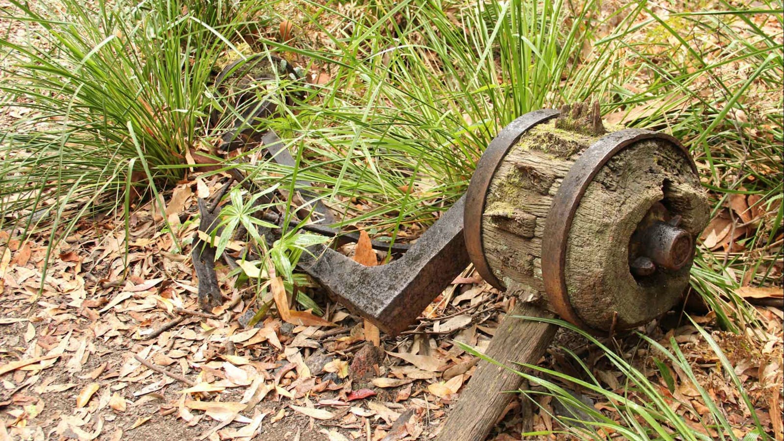
Take a journey back in time and follow a route that has been used for thousands of years. Popular today with bushwalkers and horse riding.

Open in mobile
Photo: Lucas Boyd
No Name Mountain Road, Buckenbowra, New South Wales, Australia, 2536
Horse Riding, Walks, Hiking
Get Directions
22
The Big Hole walking track

In 1862, a young man called Boxall used four long saplings, a rope and a candle to explore a deep chasm out in the bushland

Open in mobile
Cooma Road, Krawarree, New South Wales, Australia, 2622
Walks, Hiking
Get Directions
23
Ancient Headlands Walk

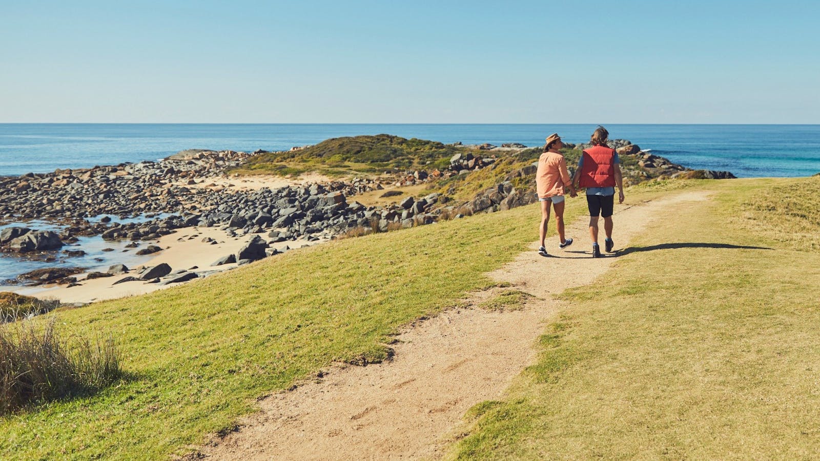
A leisurely walk looping around ancient headlands and scenic beaches.

Open in mobile
Get Directions
Follow the left fork track to Dark Beach and explore the shingle-covered southern section where you can look for fossils in the unique rock formations and admire a band of volcanic rock separating white sand from black sand. Return to the fork and take the left track to extend this walk through the enchanted forest 400m south to beautiful Myrtle Beach, stopping to admire this stunning ancient headland from the platform on the way.
Length: 2.5km return
Time: 1 hour
Grade: Easy to moderate
Start: Dark/Myrtle Beach car park, off the Old Coast Road south of South Durras and Murramarang Resort
Myrtle Beach walking track
Old Coast Road, Benandarah, New South Wales, Australia, 2536
Get Directions
Canoeing/Kayaking, Walks, Hiking

Get away from it all and escape to this beautiful, isolated beach for the day.  Surround yourself with natural bushland and revel in the sounds.

Dark Beach Walking Track
Photo: Michael van Ewijk
Old Coast Road, South Durras, New South Wales, Australia, 2536
Get Directions
Walks, Hiking

Enjoy a relaxing day away on this remote beach in Murramarang National Park, on the South Coast. Dark Beach walking track leads through spotted gum.

Cookies Beach Picnic Area - South Durras
Banyandah Street, South Durras, New South Wales, Australia, 2536
1800 802 528
info@eurobodalla.com.au
Get Directions
Free Entry
Picnic Area
Picnic Area
Birdwatching
Parking

With spectacular beach views you will be sure to spot one of the many eastern grey kangaroos basking in the sun.

South Durras
South Durras, New South Wales, Australia, 2536
Get Directions
Birdwatching, Boating, Camping, Canoeing/Kayaking, Cycling, Fishing, Hiking, Mountain Biking, Sailing, Scenic Drives, Scuba Diving, Snorkelling, Surfing, Swimming, Walks

Rich forests, secluded beaches and imposing ancient headlands form South Durras and renowned for its abundance of wildlife such as kangaroos, wallabies, echidna and possums.

24
Cullendulla Mangrove Walk

An easy walk along a beautiful boardwalk, Cullendulla Beach has pride of place in the nature reserve, right at the mouth of the creek.

Open in mobile
Get Directions
7000 years of shoreline events are preserved in the “chenier” dune complex at Cullendulla Creek Nature Reserve. One of the largest stands of mangroves south of Sydney, it also has significant Aboriginal middens and burial sites. The walk winds through an exceptional landscape of Marine Park Sanctuary Zone via a 300m boardwalk, the beach and a track. There are informative signs along the way.
Length: 1km loop
Time: 45 minutes
Grade: Easy
Start: Cullendulla Creek Nature Reserve, Myamba Parade, Surfside
Cullendulla Creek Nature Reserve
Surfside, New South Wales, Australia, 2536
1300 072 757
parks.info@environment.nsw.gov.au
Get Directions
Accessible
Non-smoking
Walks, Lookouts
Accessible

Batemans Bay is beautiful, but it also has a hidden trump card up its sleeve; Cullendulla Creek Nature Reserve.

Region X Unspoilt Experiences Batemans Bay NSW
Mossy Point Boat Ramp, Batemans Bay, NSW, Australia, 2537
Get Directions

Multi-award winning tourism operator, showing you the best secret south coast locations. Batemans Bay and beyond. Visit www.regionx.com.au

Cullendulla Beach Track
Myamba Parade, Surfside, New South Wales, Australia, 2536
Get Directions
Walks, Hiking

Just an easy walk along a beautiful boardwalk, Cullendulla Beach has pride of place in the nature reserve, right at the mouth of the creek.

25
Dalmeny to Potato Point via Lake Brou

This is a long, wild and natural beach walk.

Open in mobile
Get Directions
From the park opposite the shops in Dalmeny, cross the wooden footbridge onto Dalmeny Beach and head north. You will come to the mouth of the magnificent Lake Brou after about 4km, right near a stretch of distinctive sandy red cliffs. This is a possible turning point, or continue on to Jemisons Point and then to Potato Point, where you can enjoy a rest and the view from the bench seat high on the south side of the point.
Length: 14km return (or 8km return to Brou Lake)
Time: 4 to 5 hours return
Grade: Moderate
Start: At the park opposite Dalmeny shops, north of Narooma, (tourist drive 5)
Dalmeny
1 Noble Parade, Dalmeny, New South Wales, Australia, 2546
Get Directions

Dalmeny is a small village just north of Narooma. Sitting prettily on headlands between Mummuga Lake and Kianga Creek, Dalmeny offers magnificent views.

Brou Lake campground
Brou Lake Road, Bodalla, New South Wales, Australia, 2545
1300 072 757
parks.info@environment.nsw.gov.au
Get Directions
8 rooms
Non-smoking
Accessible
* There are no camping fees at this campground but a $6 booking fee applies.

Nestled in among a forest of spotted gums, Brou Lake campground is an idyllic place to camp for the weekend or a week away.

26
Bendethera Caves Walking Track

Open in mobile
Get Directions
*Cave and walking track is currently closed.Contact NPWS for latest updates on road conditions and cave access*
The Bendethera Caves Walking Trek is only accessible by four-wheel drive via Moruya. It is part of the Deua National Park; a stunning and rugged part of Eurobodalla. The walking trail itself is an eight-kilometre round trip with some dramatic terrain in its final stages. If you decide to access the caves, appropriate headgear, footwear and torches are essential. The walking trail meanders along, following and crossing Con Creek many times, with the peaceful sound of bubbling, flowing water. The endemic Bendethera Wattle can be found approximately three kilometres into the walk, unique to the limestone soils of the Deua National Park. Exciting four-wheel drive tracks abound with animal and bird sightings common. To enjoy the area for a few nights, stay at the campground nearby that offers a peaceful night's rest.

Using QR Codes

Open your Camera App or download a QR reader

Point your camera at the QR Code which will launch the correct app

Access websites and features such as maps and directions

Optional Downloads

GPX File

For use in apps such as GPS Navigation and wearable devices

KML File

For use in offline mapping products, such as maps.me and Google Maps

PDF File

A link to this document

Build your own itineraries

Alpaca provides a way for you to build your own itineraries. Visit https://alpaca.travel

Terms of Service and Attribution

Copyright Alpaca.travel, Mapbox.com and OpenStreetMaps openstreetmaps.com.
Terms of Service https://alpaca.travel/terms