Drive Tours and Lookouts
Eurobodalla Coast Tourism

Details

Curated selection of points

Let the road take you past rugged coastlines, ancient forests, through hidden valleys and up to spectacular lookouts.

Eurobodalla is a driver’s paradise. Let the road take you past rugged coastlines, ancient forests, through hidden valleys and up to lookouts with spectacular views from the mountains to the sea.
Open in mobile
1
Big Bit Lookout

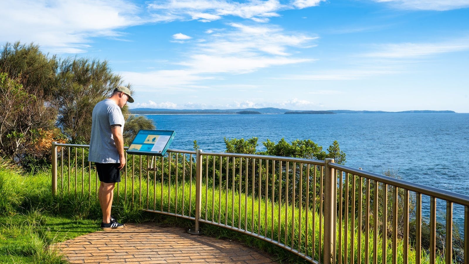
Situated North of Batemans Bay, Big Bit Lookout has stunning 360 degree views up and down the coast, and west out to the Budawang Mountains.

Open in mobile
Lookout Road, Benandarah, New South Wales, Australia, 2536
1800 802 528
info@eurobodalla.com.au
Get Directions
2
Holmes lookout

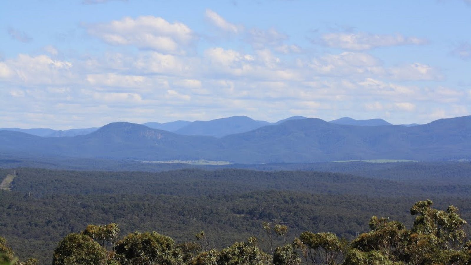
Sitting up high on the ridge line, Holmes lookout offers spectacular scenic views looking out over mighty Clyde River as it winds its way towards

Open in mobile
Rotary Drive, Batemans Bay, New South Wales, Australia, 2536
1300 072 757
parks.info@environment.nsw.gov.au
Non-smoking
Barbeque
Lookouts
Get Directions
3
Observation Point - Batehaven

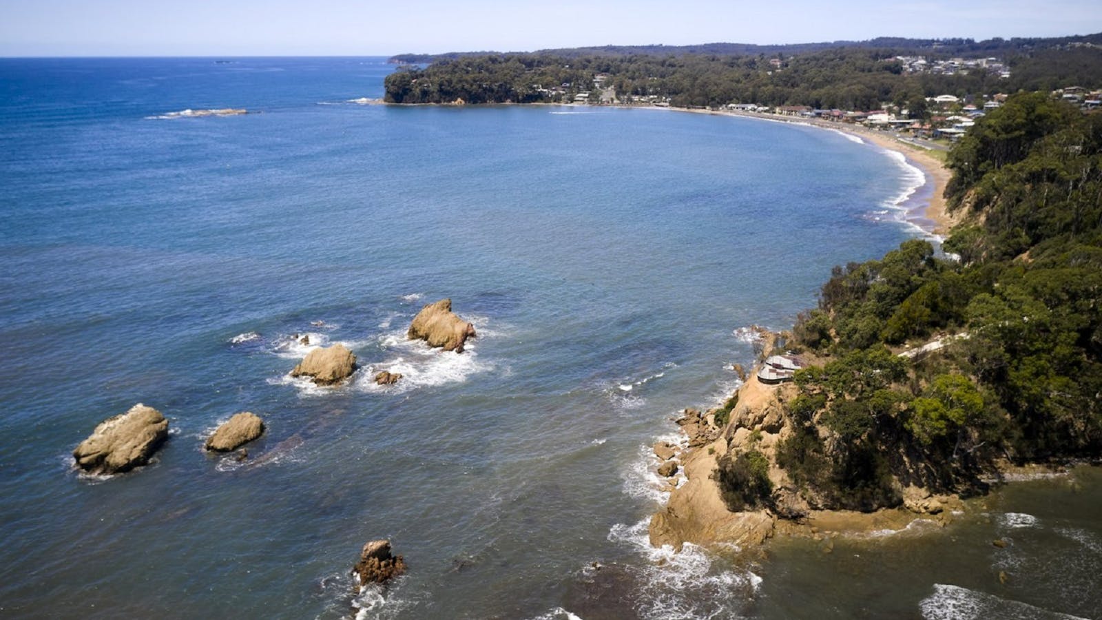
Located at Batehaven, Observation Point is a lookout and picnic area with fabulous views overlooking the beach out to the beautiful Snapper Island.

Open in mobile
Observation Avenue, Batehaven, New South Wales, Australia, 2536
1800 802 528
info@eurobodalla.com.au
Free Entry
Picnic Area
Picnic Area
Birdwatching, Lookouts
Parking
Get Directions
Batehaven
Batehaven, New South Wales, Australia, 2536
Get Directions
Cycling, Fishing, Scenic Drives, Swimming, Walks

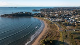
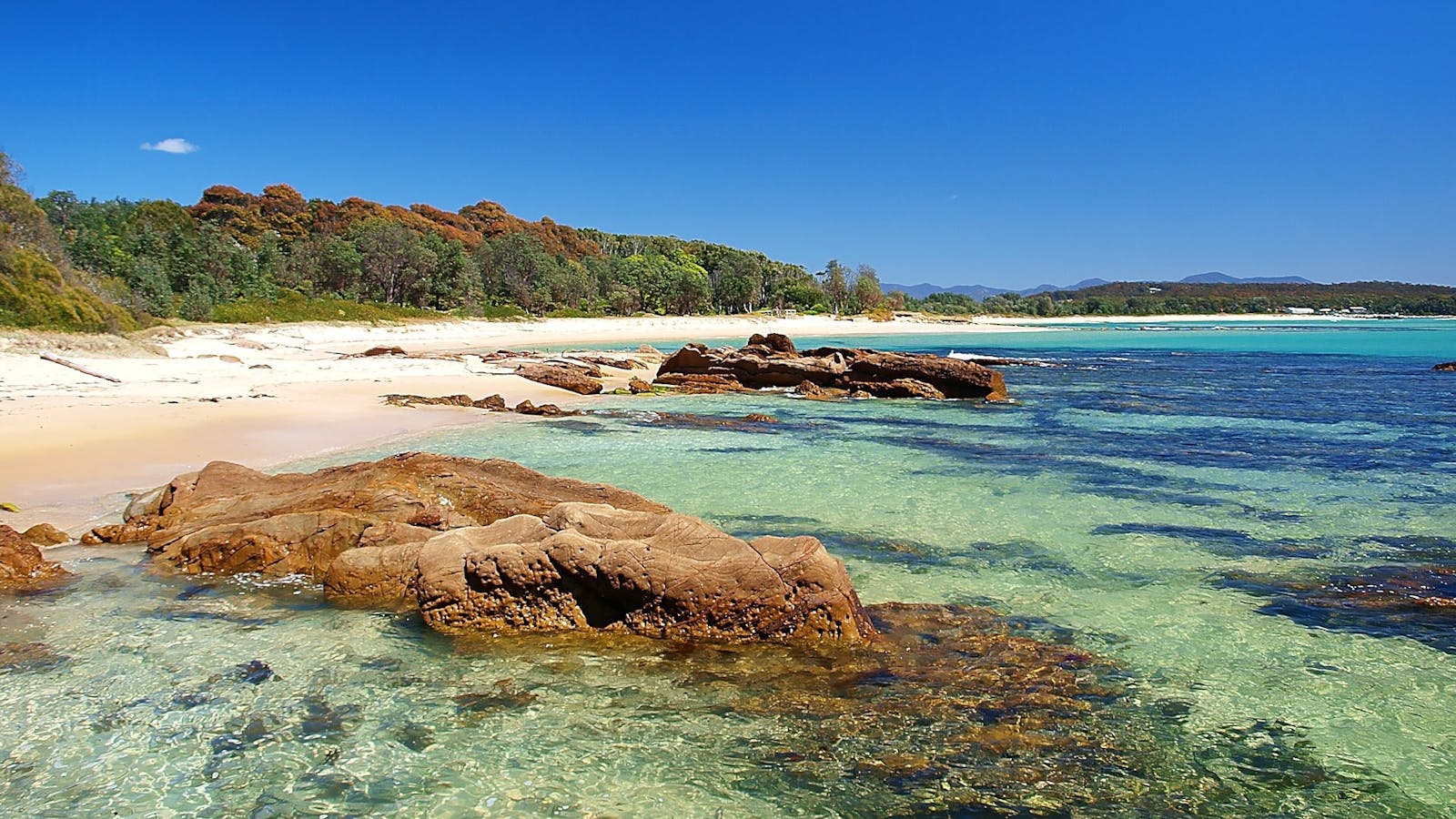
With great beaches all within a few minutes drives, Batehaven is an ideal location for holiday makers.

Corrigans Beach Reserve Park and Accessible Playground
51-59 Beach Road, Batehaven, New South Wales, Australia, 2536
1800 802 528
info@eurobodalla.com.au
Get Directions
Caters for people with sufficient mobility to climb a few steps but who would benefit from fixtures to aid balance. (This includes people using walking frames and mobility aids) Caters for people who use a wheelchair. Caters for people who are deaf or have hearing loss. Caters for people with high support needs who travel with a support person., Ambulant Access, Wheelchair Access, Free Entry
Ambulant Access, Public Toilet, Parents Room, Picnic Area
Picnic Area
Public Toilet
Cycling, Swimming, Walks
Parking, Coach Parking
Caters for people with sufficient mobility to climb a few steps but who would benefit from fixtures to aid balance. (This includes people using walking frames and mobility aids) Caters for people who use a wheelchair. Caters for people who are deaf or have hearing loss. Caters for people with high support needs who travel with a support person., Ambulant Access, Wheelchair Access, Accessible for Hearing Impairment, Catering for High Support, Caters for people with sufficient mobility to climb a few steps but who would benefit from fixtures to aid balance. (This includes people using walking frames and mobility aids) Caters for people who use a wheelchair. Caters for people who are deaf or have hearing loss. Caters for people with high support needs who travel with a support person.

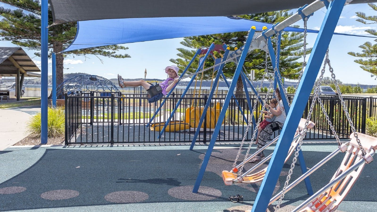
The reserve and playground is set on the calm bay of Corrigans Beach, at Batehaven, just 4 kilometres south of Batemans Bay.

4
Burrewarra Point Lookout

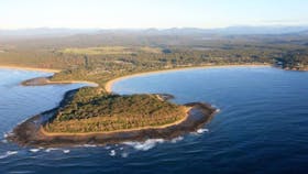
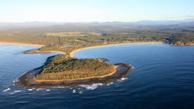
The lookout is a charming 10 minute walk from the carpark on Burri Point

Open in mobile
Burri Point Road, Guerilla Bay, New South Wales, Australia, 2536
1800 802 528
info@eurobodalla.com.au
Get Directions
Burrewarra Point Banksia Walk
Burri Point Road, Guerilla Bay, New South Wales, Australia, 2536
1800 802 528
info@eurobodalla.com.au
Get Directions
Free Entry
Birdwatching, Hiking, Walks

Burrewarra Point has a charming walk through a mature banksia forest with views of the coast and hinterland.

5
Melville Point Lookout

Melville Point, also known as “Burying Point” and “Gravehead” due to the early settler cemetery there, has beautiful sweeping coastal views.

Open in mobile
Eurobodalla Shire Council
Melville Point, Tomakin, New South Wales, Australia, 2537
1800 802 528
info@eurobodalla.com.au
Get Directions

Sights & Activities

Tomakin
Tomakin, New South Wales, Australia, 2537
Get Directions
Birdwatching, Boating, Camping, Canoeing/Kayaking, Cycling, Fishing, Scenic Drives, Scuba Diving, Snorkelling, Surfing, Swimming, Walks

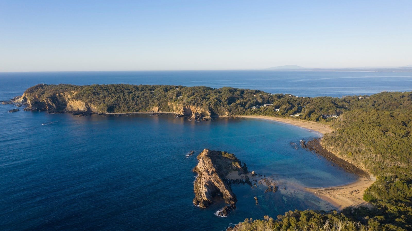
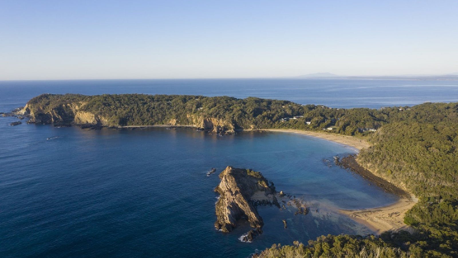
With three picturesque beaches and a winding clear river, Tomakin provides enticing options for swimming, snorkelling and walking.

6
Mossy Point Anchor Lookout

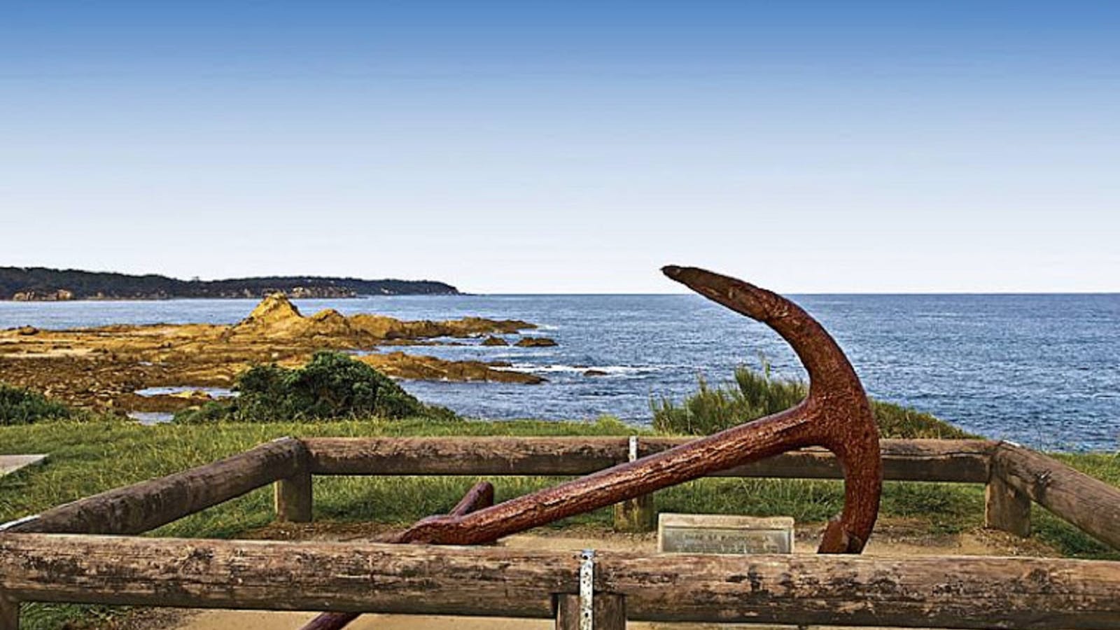
Take in the beautiful views over Tomakin, Mossy Point and Broulee from the Mossy Point Anchor Lookout.

Open in mobile
Mossy Point Anchor Lookout, Mossy Point, New South Wales, Australia, 2537
1800 802 528
info@eurobodalla.com.au
Get Directions

Sights & Activities

Mossy Point
Mossy Point Boat Ramp, Mossy Point, New South Wales, Australia, 2537
Get Directions

Mossy point is a quiet little haven often overlooked by visitors. Situated between the Tomaga River to the north, and Candlagan Creek to the south,

7
Broulee Island Nature Reserve

Broulee Island is joined to the mainland by a sandbar so it’s always accessible and takes about an hour to walk around.

Open in mobile
Broulee, NSW, Australia
Get Directions
Broulee Island is joined to the mainland by a sandbar so it’s always accessible and takes about an hour to walk around. Parking, toilets and café at Broulee Surf Club, South Broulee. Eyes up for the superb fairy wrens and white bellied sea eagles, and down for the famous pink rocks that give the nearby surf break its name.
Broulee Island Nature Reserve Walk
Broulee Island, Broulee, New South Wales, Australia, 2537
1800 802 528
info@eurobodalla.com.au
Get Directions
Free Entry
Public Toilet, Picnic Area
Picnic Area, Barbeque
Public Toilet
Birdwatching, Fishing, Swimming
Parking

The four kilometre Broulee Island Walk begins south of the main beach at Broulee, across a permanent sand bar. The walk features ocean vistas across

Broulee Heritage Area
Broulee, Broulee, New South Wales, Australia, 2537
1800 802 528
info@eurobodalla.com.au
Get Directions

Broulee was the first port in the region. In the 1830s, settlers in the district would load and unload from ships anchored in Broulee Bay.

8
Toragy Point and Moruya Heads Lookout

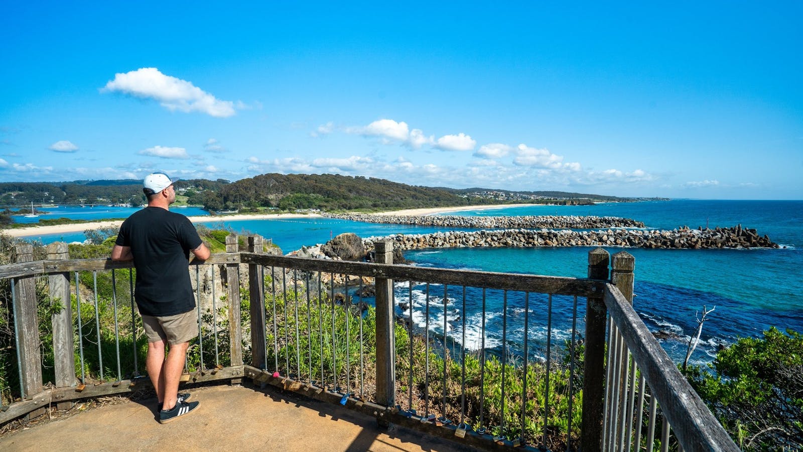
South Head Moruya holds an old graveyard on the headland - a glimpse into the past with far-reaching views of the coast.

Open in mobile
Eurobodalla Shire Council
Moruya Heads, New South Wales, Australia, 2537
Birdwatching, Hiking, Scenic Drives, Surfing, Swimming, Walks
Get Directions
Shelly Beach Picnic Area - Moruya Heads
Eurobodalla Shire Council
Elizabeth Street, Moruya Heads, New South Wales, Australia, 2537
1800 802 528
info@eurobodalla.com.au
Get Directions
Free Entry
Birdwatching, Surfing, Swimming, Walks

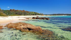
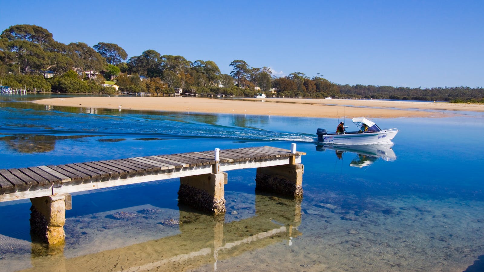
Shelly Beach at Moruya Heads is a popular family recreational spot with picnic facilities at the mouth of the Moruya River.

9
One Tree Point Lookout and Picnic Area

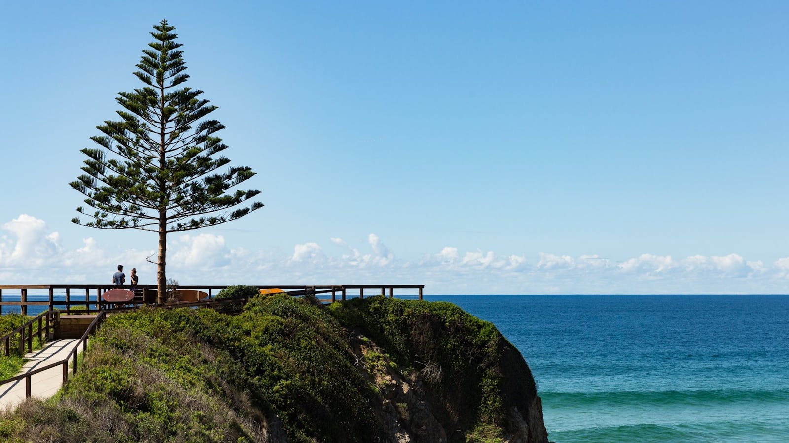
A paved path leads to a lone Norfolk Island Pine, marking the Tuross headland lookout with glorious ocean views.

Open in mobile
Eurobodalla Shire Council
Tuross Boulevard, Tuross Head, New South Wales, Australia, 2537
1800 802 528
info@eurobodalla.com.au
Free Entry
Picnic Area
Picnic Area
Birdwatching, Canoeing/Kayaking, Cycling, Fishing, Scenic Drives, Surfing, Swimming, Walks, Lookouts
Parking
Get Directions

Sights & Activities

Tuross Lake
Nelson Parade, Tuross Head, New South Wales, Australia, 2537
1800 802 528
info@eurobodalla.com.au
Get Directions
Free Entry
Birdwatching, Boating, Canoeing/Kayaking, Fishing, Sailing, Swimming

Tuross Lake offers plenty of paddling options for all levels of skill, in particular for beginner/novice paddlers. Soak up the magnificent surroundings as you explore.

Tuross Head
Tuross Head, New South Wales, Australia, 2537
Get Directions
Birdwatching, Boating, Canoeing/Kayaking, Cycling, Fishing, Scenic Drives, Surfing, Swimming, Walks

Tuross Head is set on a low-lying headland perched between twin lakes, with stunning ocean beaches stretching north and south.

10
Bar Rock Lookout and Australia Rock

Australia Rock is a popular photo opportunity. Viewed at just the right angle, the hole in the rock at Wagonga Head, has an uncanny resemblance

Open in mobile
Eurobodalla Shire Council
1 Bar Rock Road, Narooma, New South Wales, Australia, 2546
1800 802 528
info@eurobodalla.com.au
Free Entry
Parking
Get Directions
Barunguba Montague Island Nature ReserveMontague Island Nature Reserve
Montague Island, Narooma, New South Wales, Australia, 2546
1300 072 757
parks.info@environment.nsw.gov.au
Get Directions
Non-smoking
Birdwatching, Walks, Lookouts

Montague Island Nature Reserve is home to hundreds of seals and more than 90 bird species. Enjoy a stay in a heritage lighthouse keeper’s cottage.

Narooma Bar Beach South
Eurobodalla Shire Council
1 Bar Rock Road, Narooma, New South Wales, Australia, 2546
1800 802 528
info@eurobodalla.com.au
Get Directions
Free Entry
Public Toilet, Picnic Area
Picnic Area, Barbeque
Public Toilet
Birdwatching, Scuba Diving, Snorkelling, Swimming, Walks, Boating Facilities
Parking, Coach Parking

A netted beach protected by the Narooma Bar breakwalls, its sheltered position makes it perfect for families with young children.

Mill Bay Boardwalk Narooma
Eurobodalla Tourism
Centenary Drive, North Narooma, New South Wales, Australia, 2546
1800 802 528
info@eurobodalla.com.au
Get Directions
Free Entry
Picnic Area
Picnic Area
Birdwatching, Cycling, Fishing, Walks
Parking

Along the scenic Mill Bay Boardwalk, gaze out on the beautiful emerald water and see that it is teeming with life.

11
Narooma Golf Club

For golfers, no visit to the South Coast of NSW is complete without playing a round at Narooma's famous golf course.

Open in mobile
1 Ballingalla Street, Narooma, New South Wales, Australia, 2546
(02) 4476 0500
enquiries@naroomagolf.com.au
Caters for people who use a wheelchair., Wheelchair Access
Public Toilet
Cafe
Public Toilet
Golf, Games or Recreation Room
Parking, Coach Parking
Caters for people who use a wheelchair., Wheelchair Access, Caters for people who use a wheelchair.
Get Directions

Using QR Codes

Open your Camera App or download a QR reader

Point your camera at the QR Code which will launch the correct app

Access websites and features such as maps and directions

Optional Downloads

GPX File

For use in apps such as GPS Navigation and wearable devices

KML File

For use in offline mapping products, such as maps.me and Google Maps

PDF File

A link to this document

Build your own itineraries

Alpaca provides a way for you to build your own itineraries. Visit https://alpaca.travel

Terms of Service and Attribution

Copyright Alpaca.travel, Mapbox.com and OpenStreetMaps openstreetmaps.com.
Terms of Service https://alpaca.travel/terms