Our Heritage

Details

Curated selection of points

The Eurobodalla has a rich maritime, dairying, goldmining, sawmilling, fishing and tourism heritage.

The Dhurga speaking people of the Yuin nation have lived in this region for over 20,000 years. The landscape is part of their culture with Gulaga (Mount Dromedary) and Barunguba (Montague Island) having special significance. Many place names today are derived from their Aboriginal names.
Sea transport was vital to early European settlement both for people and to send produce to market in Sydney, especially timber and cheese. Road transport was difficult and there were many rivers to cross so the main settlements developed where sea access good.
Open in mobile
1
Nelligen Heritage AreaNelligen, New South Wales, Australia

Nelligen was once a busy port servicing Braidwood's farming district and the Araluen goldfields. It pre-dates Batemans Bay.

Open in mobile
Eurobodalla Coast Tourism
Nelligen, NSW, Australia
Get Directions
The track over the Clyde Mountain was built mid 1850's. Ships landed passengers and supplies and returned with cargoes of wool, gold, timber and produce for Sydney. By 1860 Nelligen boasted a large warehouse, four hotels, two stores, two blacksmiths, baker and a police watchhouse.
As gold mining waned, timber dominated Nelligen's shipping. Its days as a port ended in the early 1950's.
What to do:
Stroll along the waterfront and imagine the activity with steamers arriving twice a week and horse and bullock teams conveying goods to and from Braidwood. The punt across the river opposite operated from 1875 until the bridge opened in 1964.The dead tree near the bridge is where bushrangers Thomas and John Clarke were supposedly chained while waiting to board ship for Sydney in 1869 to stand trial for murder.
Walk up historic Braidwood Street, past the surviving historic buildings and cenotaph to the former Catholic Church (1896).
Merinda Cruises
1 Clyde Street, Batemans Bay, New South Wales, Australia, 2536
(02) 4472 4052
info@innesboatshed.com.au
Get Directions

Beautifully refurbished interiors, polished brass fittings, comfortable dining tables and chairs open up to a covered top-deck with spectacular waterway views on this three-hour cruise.

Nelligen
Nelligen, New South Wales, Australia, 2536
Get Directions
Birdwatching, Boating, Camping, Canoeing/Kayaking, Cycling, Fishing, Hiking, Mountain Biking, Walks

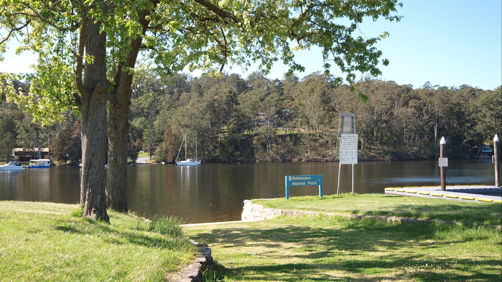
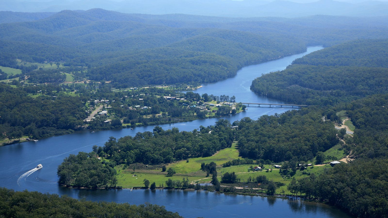
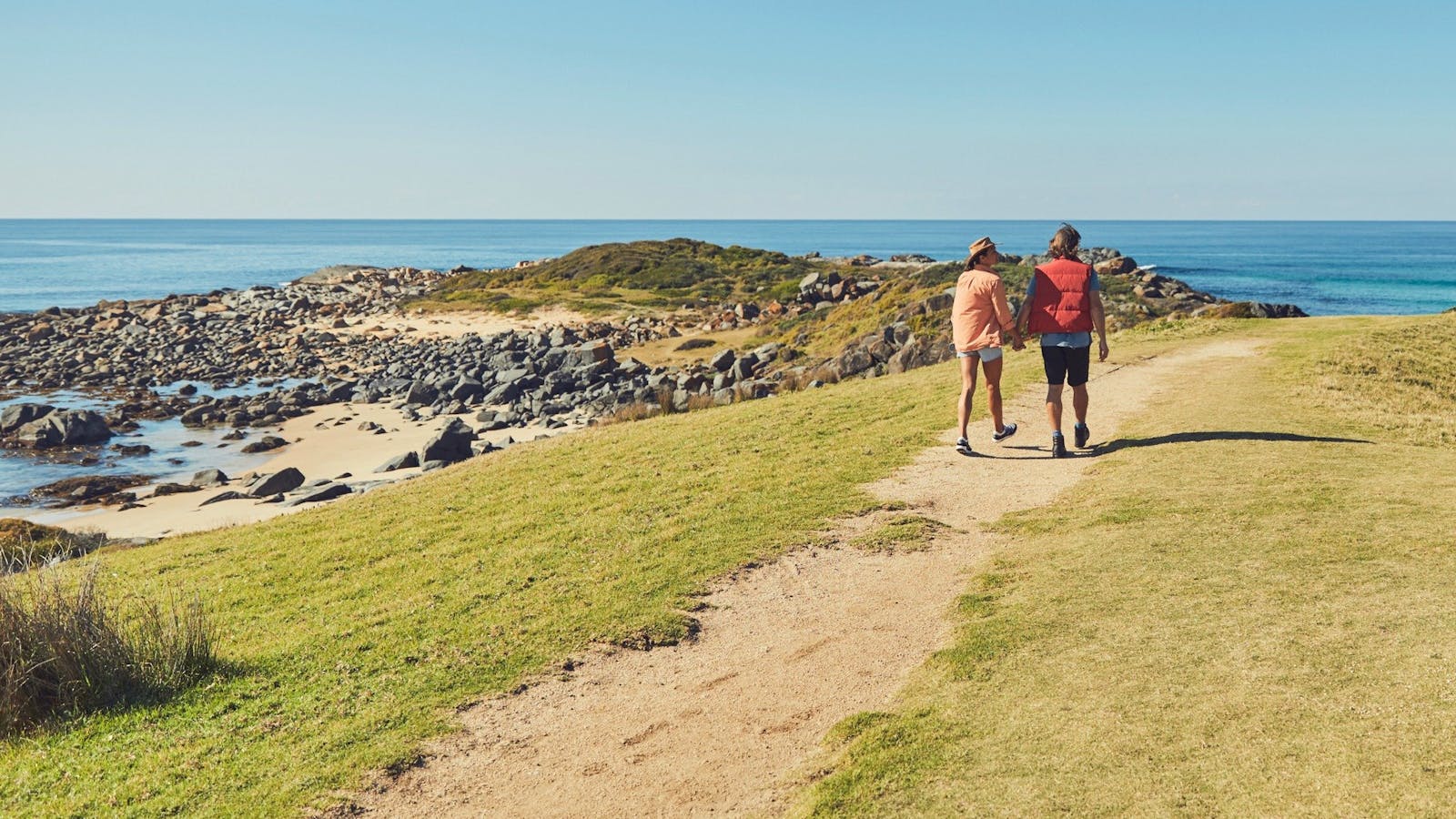
The picturesque historic village of Nelligen lies in one of the sweeping bends of the majestic Clyde River.

Shallow Crossing
The River Road, Nelligen, New South Wales, Australia, 2536
Get Directions

Enjoy a scenic drive from Batemans Bay to Shallow Crossing via historic Nelligen Village.

Nelligen Kayak Hire
Peter Counsell
33 SPROXTONS Lane, Nelligen, New South Wales, Australia, 2536
0436 016 856
paddle@NelligenKayakHire.com.au
Get Directions
$25 ~ $100 AUD*
Parking
* Whether you hire a single kayak for just one hour or a top of the line two-three person Canoe for the entire day, you are assured of top value. All safety gear including PFD's and dry bags included.

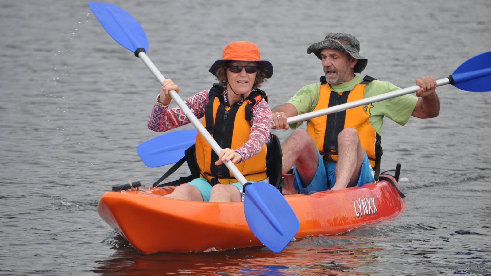
Nelligen Kayak Hire offers single or double sit-on top kayaks or "WenoNah" Canoes to explore the Clyde River on the NSW South Coast

2
Batemans Bay Heritage AreaBatemans Bay, New South Wales

At least 13 sawmills were operating around the Clyde River by the 1880's, some near Nelligen.

Open in mobile
Eurobodalla Coast Tourism
Batemans Bay, NSW, Australia
Get Directions
Names associated with the Bay' sawmills include Francis Guy, Perry and Mitchell. Fishing and oyster farming also became significant industries. Shipping gradually favoured the Bay at Nelligen's expense.
Batemans Bay grew as a regional centre last century due to it being the closest seaside town to the growing national capital, Canberra. It became a popular holiday destination particularly for Canberra residents.
The demise of coastal shipping in the early 1950's and the soth coast's subsequent reliance on road transport meant the construction of Batemans Bay Bridge in 1956 provided a vital link to the south. The last sawmill at Batemans Bay closed in 2012 and the iron lifting span bridge was removed in 2021.
What to do:
Visit the Batemans Bay Heritage Museum for a fascinating look at life in and around Batemans Bay. Take a cruise up the Clyde River to Nelligen.
The Boatshed: Batemans Bay
1 Clyde Street, Batemans Bay, New South Wales, Australia, 2536
(02) 4472 4052
info@innesboatshed.com.au
Get Directions
Non-smoking
Takeaway, Waterside Dining

Innes family boatshed has been operating in Batemans Bay for over 50 years.

Batemans Bay Sculpture Walk
no copyright
Mia Murra Walkway, Batemans Bay, New South Wales, Australia, 2536
info@sculptureforclyde.com.au
Get Directions
Picnic Area
Picnic Area, Cafe

A seaside walk past beautiful sculptures and bayside vistas. Batemans Bay Sculpture Walk was created from the acquisitive award winning sculptures.

Batemans Bay Heritage Museum
3 Museum Place, Batemans Bay, New South Wales, Australia, 2536
(02) 4472 1635
secretary@batemansbayheritagemuseum.com
Get Directions
Caters for people with sufficient mobility to climb a few steps but who would benefit from fixtures to aid balance. (This includes people using walking frames and mobility aids) Caters for people who use a wheelchair., Ambulant Access, Wheelchair Access
Ambulant Access, Public Toilet, Non-smoking, Picnic Area
Picnic Area
Public Toilet
$7 ~ $12 AUD*
Parking, Coach Parking
Caters for people with sufficient mobility to climb a few steps but who would benefit from fixtures to aid balance. (This includes people using walking frames and mobility aids) Caters for people who use a wheelchair., Ambulant Access, Wheelchair Access, Caters for people with sufficient mobility to climb a few steps but who would benefit from fixtures to aid balance. (This includes people using walking frames and mobility aids) Caters for people who use a wheelchair.
* Children under 12: Free Adults AUD7 per head Guided Groups AUD7 per head AUD12 incl. morning tea (by arrangement)

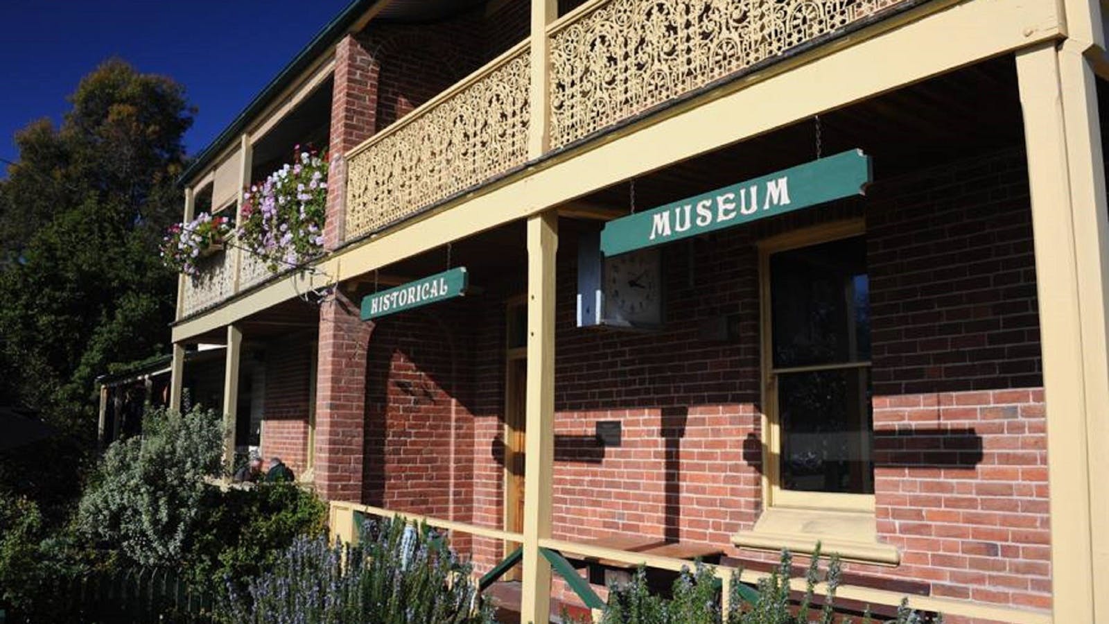
The Old Courthouse Museum is operated by volunteer members of the Clyde River and Batemans Bay Historical Society.

Merinda Cruises
1 Clyde Street, Batemans Bay, New South Wales, Australia, 2536
(02) 4472 4052
info@innesboatshed.com.au
Get Directions

Beautifully refurbished interiors, polished brass fittings, comfortable dining tables and chairs open up to a covered top-deck with spectacular waterway views on this three-hour cruise.

3
Broulee Heritage AreaBroulee, New South Wales

Broulee was the region's first port.

Open in mobile
Eurobodalla Coast Tourism
Broulee, NSW, Australia
Get Directions
In the 1830's, settlers around the district would load and unload from ships anchored in Broulee Bay because a sandbar blocked the entrance to the Moruya River.
Broulee was surveyed and gazetted in 1837 and by mid-1841 a brisk sea trade had developed with Sydney. It was also a depot for Jervis Bay's whaling fleet. It had six buildings and the 46 residents were mostly convicts employed by the local landowner Captain William Oldrey. The port was also the centre for the court and police districts stretching from the Jervis Bay to Eden.
After a flood scoured out the bar at Moruya River in 1841, Moruya became the preferred port. The court and hotel were relocated to Moruya in the 1850's and Broulee was abandoned. Holidaymakers discovered Broulee in the 1920's
What to do:
Visit the memorial to the settlers and aborigines who rescued people from the wreck of the schooner Rover in 1841. It is in the park on thenorthern bank of Candlagan Creek . Walk around Broulee Island, a nature reserve since 1964, and see the site of the 1840-41 Erin-Go-Bragh Hotel and an interesting 1842 grave.
Broulee Island Nature Reserve Walk
Broulee Island, Broulee, New South Wales, Australia, 2537
1800 802 528
info@eurobodalla.com.au
Get Directions
Free Entry
Public Toilet, Picnic Area
Picnic Area, Barbeque
Public Toilet
Birdwatching, Fishing, Swimming
Parking

The four kilometre Broulee Island Walk begins south of the main beach at Broulee, across a permanent sand bar. The walk features ocean vistas across

Broulee Beach
27 Heath Street, Broulee, NSW, Australia, 2537
Get Directions

Located on the south coast of NSW, Broulee is surrounded by crystal clear waters, great surf and wide expanses of sandy beaches extending for kilometres.

4
Tuross Head Heritage Area

Small coastal vessels carried timber and produce (particularly potatoes) from farms around Tuross Lake 1850s-1860s.

Open in mobile
Eurobodalla Coast Tourism
Australia, 2537
Get Directions
Attempts to make Tuross a recognised port were frustrated by its difficult entrance.
The Tuross peninsular (875 acres) was acquired by Patrick Mylott in 1870. He built Tuross House, overlooking Coila and Tuross Lakes. He farmed until 1883 when he moved to Sydney to ensure his young daughter Eva, born at Tuross, received appropriate training; she became an internationally acclaimed opera singer. A special plaque is in Eva Mylott Park in Jutland Ave.
Tuross Head was eventually developed as a tourist destination by landowner Hector McWilliam in the mid-1920s. He purchased the property from Mylott’s widow in 1925, subdivided it and advertised the lots for holiday houses. He established a nine-hole golf course and planted 200 Norfolk Island Pines around Tuross Head. These pines are McWilliam’s distinctive legacy. Several boat sheds with hire facilities were built to service the growing demand for fishing and boating.
What to do:
Enjoy the foreshore walk. and take in the view at One Tree Point Lookout. Visit the historic boatsheds.
One Tree Point Lookout and Picnic Area
Eurobodalla Shire Council
Tuross Boulevard, Tuross Head, New South Wales, Australia, 2537
1800 802 528
info@eurobodalla.com.au
Get Directions
Free Entry
Picnic Area
Picnic Area
Birdwatching, Canoeing/Kayaking, Cycling, Fishing, Scenic Drives, Surfing, Swimming, Walks, Lookouts
Parking

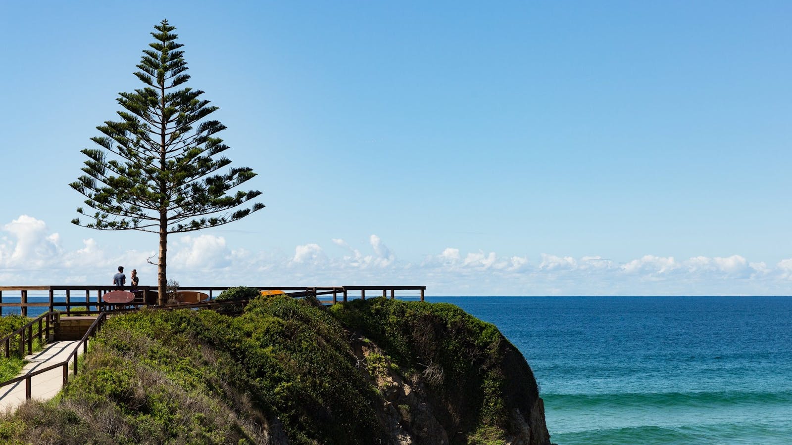
A paved path leads to a lone Norfolk Island Pine, marking the Tuross headland lookout with glorious ocean views.

Bingi Dreaming Track
Destination NSW
Tuross Boulevard, Tuross Head, New South Wales, Australia, 2537
Get Directions
Walks, Hiking

Follow in the footsteps of the Brinja-Yuin people as you walk the Bingi Dreaming track.

Tuross Lake
Nelson Parade, Tuross Head, New South Wales, Australia, 2537
1800 802 528
info@eurobodalla.com.au
Get Directions
Free Entry
Birdwatching, Boating, Canoeing/Kayaking, Fishing, Sailing, Swimming

Tuross Lake offers plenty of paddling options for all levels of skill, in particular for beginner/novice paddlers. Soak up the magnificent surroundings as you explore.

5
Bodalla Heritage Area

Bodalla has two significant churches designed by two of the Colony’s most famous nineteenth century architects.

Open in mobile
Eurobodalla Coast Tourism
Australia, 2545
Get Directions
The Bodalla Estate was established in 1860 by leading Sydney businessman Thomas Sutcliffe Mort (1816-1878) as his country estate. He had pioneered specialised wool auctions and pastoral finance, developed Mort’s Dock, and pioneered frozen meat export.
Mort was ‘the father of Australian dairying’. In 1864, he changed Australian cheese production from a cottage industry into a factory system where for the first time milk from different sources was manipulated to produce a uniform quality cheese to rival English imports.Bodalla was regarded as ‘one of the few showplaces of the industrial progress and enterprise of the Colony’. Ideas developed here were taken up by dairy farmers elsewhere. Bodalla’s ‘village’ was initially on the river flats but floods in the 1860s and 1870 prompted Mort to establish a new village on higher ground. The Bodalla Estate remained in the Mort family for over 100 years.
What to do:
Visit All Saints Anglican Church, a memorial to Thomas Mort and his first wife Theresa. Designed by Edmund Blacket. Built in two stages - the first completed 1883, the second 1902.
Other historical building to see include the Bodalla Arms Hotel (1910), bakery (by mid 1880s), Post Office (1899), and original school and residence (1878). The shingled Catholic Church (1886), was designed by John Horbury Hunt.
Visit Bodalla Dairy Shed to hear about Bodalla’s history and enjoy the delicious local dairy products made on site.
Bodalla Dairy - Cheese, Milk and Ice Cream Factory and Cafe
52 Princes Highway, Bodalla, New South Wales, Australia, 2545
(02) 4473 5234
office@bodalladairy.com.au
Get Directions
Caters for people with sufficient mobility to climb a few steps but who would benefit from fixtures to aid balance. (This includes people using walking frames and mobility aids) Caters for people who use a wheelchair., Ambulant Access, Wheelchair Access
Ambulant Access, Non-smoking
Australian, Beverage, Brunch, Dessert, High Tea or Afternoon Tea, Native Australian, Lunch, Takeaway
Entertainment, Live Music
Parking, Coach Parking
Caters for people with sufficient mobility to climb a few steps but who would benefit from fixtures to aid balance. (This includes people using walking frames and mobility aids) Caters for people who use a wheelchair., Ambulant Access, Wheelchair Access, Caters for people with sufficient mobility to climb a few steps but who would benefit from fixtures to aid balance. (This includes people using walking frames and mobility aids) Caters for people who use a wheelchair.

The Bodalla Dairy Cheese Factory is located in the heart of the historic village of Bodalla.

Bodalla Historic Town Walk
Princes Highway, Bodalla, New South Wales, Australia, 2545
1800 802 528
info@eurobodalla.com.au
Get Directions

Take a walk back in time through Bodalla to ponder the village as it was.

6
Narooma and Montague Island Heritage

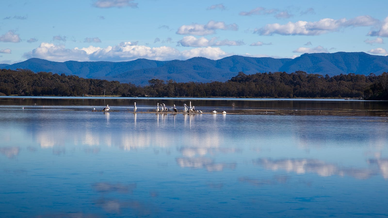
Wagonga Inlet was used as a port from 1860 to supply Dromedary and Nerrigundah goldfields, with initial settlement ‘up river’.

Open in mobile
Eurobodalla Coast Tourism
Australia, 2546
Get Directions
Sawmilling became the major industry; ships carried timber to Sydney from several sawmills until the mid-1950s. Shoaling within the inlet led to sawmills moving closer to the entrance. Narooma was gazetted in 1886.
Tourists were attracted to Narooma from its early days by the area’s beauty, ocean and inlet fishing, and oysters. From the 1920s, Narooma’s stylish guest houses attracted Sydney professionals and farmers and graziers from ‘out west’ and camping along the foreshore was popular from the 1920s.Tourism is now Narooma’s main industry.
Australia’s first commercial fish cannery was established in Narooma in 1937. Narooma is the closest port for Montague Island and its historic lightstation (1881)
What to do:
The original lens from Montague Lighthouse is on permanent display, along with related maritime artefacts at the Lighthouse Museum. Visit historic Montague Island Lightstation (1881) on Montague Island.
Stroll along the shore to Narooma’s Bar Rock Lookout, or head north across the bridge to Mill Bay Boardwalk. Interpretive signs include some of Narooma’s history. Walk or cycle to Dalmeny.
See the cluster of heritage-listed boathouses on Forsters Bay, the largest group of boatsheds on the south coast . Cruise in Wagonga Princess and hear about life on the river. Watch a movie at the School of Arts Hall (1926, now the Kinema), one of the longest-running movie theatres in NSW.
Montague Island Nature Reserve
Montague Island, Narooma, New South Wales, Australia, 2546
1300 072 757
parks.info@environment.nsw.gov.au
Get Directions
Non-smoking
Birdwatching, Walks, Lookouts

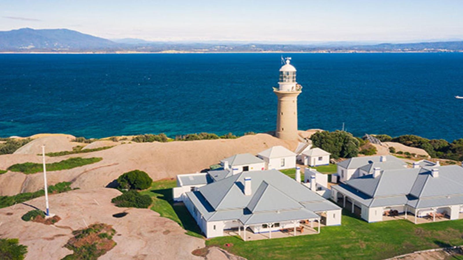
Montague Island Nature Reserve is home to hundreds of seals and more than 90 bird species. Enjoy a stay in a heritage lighthouse keeper’s cottage.

Wagonga Inlet Cruises
The Inlet, Narooma, New South Wales, Australia, 2546
Get Directions

Mill Bay Boardwalk Narooma
Eurobodalla Tourism
Centenary Drive, North Narooma, New South Wales, Australia, 2546
1800 802 528
info@eurobodalla.com.au
Get Directions
Free Entry
Picnic Area
Picnic Area
Birdwatching, Cycling, Fishing, Walks
Parking

Along the scenic Mill Bay Boardwalk, gaze out on the beautiful emerald water and see that it is teeming with life.

Bar Rock Lookout and Australia Rock
Eurobodalla Shire Council
1 Bar Rock Road, Narooma, New South Wales, Australia, 2546
1800 802 528
info@eurobodalla.com.au
Get Directions
Free Entry
Parking

Australia Rock is a popular photo opportunity. Viewed at just the right angle, the hole in the rock at Wagonga Head, has an uncanny resemblance

Narooma Lighthouse Museum
Eurobodalla Shire Counci
Princes Highway, Narooma, New South Wales, Australia, 2546
(02) 4476 3357
bookings@southboundescapes.com
Get Directions
Free Entry
Public Toilet, Non-smoking
Public Toilet
WiFi
Parking, Coach Parking

Come and discover the history of Montague Island Lighthouse the Narooma Lighthouse Museum, located at the Narooma Visitor Centre.

7
Mogo Heritage Area

Mogo, once one of Australia’s most productive goldfields, was home to thousands of people from across the globe.

Open in mobile
Get Directions
The gold rush at Mogo began with the discovery of gold at Cabbage Tree Creek in 1857. Two hundred diggers appeared almost overnight and the township quickly became a reality. According to some reports, there were over 10,000 people in the area.
Although fossicking continued in the Mogo gold fields, the gold rush was over, giving way to timber harvesting in the 1880s after Lynch’s mill was set up there. The steady growth in population led to the building in1866 of a church, shops, a post office and in 1869 a school of arts and government school opened. By 1910 there were two general stores, one hotel, a butcher and a draper.
However, the boom faded and the village became a sleepy backwater to drive through, until rediscovered and transformed into a quant tourist village in the late 1980s with period buildings used as cafes and boutique gift shops selling arts and crafts. The Original Gold Rush Colony opened in 1991 was a popular 1850s replica theme park of the bygone days of old Mogo Town. Sadly it was destroyed in the bushfires in 2020 and is permanently closed, however the village continues to thrive as a popular shopping destination.
What to do:
Spend time browsing the eclectic range of shops and smapling local produce from the cafes. T
ake a short drive east out to the Mogo Wildlife Park, or north to the Eurobodalla Regional Botanic Garden.

Sights & Activities

Mogo
Sydney Street, Mogo, New South Wales, Australia, 2536
Get Directions
Birdwatching, Hiking, Scenic Drives, Walks

Mogo has a charm that is hard to define. The former gold rush village has developed that certain something – an authentic but quirky mix.

Mogo Bushwalk
Tomakin Road , Mogo, New South Wales, Australia, 2536
1800 802 528
info@eurobodalla.com.au
Get Directions
Free Entry
Birdwatching, Hiking, Walks

Tucked in behind the historic town of Mogo, Mogo Bushwalk in the Mogo State Forest meanders through wet and dry eucalyptus forests.

8
Moruya Heritage Area

Moruya is famous for its granite, first quarried in 1850.

Open in mobile
Eurobodalla Coast Tourism
Get Directions
Moruya granite was used in the pylons for the Sydney Harbour Bridge. From 1925 to 1932, Dorman, Long and Company employed over 250 stonemasons from 13 different countries to supply, cut and dress granite slabs for the pylons. A flood in 1840 scoured the sandbar and opened up the Moruya River to shipping. The government then abandoned Broulee in favour of Moruya, gazetted as a village in 1851.
The first wharves were near the entrance. The river's deep channels changed frequently and vessels often grounded so a pilot was stationed at Moruya South Head from 1860.Moruya was an important port for the Araluen goldfields and for the district's producers. Moruya also developed into an important regional and administrative centre.
What to do:
Visit Moruya Museum in Emmott House and see the State Heritage listed Abernethy and Co stonemason's lathe. Follow the https://www.mdhs.org.au/pdfs/Moruya_Town_Walk.pdf to discover Moruya's delightful historic buildings.
Drive to Moruya Heads (Toragy Point). The Pilot Station (1861-1953), now private residence, is nearby.
Walk the stunning Bingi Dreaming Track from Congo to Coila Lake. The track links camp and ceremonial sites, water and food sources.
Bingi Dreaming Track
Destination NSW
Tuross Boulevard, Tuross Head, New South Wales, Australia, 2537
Get Directions
Walks, Hiking

Follow in the footsteps of the Brinja-Yuin people as you walk the Bingi Dreaming track.

Historic Quarry Park - Moruya
North Head Drive, Moruya, New South Wales, Australia, 2537
1800 802 528
info@eurobodalla.com.au
Get Directions
Free Entry
Public Toilet
Barbeque
Public Toilet

Historic Quarry Park is an idyllic picnic area located on the shores of the beautiful Moruya River.

Moruya Museum
85 Campbell Street, Moruya, New South Wales, Australia, 2537
(02) 4474 3224
moruyamuseum@gmail.com
Get Directions
$5 AUD
Parking

A collection of furniture, books, artefacts and memorabilia, intended to show visitors the lives of ordinary people from the middle of the 1800s.

Shelly Beach Picnic Area - Moruya Heads
Eurobodalla Shire Council
Elizabeth Street, Moruya Heads, New South Wales, Australia, 2537
1800 802 528
info@eurobodalla.com.au
Get Directions
Free Entry
Birdwatching, Surfing, Swimming, Walks

Shelly Beach at Moruya Heads is a popular family recreational spot with picnic facilities at the mouth of the Moruya River.

Toragy Point and Moruya Heads Lookout
Eurobodalla Shire Council
Moruya Heads, New South Wales, Australia, 2537
Get Directions
Birdwatching, Hiking, Scenic Drives, Surfing, Swimming, Walks

South Head Moruya holds an old graveyard on the headland - a glimpse into the past with far-reaching views of the coast.

9
The Tilba District Heritage Areas

Gulaga, also called Mt Dromedary, is sacred to Yuin people and dominates the Tilba region.

Open in mobile
Eurobodalla Coast Tourism
Get Directions
Goldmining contributed to the district’s prosperity but only on a modest scale. At its peak 1902-1904, 300 people lived on the mountain. The two villages of Tilba Tilba and Central Tilba relied more on dairying.
The ABC Co-operative in Central Tilba was the first cheese co-operative in NSW (1891); the village developed to mainly service farmers delivering milk to the factory. The district once led NSW in forage conservation and was known as ‘the land of silos’. Central Tilba was listed as a National Trust village in the mid 1970s.
Gulaga and Mumbulla Mountain (further south) were handed back to traditional owners in 2006.
What to do:
Walk along Central Tilba’s Bate Street to the ABC Cheese Factory. Interpretative signs are on some buildings.
Drive to the picturesque Tilba Cemetery on the coast. Walk up Gulaga from the historic La Galette Creperie (formerly Pam’s Store) in Tilba Tilba (1879/1880). It’s a 14km 4 hour return walk; an interpretative sign at the saddle explains Gulaga’s significance to Yuin people and some goldmining history.
Bellbrook Farm Loop Walk
Eurobodalla Shire Council
Station Street, Central Tilba, New South Wales, Australia, 2546
info@eurobodalla.com.au
Get Directions
Picnic Area
Picnic Area

A scenic 2km walk around the foothills of Gulaga (Mount Dromedary). Start the walk at the end of Station Street, which runs off Bate Street

Water Tower Lookout Central Tilba
3 Station Street, Central Tilba, New South Wales, Australia, 2546
1800 802 528
info@eurobodalla.com.au
Get Directions
Free Entry
Picnic Area
Picnic Area

Take the five minute walk from Station Street in Central Tilba for a rewarding panoramic view of the town, surrounding region and Montague Island.

Tilba Talks Heritage Walks, Walking Tours
Tilba walks
Corkhill Drive, Central Tilba, New South Wales, Australia, 2546
0433 114 374
tilbatalks@gmail.com.au
Get Directions

Tapping into this fascinating history is Tilba Walks Heritage Talks Walking Tours. This small group tour specialist offers an exclusive walking tours.

Gulaga National Park
Gulaga National Park, Tilba Tilba, New South Wales, Australia, 2546
(02) 4476 0800
Get Directions
Free Entry
Birdwatching, Walks
Parking

Gulaga National Park was created in January 2001. It covers an area of 4673ha. Gulaga (Mount Dromedary) and the surrounding landscape have great spiritual significance

Gulaga Mountain Walk
La Galette Cafe, Tilba Tilba, New South Wales, Australia, 2546
1800 802 528
info@eurobodalla.com.au
Get Directions
Free Entry
Picnic Area
Picnic Area
Birdwatching, Walks, Hiking
Parking

The steep track up the mountain was built in 1894 for gold miners.

Using QR Codes

Open your Camera App or download a QR reader

Point your camera at the QR Code which will launch the correct app

Access websites and features such as maps and directions

Optional Downloads

GPX File

For use in apps such as GPS Navigation and wearable devices

KML File

For use in offline mapping products, such as maps.me and Google Maps

PDF File

A link to this document

Build your own itineraries

Alpaca provides a way for you to build your own itineraries. Visit https://alpaca.travel

Terms of Service and Attribution

Copyright Alpaca.travel, Mapbox.com and OpenStreetMaps openstreetmaps.com.
Terms of Service https://alpaca.travel/terms