Cycling - Gravel Rides
Eurobodalla Coast Tourism

Details

Curated selection of points

Get off road with your bike and travel on some gravel in Eurobodalla!

A selection of gravel rides that will take you through spectacular forest, rolling rural landscapes, riverside roads and hinterland climbs across Eurobodalla.
open in youtube
Open in mobile
1
South Durras Course

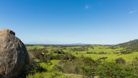
Spectacular family loop ride through Murramarang National Park

Open in mobile
Eurobodalla Coast Tourism
Get Directions
Fantastic gum tree and lush fern sections with a superb coastal view once riders are at the turn around point of North Head lookout.
Difficulty Level: 1/5
Level of Rider: Beginners / Family / Open for all riders
Suggested Bike: Gravel, MTB and E-MTB possible
Surface: All solid, well compacted gravel roads - 7% Paved / 92% Gravel / 1% Other
Other: The final 2km to finish the loop is on Durras Drive which is on open-road
Elevation: 14m - 149m
Estimated ride time @ 15kph: ~1:30 hours
Estimated ride time @ 25kph: ~0:50 mins
Parking: Area of Corilla St, South Durras NSW 2536
Facilities at Start / Finish: General Store (now permanently closed)
Public Toilet Facilities: Murramarang Beach Reserve or Durras Oval
Other Facilities on loop: Toilet available at the turn around at North Head camp ground ~9km
Other Notes: When at the North Head camp site (~9km), ride the walking track up towards the North Head Beach lookout.
Please remember:
Walkers have right of way. You will need to park your bikes at the start of the stairs and walk the short distance to the raised platform where you will have a superb costal view. Return back the same way to the North Head camp site and continue to follow the route. Once you come out of the Murramarang National Park, you will be riding for 2km along Durras Drive which is on open road back to the start location.
North Head campground
North Head Road, Benandarah, New South Wales, Australia, 2536
1300 072 757
parks.info@environment.nsw.gov.au
Get Directions
1 rooms
Non-smoking
$0 AUD*
Parking
* There are no camping fees at this campground but a $6 booking fee applies.

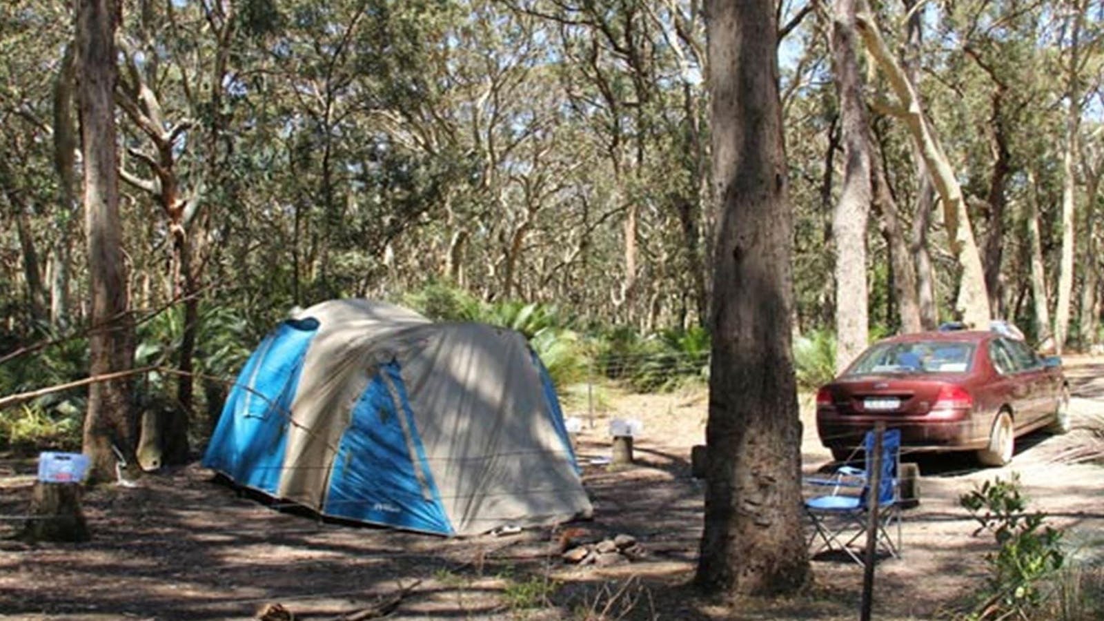
This remote bush camp spot is ideal for the adventurous campers who like to get away from it all. At North Head campground, in Murramarang

Honeysuckle Beach Walking Track
Photo: John Yurasek/NSW Government
North Head Road, Benandarah, New South Wales, Australia, 2536
Get Directions
Walks, Hiking

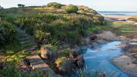
Honeysuckle Beach walking track is a great short hike in the southern end of Murramarang National Park, just north of Batemans Bay. It’s an ideal

Oaky Beach Walking Track
Photo: Michael van Ewijk
Old Coast Road, Benandarah, New South Wales, Australia, 2536
Get Directions
Walks, Hiking

A great off the beaten track hike, Oaky Beach walking track leads through gums and rainforest to a secluded beach in the southern area of

Myrtle Beach walking track
Old Coast Road, Benandarah, New South Wales, Australia, 2536
Get Directions
Canoeing/Kayaking, Walks, Hiking

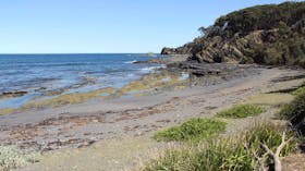
Get away from it all and escape to this beautiful, isolated beach for the day.  Surround yourself with natural bushland and revel in the sounds

Dark Beach Walking Track
Photo: Michael van Ewijk
Old Coast Road, South Durras, New South Wales, Australia, 2536
Get Directions
Walks, Hiking

Enjoy a relaxing day away on this remote beach in Murramarang National Park, on the South Coast. Dark Beach walking track leads through spotted gum

Richmond Beach
Photo: Michael Van Ewijk
Richmond Beach, Benandarah, New South Wales, Australia, 2536
Get Directions
Picnic Area
Picnic Area
Canoeing/Kayaking, Fishing, Snorkelling, Surfing, Swimming

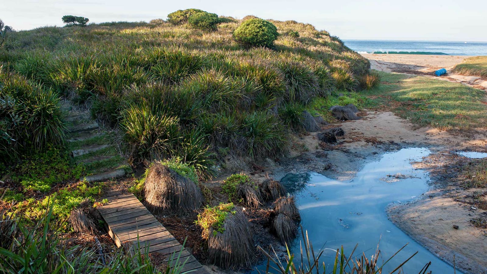
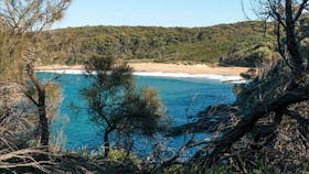
Wander along a short and easy walking track and within a few steps you’ll arrive at the secluded beauty of Richmond Beach. Ideal for families,

North Head Lookout
Photo: M Jarmon
North Head Road, Benandarah, New South Wales, Australia, 2536
1300 072 757
parks.info@environment.nsw.gov.au
Get Directions

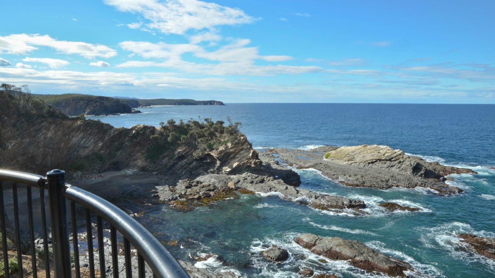
The spectacular cliffs along the Murramarang coastline are on fine display from North Head lookout. After following a well-formed track for 300 metres over gently

2
Nelligen Course A

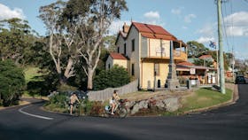
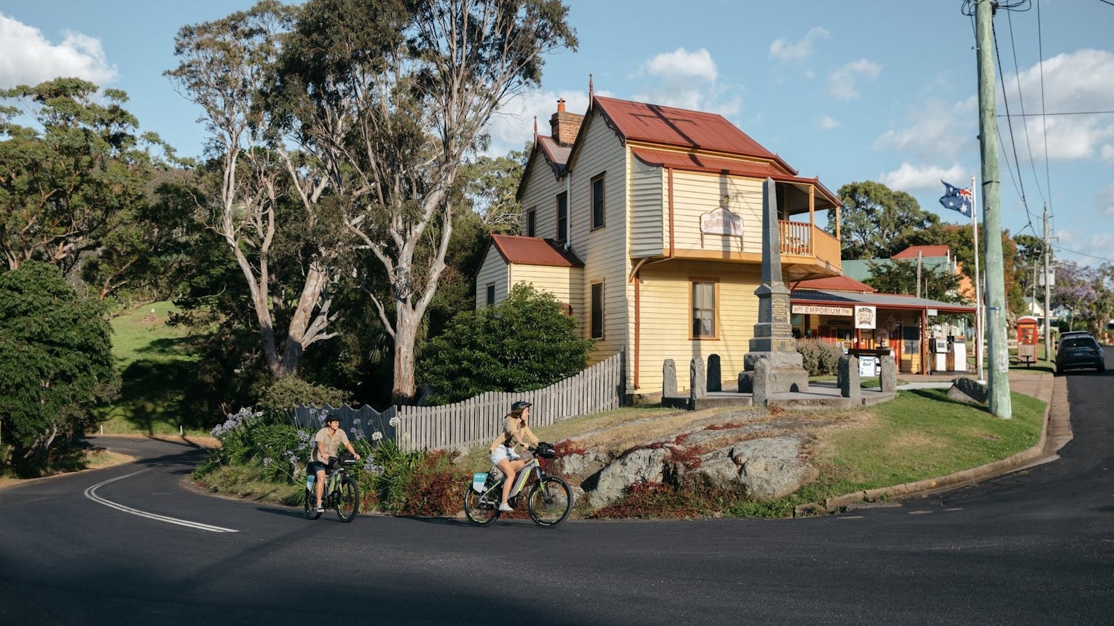
Family ride which starts and finishes in the beautiful historical village of Nelligen.

Open in mobile
Eurobodalla Coast Tourism
Get Directions
Enjoy the out and back ride along the scenic Clyde River.
Difficulty Level: 1/5
Level of Rider: Beginners / Family / Open for all riders
Suggested Bike: Gravel, MTB and E-MTB possible
Surface: All solid, well compacted gravel roads - 7% Paved / 92% Gravel / 1% Other
Other : ALTERNATE START POINT OFF KINGS HIGHWAY. On the full ride, the first and final 2km is on The Kings Highway - speed limit of 80KPH
Alternate start and finish location for Beginner Riders, park at the corner of River Road and Kings Highway
Elevation: 2m - 42m
Estimated ride time @ 15kph: ~3:00 hours
Estimated ride time @ 25kph: ~1:45 hours
Parking: Area of Braidwood St, Nelligen NSW 2536
Facilities at Start / Finish: Cafe (not open daily)
Public Toilet Facilities: Braidwood Street
Parking Beginner Riders: Corner of River Road and Kings Highway
Other Facilities on loop: There are no other facilities on this ride
Other Notes: Riders have at least ONE river crossing, roughly 30m in length so you will get wet. If you cross the second crossing, which is the Shallow River Crossing, please note that it is tidal and should NOT be crossed at high tide. It is roughly 100m in length so you will get wet. If you go over the Shallow Crossing of the Clyde River and continue along The River Road for ~5km, you can stop at the Clyde Berry Farm. We suggest that you call ahead to make sure it is open. It is not designated on this ride link.
Clyde Berry Farm: Lot 22 The River Rd, Mogood NSW 2538 : +61 2 4478 1057
Once you turn around at Shallow Crossing follow the same exact way that you rode out back to the start location.
Nelligen
Nelligen, New South Wales, Australia, 2536
Get Directions
Birdwatching, Boating, Camping, Canoeing/Kayaking, Cycling, Fishing, Hiking, Mountain Biking, Walks

The picturesque historic village of Nelligen lies in one of the sweeping bends of the majestic Clyde River.

Nelligen Heritage Area
Nelligen, Nelligen, New South Wales, Australia, 2536
1800 802 528
info@eurobodalla.com.au
Get Directions

Nelligen was once a busy port servicing Braidwood's farming district and the Araluen goldfields. It pre-dates Batemans Bay.

Shallow Crossing
The River Road, Nelligen, New South Wales, Australia, 2536
Get Directions

Enjoy a scenic drive from Batemans Bay to Shallow Crossing via historic Nelligen Village.

3
Nelligen Course B

Enjoy some long climbs and descents during this loop ride including Big Bit lookout and river riding

Open in mobile
Eurobodalla Coast Tourism
Get Directions
open in youtube
Start in the beautiful historical village of Nelligen. There is also the chance to climb all the way up to Big Bit Road. Riders will also cross the weir at Shallow Crossing and end the loop with a superb ride along River Road which parallels the Clyde River all the way back to Nelligen.
Difficulty Level : 3.5/5
Level of Rider: Intermediate to Advanced
Suggested Bike: Gravel, MTB and E-MTB possible
Surface: Primarily well compacted gravel roads with some steep sections both up and down mostly in the first 40km - 4% Paved / 96% Gravel / 0% Other
Elevation: 1m - 218m
Estimated ride time @ 15kph: ~4:00 hours
Estimated ride time @ 25kph: ~2:45 hours
Parking: Area of Braidwood St, Nelligen NSW 2536
Facilities at Start / Finish: Cafe (not open daily)
Public Toilet Facilities: Braidwood Street
Other Facilities on loop: There are no other facilities on this ride
Other Notes: The first 1km from Nelligen is along The Kings Highway which includes a crossing of the Clyde River over the Nelligen bridge. The climb up to Big Bit Road includes some +15% sections of fire trail. At the top there are views over the ranges and out to the Tasman Sea. There are at least two river crossings with the main one being the Clyde River at Shallow Crossing. The second one is ~13.5km before you get back to Nelligen, it is not as long as the Shallow Crossing. Shallow Crossing is tidal and should not be crossed at high tide. It is roughly 100m in length so you will get wet. The second crossing is roughly 30m in length, again you will get wet. There is an option to visit the Clyde River Berry Farm. It is open seasonally so call ahead. It is not designated on the loop and you will need to turn right at River Rd. The Clyde River Berry Farm is 5km in the other direction from Shallow Crossing.
Clyde River Berry Farm: Lot 22 The River Rd, Mogood NSW 2538 : +61 2 4478 1057
Please remember:
The last 2km, once riders turn off River Road, is along The Kings Highway which takes you back to Nelligen. NOTE : As of October 2020, stay on the course through the Boyne State Forest as there are many bridges which have been burnt/washed away.
Nelligen Heritage Area
Nelligen, Nelligen, New South Wales, Australia, 2536
1800 802 528
info@eurobodalla.com.au
Get Directions

Nelligen was once a busy port servicing Braidwood's farming district and the Araluen goldfields. It pre-dates Batemans Bay.

Nelligen
Nelligen, New South Wales, Australia, 2536
Get Directions
Birdwatching, Boating, Camping, Canoeing/Kayaking, Cycling, Fishing, Hiking, Mountain Biking, Walks

The picturesque historic village of Nelligen lies in one of the sweeping bends of the majestic Clyde River.

Shallow Crossing
The River Road, Nelligen, New South Wales, Australia, 2536
Get Directions

Enjoy a scenic drive from Batemans Bay to Shallow Crossing via historic Nelligen Village.

4
Mogo Course

This loop takes riders on forestry roads and through the beautiful locality of Runnyford before heading back to Mogo

Open in mobile
Eurobodalla Coast Tourism
Get Directions
Start in the village of Mogo for this scenic loop ride.
Difficulty Level: 3.5/5
Level of Rider: Intermediate to Advanced
Suggested Bike: Gravel, MTB and E-MTB possible
Surface : Primarily well compacted gravel roads with some steep gravel roads, both up and down -1% Paved / 99% Gravel / 0%
Elevation: 15m - 425m
Other:
Estimated ride time @ 15kph: ~4:45 hours
Estimated ride time @ 25kph: ~2:45 hours
Parking: Mogo Public Toilets off Tomakin Road, Mogo.
Facilities at Start / Finish: A variety of cafes in Mogo
Public Toilet Facilities: Corner Princes Hwy and Tomakin Road
Other Facilities on loop: There are no other facilities on this ride
Other Notes: There is a lot of climbing on this loop including one very long climb which is ~11km in distance. This climb takes riders from 30m to 425m above sea-level which is followed by a 4km steep gravel descent. This loop offers a great variety of forestry roads through the Mogo State Forest and then through some beautiful open farm land. Riders will cross the spectacular wooden bridge in Runnyford. If safe, stop and watch the water pass and keep an eye out for stingrays and schools of fish. Riders then finish the loop by coming back through a different section of the Mogo State Forest.

Sights & Activities

Mogo Bushwalk
Tomakin Road , Mogo, New South Wales, Australia, 2536
1800 802 528
info@eurobodalla.com.au
Get Directions
Free Entry
Birdwatching, Hiking, Walks

Tucked in behind the historic town of Mogo, Mogo Bushwalk in the Mogo State Forest meanders through wet and dry eucalyptus forests.

Mogo
Sydney Street, Mogo, New South Wales, Australia, 2536
Get Directions
Birdwatching, Hiking, Scenic Drives, Walks

Mogo has a charm that is hard to define. The former gold rush village has developed that certain something – an authentic but quirky mix.

5
Moruya Course

Starting in Moruya, near the river, follow paved roads before venturing through the Deua National Park and State Forest

Open in mobile
Eurobodalla Coast Tourism
Get Directions
Be prepared for some steep hill climbs on this scenic 2-3 hour ride.
Difficulty Level: 3/5
Level of Rider: Intermediate to Advanced
Suggested Bike: Gravel, MTB and E-MTB possible
Surface: Primarily well compacted gravel roads with some steep gravel sections, both up and down - 8% Paved / 92% Gravel / 0% Other
Elevation: 5m - 222m
Estimated ride time @ 15kph: ~3:00 hours
Estimated ride time @ 25kph: ~2:00 hours
Parking: Riverside Park off Shore St, Moruya
Facilities at Start / Finish: A variety of cafes in Moruya
Public Toilet Facilities: Riverside Park
Other Facilities on loop: There are no other facilities on this ride
Other Notes: This is not a flat ride, be prepared for some long and steep climbs and descents on gravel roads. This ride starts next to the Moruya River which is just a stones throw away from many cafes and eateries, plus Moruya Cycles. Riders will head out from Moruya on paved roads before climbing and descending through the Deua National Park and also the Moruya State Forest before returning back to the start via paved roads into Moruya.
open in youtube
Moruya Heritage Area
Moruya, Moruya, New South Wales, Australia, 2537
1800 802 528
info@eurobodalla.com.au
Get Directions

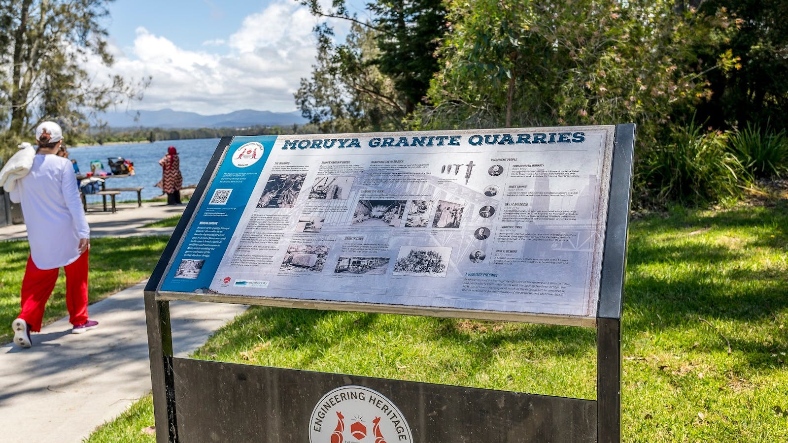
Moruya is well-known for its granite, which was first quarried in 1850.

Moruya
Moruya, New South Wales, Australia, 2537
Get Directions
Boating, Canoeing/Kayaking, Cycling, Fishing, Surfing, Swimming, Walks

Moruya is a lovely inland town on the Eurobodalla coast. It's a great base for exploring the surrounding coastline with its bays, beaches and headlands

6
Bodalla Course

Experience a variety of terrain on this loop from rolling hills through farming country to steep climbs and descents in State Forest.

Open in mobile
Eurobodalla Coast Tourism
Get Directions
​​​​​​​​​
open in youtube
This ride starts in the picturesque town of Bodalla. Make sure you leave enough time to stop in at the Bakery, Dairy or Pub in Bodalla.
Difficulty Level: 4.5/5
Level of Rider: Advanced
Suggested Bike: Gravel, MTB and E-MTB possible
Surface: To begin you will be on paved roads before riding along mostly solid, well compacted gravel roads. The first and last ~500m is on the Princes Highway as riders leave Bodalla.8% Paved / 92% Gravel / 0% Other
Elevation: 7m - 638m
Estimated ride time @ 15kph: ~5:45 hours
Estimated ride time @ 25kph: ~3:30 hours
Parking: Behind the Bodalla Dairy Shed.
Facilities at Start / Finish: Bodalla Bakery, Bodalla Dairy Cafe and Bodalla Pub.
Public Toilet Facilities: Bodalla Memorial Hall, 60 Princes Hiighway Bodalla.
Other Facilities on loop: There are no other facilities on this ride.
Other Notes: This is a 4.5/5 level ride due to the large and steep climb/descent that riders will face. Riders will head out from Bodalla on paved roads before rolling through some brilliant Eurobodalla farming country. Then riders begin a ~24km section up one of the biggest climbs in the area to the top of Comerang Road (638m). Then comes ~12km descent through the Dampier State Forest down into Nerrigundah. Soon after the descent there is a chance to visit the Miles O'Grady Monument in Nerrigundah to read about the history of the valley during the gold rush. There a variety of ways to shorten the loop from Nerrigundah back to Bodalla. If you do not want to do the full loop you can follow the signs back to Bodalla.
Please remember:
On the weekends Bodalla gets very busy so please park further up the road near All Saints Anglican Church. The link given on this ride is for the full loop. To finish the full loop riders go through the Bodalla State Forest and then ride over and alongside the beautiful Tuross River before returning back through more lush farming land on the way back to Bodalla. As of October 2020, the bridge over the Tuross River is not there. Riders will get wet crossing the Tuross River.
Bodalla Historic Town Walk
Princes Highway, Bodalla, New South Wales, Australia, 2545
1800 802 528
info@eurobodalla.com.au
Get Directions

Take a walk back in time through Bodalla to ponder the village as it was.

Bodalla Heritage Area
Bodalla, Bodalla, New South Wales, Australia, 2545
1800 802 528
info@eurobodalla.com.au
Get Directions

Bodalla boasts two significant churches designed by two of the most prominent architects of the 19th century in the colony.

Bodalla
Eurobodalla Shire Council
Bodalla, New South Wales, Australia, 2545
Get Directions
Birdwatching, Boating, Camping, Cycling, Four Wheel Driving, Scenic Drives, Walks

Lush green countryside, heritage architecture and cheese making are the hallmarks of this 150-year-old dairy village.

7
Narooma Course

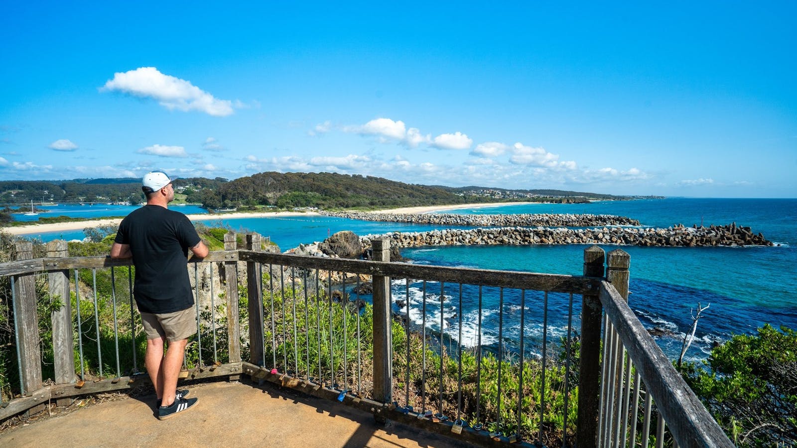
This loop ride starts and finishes in the fishing town of Narooma which hosts an annual Oyster Festival each late April or early May.

Open in mobile
Eurobodalla Coast Tourism
Get Directions
While in Narooma we highly recommend that riders head out and take a photo of the iconic Australia Rock. Riders will then head out on glorious gravel roads to complete a beautiful loop through lush farming land and visit Central Tilba via the out and back section before returning to Narooma.
Difficulty Level: 3/5
Level of Rider: Beginners / Open for all riders. Please be aware that there is +1000m of elevation for the entire route.
Suggested Bike : Gravel, MTB and E-MTB possible
Surface: All solid, well compacted gravel roads plus a lot of paved roads, especially the out and back section to Central Tilba and around Narooma.46% Paved / 54% Gravel / 0% Other
Elevation: 1m - 173m
Estimated ride time @ 15kph: ~3:10 hours
Estimated ride time @ 25kph: ~1:50 hours
Parking: Ken Rose Park Narooma off 2 Princes Hwy, Narooma NSW 2546 or for beginnersCorner of Old South Coast Rd and Old Highway, Narooma
Public Toilet Facilities: Ken Rose Park, Narooma Visitor Centre, Narooma Plaza
Other Facilities on loop: There are facilities, food and toilets in Central Tilba
Other Notes: Riders will be riding through Narooma on paved roads to the tourist sites of Bar Rock Lookout and Australia Rock. Feel free to use the shared cycle ways / footpaths where possible. Riders need to exercise caution when riding and crossing the Princes Highway. There are some beautiful sections of lush farm land plus riders will go through Bodalla State Forest on this loop. As riders head along the out and back section to Tilba, they will witness the terrain change as they near the imposing granite of Gulaga (Mount Dromedary) which lays behind Central Tilba. It is highly recommended spending time in Central Tilba and visit The Dromedary Hotel, ABC Cheese Factory and the other shops in Central Tilba. On the return to Narooma riders will go along the Old Highway past the beautiful Corunna Lake, remember to save your legs as there is still some climbing to be done before arriving back to the start.
Please remember:
For beginner riders there is an alternate starting point as the first 6km and final 3km is riding through Narooma and on Princes Highway which has a speed limit of 50kph
Water Tower Lookout Central Tilba
3 Station Street, Central Tilba, New South Wales, Australia, 2546
1800 802 528
info@eurobodalla.com.au
Get Directions
Free Entry
Picnic Area
Picnic Area

Take the five minute walk from Station Street in Central Tilba for a rewarding panoramic view of the town, surrounding region and Montague Island.

The Tilba District Heritage Areas
The District Heritage Areas, Tilba, Central Tilba, New South Wales, Australia, 2546
1800 802 528
info@eurobodalla.com.au
Get Directions

The Tilba Conservation Area was listed by the National Trust in 1974. Gulaga, formerly Mt Dromedary, is sacred to the people of the Yuin nation.

Bar Rock Lookout and Australia Rock
Eurobodalla Shire Council
1 Bar Rock Road, Narooma, New South Wales, Australia, 2546
1800 802 528
info@eurobodalla.com.au
Get Directions
Free Entry
Parking

Australia Rock is a popular photo opportunity. Viewed at just the right angle, the hole in the rock at Wagonga Head, has an uncanny resemblance

Central Tilba
Central Tilba, New South Wales, Australia, 2546
Get Directions
Birdwatching, Hiking, Scenic Drives, Walks

Central Tilba is an historic clutch of weatherboard buildings perched on a rippling green ridge, below Gulaga Mountain.

Narooma
78A Princes Highway, Narooma, New South Wales, Australia, 2546
Get Directions
Birdwatching, Boating, Canoeing/Kayaking, Cycling, Fishing, Sailing, Scenic Drives, Snorkelling, Surfing, Swimming, Walks

Narooma, derived from the Yuin term for ‘clear blue water’, seems fit to describe the vibrant hues of the iconic waterways surrounding the town.

8
Tilba Course

This loop ride starts and finishes in the picturesque National Trust village of Central Tilba.

Open in mobile
Eurobodalla Coast Tourism
Get Directions
Riders will go to Mystery Bay in the Eurobodalla National Park and then head to Corunna Point to do a loop of one of Australia’s first ever Velodromes before heading back to Central Tilba.
Difficulty Level: 3/5
Level of Rider: Beginners / Open for all riders. Exercise caution when riding and crossing the Princes Highway.
Suggested Bike: Gravel, MTB and E-MTB possible
Surface: All solid, well compacted gravel roads plus some paved roads around the Central Tilba area -25% Paved / 72% Gravel / 3% Other
Elevation: 4m - 119m
Estimated ride time @ 15kph: ~2:00 hours
Estimated ride time @ 25kph: ~1:10 hours
Parking: Central Tilba Village Car park
Facilities at Start / Finish: Central Tilba has a range of shops in the village. NOTE on the weekends Central Tilba can get very busy so you may need to park further up Corkhill Drive towards the Princes Highway.
Public Toilet Facilities: 3A Bate Street Central Tilba
Facilities on loop: Toilet available at the turn around at Eurobodalla National Park ~9km
Other Notes: Make sure you leave enough time either pre or post (or both) to stop in at ABC Cheese Factory, the Dromedary Hotel or at one of the many other stores in Central Tilba. From Central Tilba, riders will head up to the Princes Highway and must use caution when crossing the road before heading down to Mystery Bay. Then riders go out and back through the beautiful Eurobodalla National Park to 1080 Beach; keep an eye out for wallabies as your ride through the park. Before heading back to Central Tilba, riders will visit the historic site of Corunna Point which has a great history including the site of Australia’s first velodrome. It is now all grass but feel free to do a lap or two. Then head back and once again use caution when crossing the Princes Highway and if it is open feel free to stop in at Tilba Valley Winery & Ale House before climbing back up to Central Tilba.
Historic Mystery Bay Velodrome
Mystery Bay Road, Mystery Bay, New South Wales, Australia, 2546
1800 802 528
info@eurobodalla.com.au
Get Directions
Free Entry
Public Toilet, Picnic Area
Picnic Area, Barbeque
Public Toilet
Mountain Biking, Birdwatching, Camping, Cycling, Walks
Parking

A scenic track takes you on a loop from Mystery Bay, through the camping ground, and to the historic Velodrome.

1080 Beach
1080 Beach Road, Mystery Bay, New South Wales, Australia, 2546
1300 072 757
parks.info@environment.nsw.gov.au
Get Directions
Picnic Area
Picnic Area
Surfing, Swimming

If you’re looking for a spot to surf the turquoise waters of the far south coast, head to 1080 Beach near Mystery Bay. It’s breathtakingly

Central Tilba
Central Tilba, New South Wales, Australia, 2546
Get Directions
Birdwatching, Hiking, Scenic Drives, Walks

Central Tilba is an historic clutch of weatherboard buildings perched on a rippling green ridge, below Gulaga Mountain.

The Tilba District Heritage Areas
The District Heritage Areas, Tilba, Central Tilba, New South Wales, Australia, 2546
1800 802 528
info@eurobodalla.com.au
Get Directions

The Tilba Conservation Area was listed by the National Trust in 1974. Gulaga, formerly Mt Dromedary, is sacred to the people of the Yuin nation.

Mystery Bay
Mystery Bay, New South Wales, Australia, 2546
Get Directions

The crystal-clear water, rock pools, caves and sandy beaches make this small yet stunning hamlet a must to explore.

Water Tower Lookout Central Tilba
3 Station Street, Central Tilba, New South Wales, Australia, 2546
1800 802 528
info@eurobodalla.com.au
Get Directions
Free Entry
Picnic Area
Picnic Area

Take the five minute walk from Station Street in Central Tilba for a rewarding panoramic view of the town, surrounding region and Montague Island.

Using QR Codes

Open your Camera App or download a QR reader

Point your camera at the QR Code which will launch the correct app

Access websites and features such as maps and directions

Optional Downloads

GPX File

For use in apps such as GPS Navigation and wearable devices

KML File

For use in offline mapping products, such as maps.me and Google Maps

PDF File

A link to this document

Build your own itineraries

Alpaca provides a way for you to build your own itineraries. Visit https://alpaca.travel

Terms of Service and Attribution

Copyright Alpaca.travel, Mapbox.com and OpenStreetMaps openstreetmaps.com.
Terms of Service https://alpaca.travel/terms