Ancient Geological Sites
Eurobodalla Coast Tourism

Details

Curated selection of points

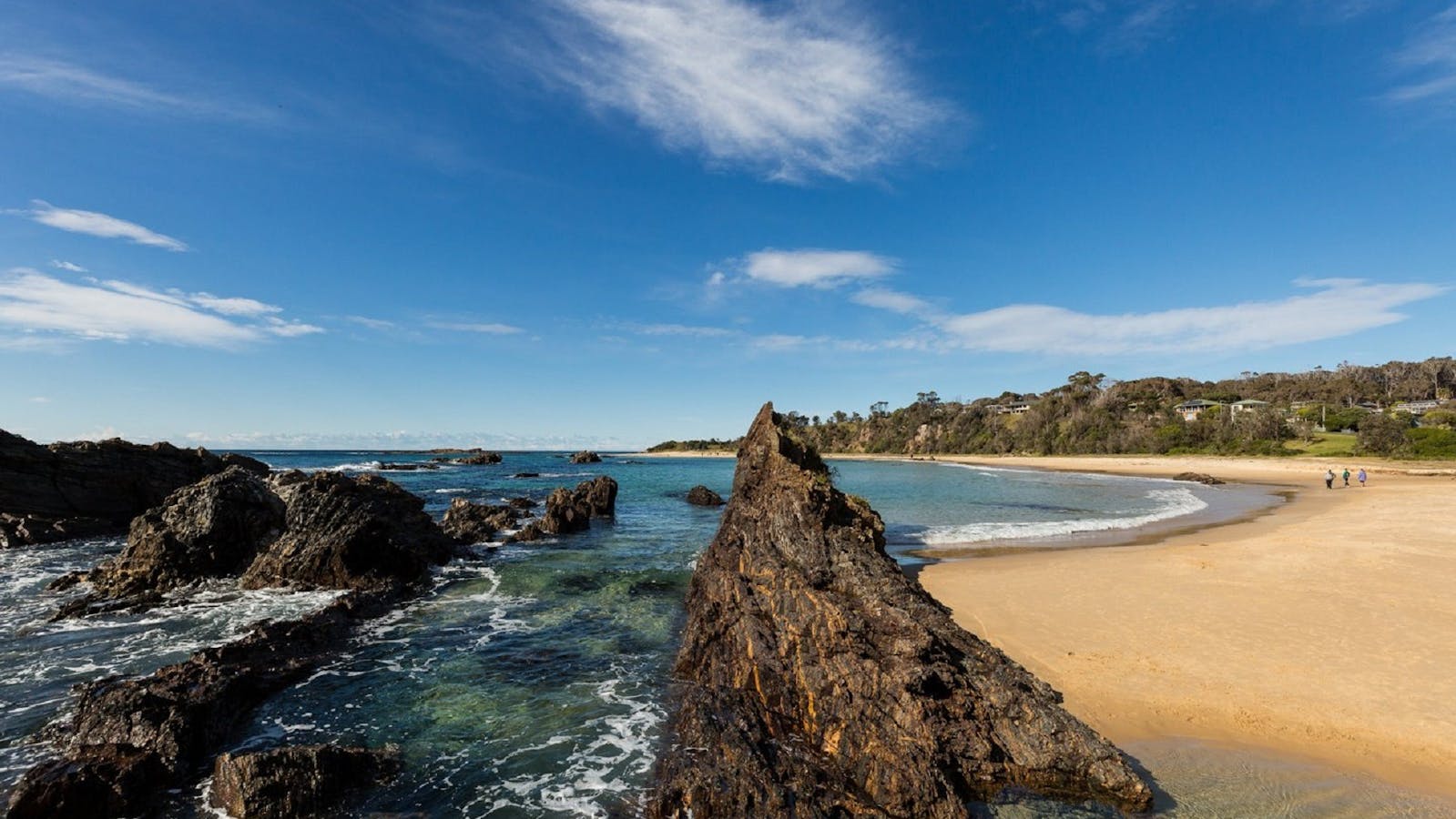
Eurobodalla is home to a world-class gallery of amazing formations and folds of sandstone, siltstone, shale, granite and basalt

Some places date back as far as 510 million years, while the coastline itself was shaped around 90 to 70 million years ago. Covering over 40kms of dramatic coastline north from Batemans Bay, you’ll discover Murramarang National Park features beaches, rock platforms, spotted gum forests and rainforest gullies, all surrounding the beautiful Durras Lake. With spectacular rock formations millions of years in the making, magnificent spotted and blue gum forests and a community of native animals and birdlife, the park is a must for geology enthusiasts, photographers and bush walkers.
Open in mobile
1
Wasp Head South DurrasWasp Head

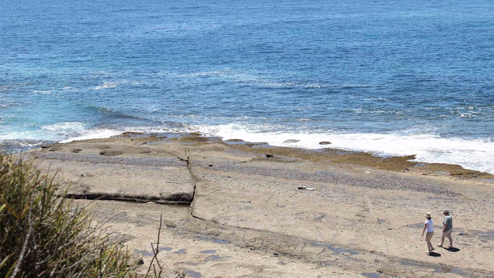
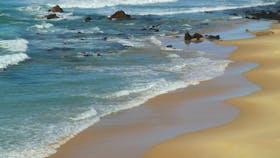
The sculpted sandstone cliffs, which are the exposed southern edge of the 280 million year old Sydney Basin, are a unique treat at Wasp Head

Open in mobile
South Durras, New South Wales, Australia
Get Directions
The golden warm colours of the sculpted sandstone cliffs, which are the exposed southern edge of the 280 million year old Sydney Basin, are a unique treat at Wasp Head, but the spectacle doesn’t end with these beautiful cliffs. Out on the rock ledge of the head, both south and north you will find the most amazing rock formations and evidence of many millennia and life that has gone before. You’ll need your camera as you encounter the honeycomb weathering of the eroded sandstone on the northern side of the head, that from afar looks like a discarded fisherman’s net, or in some places an elaborate spider’s web. While on the southern side the display of ironstone box work - iron rich sediment that has been formed into a box-like pattern - is spectacular and is one of the highlights of Murramarang National Park.
You’ll also see clusters of shellfish fossils, which are clearly evident, embedded in the rocks, as is an old fault plane and igneous dike, with boulders of petrified magma, now basalt, clearly visible. Dropstones and pools of sedimentary conglomerate rock, carried to the area in melt water from west to east as the earth was emerging from an ancient ice age, are also visible and contribute to the richness of this site.
How to get there: Wasp Head is about 8.5km from the Princes Highway. Take the South Durras turn-off just 9.6km north of Batemans Bay and follow it until you reach the Murramarang Resort, turn left immediately after the Murramarang Resort car park, travel along the dirt road for 230 metres and then turn left (no sign) and you’ll drive downhill to the back of Mill Beach where you will see a car park. From here you can walk to the Wasp Head rock ledge – north – and at low tide you walk right around the head. To access the southern side of Wasp Head turn left after the Murramarang Resort car park but instead of turning left to Mill Beach go straight ahead for another two hundred metres, where you will find the Wasp Head car park. Follow the track straight in front of you which is signposted,and clearly defined, for the first sixty metres, you will turn right and connect with an informal foot track, walk another sixty metres to the rock ledge. This is a good access point during high tide, when you won’t be able to walk around the rock ledge. The closest toilets are at the back of Cookies Beach at the western side of Murramarang Resort near the boat ramp.
What to do: Look for the clusters of shell fossils; discover the dike on the southern side of the headland; walk around the headland at low tide, picnic on the grass near the old boiler on the northern side. Take artistic photographs of the wonderful rock formations and patterns in this unique and beautiful natural gallery.
Cookies Beach Picnic Area - South Durras
Banyandah Street, South Durras, New South Wales, Australia, 2536
1800 802 528
info@eurobodalla.com.au
Get Directions
Free Entry
Picnic Area
Picnic Area
Birdwatching
Parking

With spectacular beach views you will be sure to spot one of the many eastern grey kangaroos basking in the sun.

Wasp Head Picnic Area
Wasp Head Road, South Durras, New South Wales, Australia, 2536
1300 072 757
parks.info@environment.nsw.gov.au
Get Directions
Non-smoking, Picnic Area
Picnic Area
Fishing, Swimming
Parking

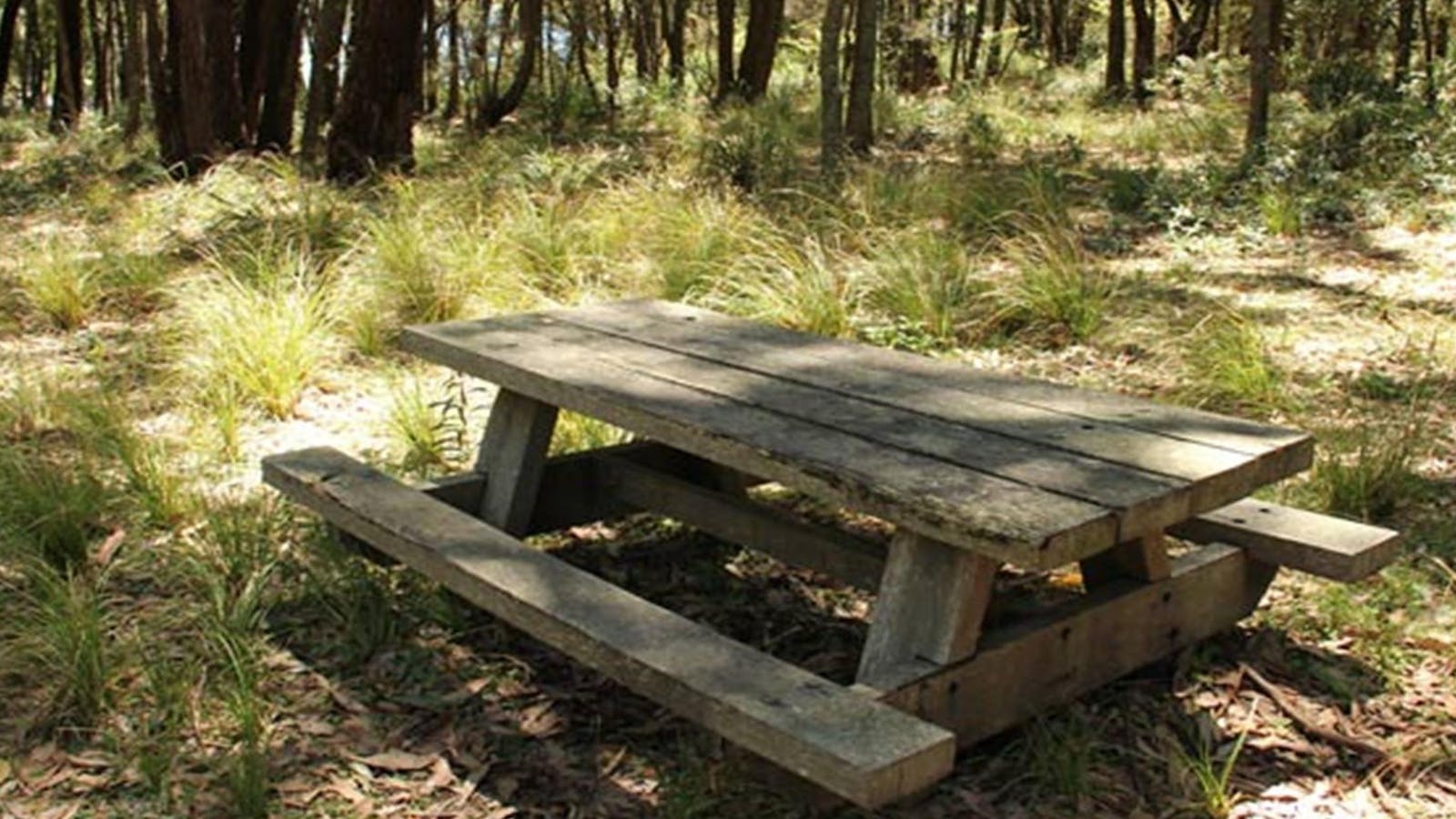
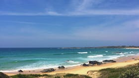
If you enjoy a remote spot for a relaxing lunch, then head to the Wasp Head picnic area near South Durras in Murramarang National Park.

Wasp Head Walk
Photo: John Yurasek/NSW Government
Wasp Head Road, South Durras, New South Wales, Australia, 2536
Get Directions
Walks, Hiking

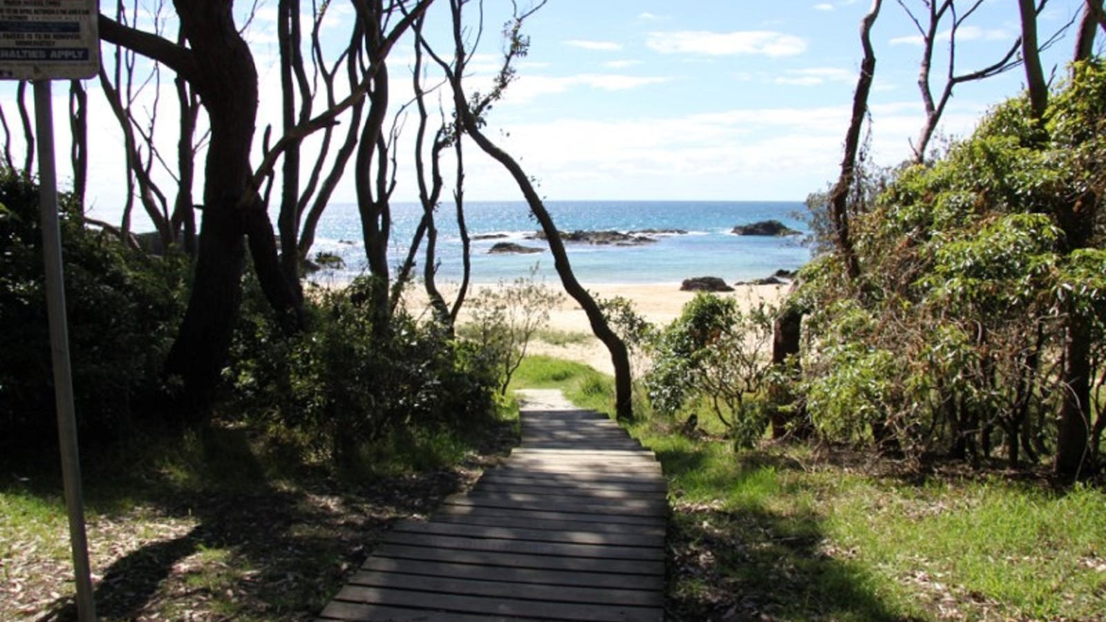
This short, scenic walk in Murramarang National Park, south of Durras Lake, is a delightful easy walk taking in coastal views and golden beaches in

2
Myrtle Beach

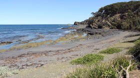
Two worlds collide at Myrtle Beach where the sandstone cliffs of the Sydney Basin come to an end and rise up to meet the Lachlan Fold Belt

Open in mobile
New South Wales, Australia
Get Directions
A trip to Myrtle Beach is an opportunity to see two worlds collide. At Myrtle Beach the breathtaking sandstone cliffs of the Sydney Basin come to an end and rise up to meet the much older Wagonga Ordovician rocks of the Lachlan Fold Belt, which continue south. The point where two major geological units meet is called an unconformity and this unconformity is clearly and strikingly revealed in the cliff face at the northern to middle section of the beach.
The sedimentary rock that forms the massive Sydney Basin, which extends from Newcastle to these beaches just south of Durras and inland to take in the Blue Mountains, was laid down during the Permian and Triassic periods, that is between 300 and 230million years ago, while the older Wagonga Ordovician beds were created 500 to 450 million years ago. At Myrtle Beach look at the cliffs on the northern end of the beach – these are the sandstone cliffs that are the southern most exposed edge of the Sydney Basin, while the cliffs you see at the southern end of the beach are from the Ordovician period.
How to get there: Myrtle Beach is about 9km from the Princes Highway. Take the South Durras turn-off just 9.6km north of Batemans Bay and follow it until you reach the Murramarang Resort. Keep on the road and it will take you through the Murramarang Resort car parking area, keep travelling south along the Old South Coast Road for just over 1km until you get to the Dark Beach/Myrtle Beach turn off where you turn left, then drive along this road for 450 metres to the main car park to access both these beaches. The walk from the car park to Myrtle Beach is approximately 400 metres. The start of the track is facing you as you enter the car park. This track heads part of the way east and is signposted - walk for 200 metres, take the first turn right – which is not signposted – walk a further 200 metres, descend the last part via the staircase. The closest public toilet is near Cookies Beach, next to the Murramarang Resort.
What to do: Walking, picnicking, swimming, photography. This is one of the best spots in Murramarang National Park; the walk to the beach takes you through what the locals call the ‘enchanted forest’, which is an incredible display of stunted spotted gum forests.
North Head campground
North Head Road, Benandarah, New South Wales, Australia, 2536
1300 072 757
parks.info@environment.nsw.gov.au
Get Directions
1 rooms
Non-smoking
$0 AUD*
Parking
* There are no camping fees at this campground but a $6 booking fee applies.

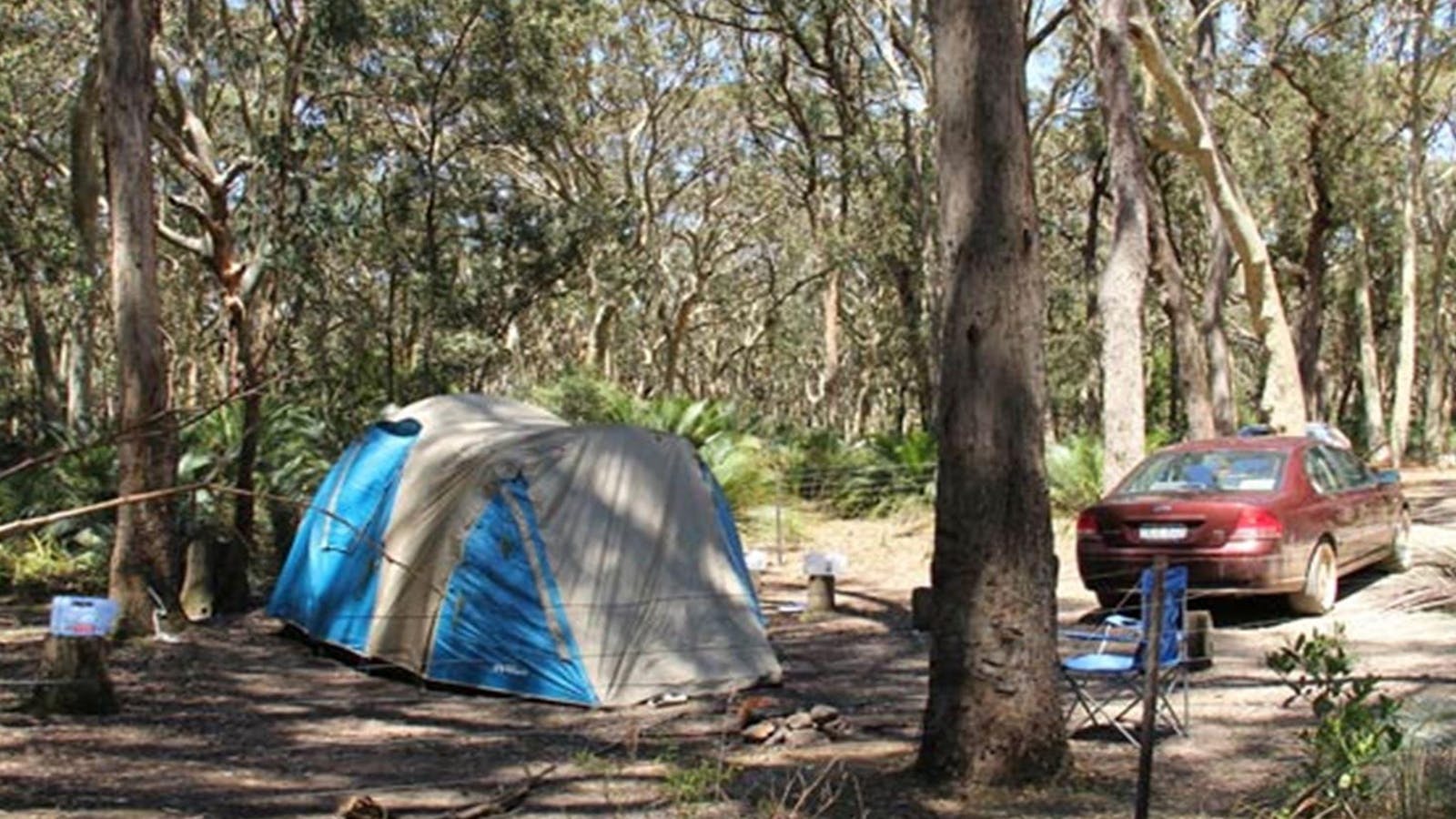
This remote bush camp spot is ideal for the adventurous campers who like to get away from it all. At North Head campground, in Murramarang

North Head Lookout
Photo: M Jarmon
North Head Road, Benandarah, New South Wales, Australia, 2536
1300 072 757
parks.info@environment.nsw.gov.au
Get Directions

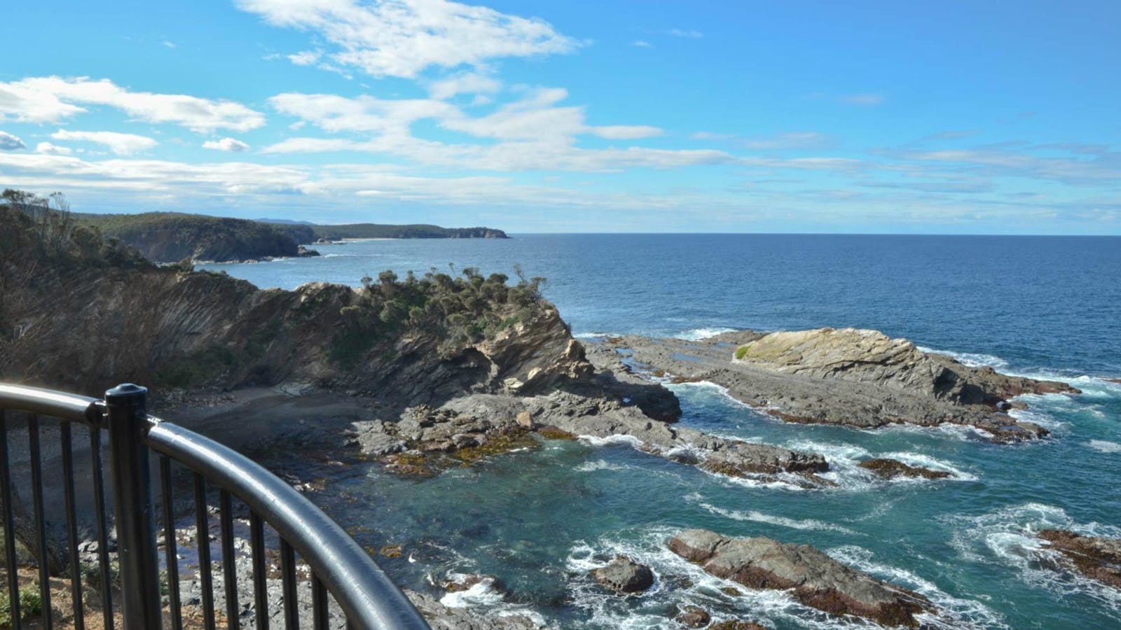
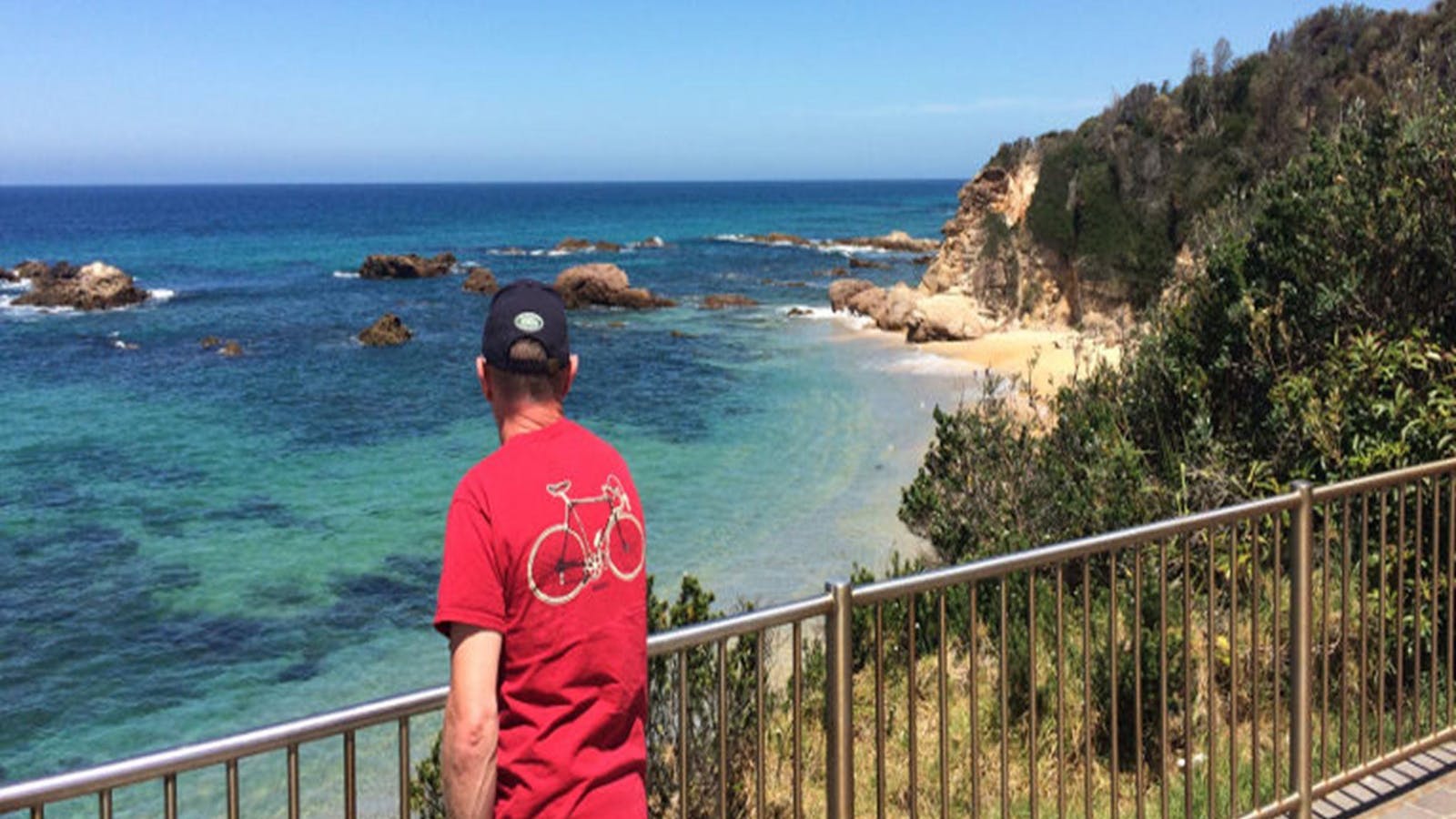
The spectacular cliffs along the Murramarang coastline are on fine display from North Head lookout. After following a well-formed track for 300 metres over gently

Honeysuckle Beach Walking Track
Photo: John Yurasek/NSW Government
North Head Road, Benandarah, New South Wales, Australia, 2536
Get Directions
Walks, Hiking

Honeysuckle Beach walking track is a great short hike in the southern end of Murramarang National Park, just north of Batemans Bay. It’s an ideal

Oaky Beach Walking Track
Photo: Michael van Ewijk
Old Coast Road, Benandarah, New South Wales, Australia, 2536
Get Directions
Walks, Hiking

A great off the beaten track hike, Oaky Beach walking track leads through gums and rainforest to a secluded beach in the southern area of

Myrtle Beach walking track
Old Coast Road, Benandarah, New South Wales, Australia, 2536
Get Directions
Canoeing/Kayaking, Walks, Hiking

Get away from it all and escape to this beautiful, isolated beach for the day.  Surround yourself with natural bushland and revel in the sounds

Dark Beach Walking Track
Photo: Michael van Ewijk
Old Coast Road, South Durras, New South Wales, Australia, 2536
Get Directions
Walks, Hiking

Enjoy a relaxing day away on this remote beach in Murramarang National Park, on the South Coast. Dark Beach walking track leads through spotted gum

3
Guerilla Bay

Guerilla Bay is one of the most hidden, sheltered and picturesque bays in Eurobodalla, and has been formed in some of the oldest rocks.

Open in mobile
Guerilla Bay, New South Wales, Australia
Get Directions
Guerilla Bay is one of the most hidden, sheltered and picturesque bays in Eurobodalla, and has been formed in some of the oldest rocks - dating back 510 million years - along Eurobodalla’s coastline. These exciting rock formations and features are layers of chert and slate, and were initially laid down in the ancient Pacific Ocean, before becoming part of the Gondwana continent possibly during an interval of subduction.
A subduction zone is an area where tectonic plates move together, or converge, with one plate overlapping and overriding the other; they can sink to great depths in the Earth’s mantle at a 25 to 90 degree angle. Through the high temperatures and pressures associated with this process, seabed sediment is converted to rock. Although plate movement only occurs at a rate of centimetres per year (comparable to fingernail and toenail growth rates), an active zone such as in Japan or New Zealand, can cause tsunamis and earthquakes. Through plate movement sediments and rocks can be carried long distances to become part of land masses.
Squeezed, bent and broken after they formed, possibly as a result of compressive movement within the ancient subduction zone, these Guerilla Bay rocks now consist of a mix of fragments called tectonic melange. Also contained in these chert rocks are tooth-like microfossils (less than 1mm) from the gut of extinct eel-like animals, however a microscope is needed to see these minute fossils.
How to get there: Guerilla Bay is 13km south of Batemans Bay and accessible from George Bass Drive. Drive south along the Princes Highway to Mogo, turn left into Tomakin Road, and left into George Bass Drive. Or take the scenic coast route from Batemans Bay along Beach Road to George Bass Drive via Batehaven, Lilli Pilli, Malua Bay and Rosedale. From George Bass Drive, turn east into Burri Point Rd which takes you to Guerilla Bay. There is a small car park, a few picnic tables but no other amenities.
Things to do: Guerilla Bay is suitable for swimming, snorkelling and kayaking in calm seas and is the starting point for the 1.5km Banksia Walk to Burrewarra Point. The kids will love the rock pools and climbing the rocks.
Burrewarra Point Lookout
Burri Point Road, Guerilla Bay, New South Wales, Australia, 2536
1800 802 528
info@eurobodalla.com.au
Get Directions

The lookout is a charming 10 minute walk from the carpark on Burri Point

Burrewarra Point Banksia Walk
Burri Point Road, Guerilla Bay, New South Wales, Australia, 2536
1800 802 528
info@eurobodalla.com.au
Get Directions
Free Entry
Birdwatching, Hiking, Walks

Burrewarra Point has a charming walk through a mature banksia forest with views of the coast and hinterland.

4
Bendethera Caves Trail

Sparkling limestone in the mountains of the Deua National Park.

Open in mobile
Bendethera Caves Trail, New South Wales, Australia
Get Directions
White limestone in the creek bed that runs along the walking trail leading to the Bendethera caves is easily seen and is lovely in its natural state. It’s also a reminder that you’re now walking through the largest karst (limestone) area in Deua National Park. The walking trail meanders along, following and crossing Con Creek many times, with the sound of the bubbling, flowing water a peaceful, welcome fellow traveller. About 3km into the walk covering the hillside to the right of the trail is another feature of the area, the endemic Bendethera wattle that is unique to the limestone soils in this region. Also known as blue bush, depending on the time of year, you can expect to see a display of shimmering blue green foliage, or a sea of yellow flowers.
To the left of the trail, and with interpretive signs thanks to the diligence of the NSW National Parks and Wildlife Service are a number of dolines, which are circular bowl shaped depressions in the limestone. Dolines are one of many weathering features, including caves that form when rainwater dissolves limestone and the solution seeps away through the rock.
The limestone has been identified as forming in a shallow sea during the Silurian Period and is between 440 and 415 million years old. Limestone consists of calcium carbonate, the main gluing agent in cement. The limestone contains abundant fossils, the remains of shell marine animals. It predates the Great Dividing Range itself, which formed from 250 million years BP onward, possibly through uplifting over the ages and during the rifting of the Lord Howe Rise from the east coast 90 to 70 million years ago.
How to get there:The Bendethera Caves walking trail is 48km from Moruya. If driving south from Batemans Bay on the Princes Highway turn right at the roundabout at Moruya into Campbell Street, which is the road to Araluen. Campbell St turns into Luck Street, which will take you out of town for about 3kms then turn left into Womban Road. Womban becomes Little Sugarloaf Road follow Little Sugarloaf for 30km until you get to the Bendethera Fire trail, which is clearly signposted as the way to Bendethera. Be aware that from this point on it is four-wheel-drive access only and there is steep terrain and three river crossings. Turn left onto the fire trail and follow for 9kms. The only public toilets are a few kilometres from the walking trail at a clearing near the river, where the old homestead was situated. The walking trail to the caves is an 8km return trip, and is very steep in its final stages. If accessing the caves take appropriate footwear, headgear and torches. The wattle and dolines are about three kilometres along the track and the walk there is moderately easy with numerous creek crossings. Always check in with the National Parks and Wildlife Service as to conditions.
What do to:Get away from it all and camp along the Deua River near site of the old homestead; bushwalk; explore the caves and the limestone environment; taste the clear mountain creek water near its source.For more information call the National Parks and Wildlife Service at Narooma on 02 4476 0800.
Bendethera Valley campground
Bendethera Camp Trail, Deua, New South Wales, Australia, 2537
1300 072 757
parks.info@environment.nsw.gov.au
Get Directions
1 rooms
Non-smoking
Barbeque
$0 AUD*
* There are no camping fees at this campground but a $6 booking fee applies.

The beautiful and remote campground of Bendethera Valley is the ideal place for a relaxing break, as well as a great base for cavers.

Bendethera Caves Walking Trek
Bendethera, Deua River, New South Wales, Australia, 2537
Get Directions

5
Bingie Bingie Point

A site of intense interest to geologists and their students because of the prolific and spectacular display of intrusive igneous rocks.

Open in mobile
Bingie, New South Wales, Australia, 2537
Get Directions
Bingie Bingie Point is a site of intense interest to geologists and their students because of the prolific and spectacular display of intrusive igneous rocks on the northern side of the point, which lies at the northern end of Bingie Beach. The NSW National Parks and Wildlife Service says the area is regarded as outstanding among exposures of igneous intrusive rocks in New South Wales and is the main geological point of interest in Eurobodalla National Park. It is where a complex association of two igneous rock types exists - granite (Tuross Head tonalite) and gabroic diorite (Bingie Bingie suite).
Intrusive rock bodies are masses of magma which have cooled and crystallized below the earth's surface as opposed to having been formed from a volcanic eruption and cooled on the surface. The Bingie Bingie Point rocks are part of the early Devonian granites of the Moruya batholith and are 415 to 390 million years old.A batholith is a body of rock that has formed in the earth’s crust and is usually granite.
Bingie Bingie Point is also on the Bingi Dreaming Track, which is a coastal path used by the Brinja-Yuin people prior to European development. The track is a total of 13.5 km and runs from Congo south to Tuross Heads. The point is easily accessible and well worth a visit whether to explore the rocks or to walk a part of the Bingi Dreaming Track.
How to get there: Follow the Princes Highway south out of Moruya for about 9km. Take the turn off at Bingi Road to Bingi and Congo. Follow Bingi Road for about seven kilometres until the T-junction and a sign pointing to Bingie Point and Eurobodalla National Park, turn right (this is still Bingi Road) follow the road for a few kilometres and then turn left (again this is still Bingi Road) and follow the road down to the Bingie Bingie Point. There are no amenities.
What to do:Walk amongst the rocks and see the contrast, take in the 360 degree view; walk to Tuross or Congo, take a deck chair and watch for whales; practise your photography.
Bingi Dreaming Track
Destination NSW
Tuross Boulevard, Tuross Head, New South Wales, Australia, 2537
Get Directions
Walks, Hiking

Follow in the footsteps of the Brinja-Yuin people as you walk the Bingi Dreaming track.

Cathedral Rocks: Bingie
Mullimburra Point Road, Bingie, New South Wales, Australia, 2537
1800 802 528
info@eurobodalla.com.au
Get Directions
Free Entry
Birdwatching, Hiking, Walks
Parking

An excellent photo opportunity with the best time being in late afternoon light when the setting sun gives the rocks an incandescent-like glow.

Bingie Beach North
Mullimburra Point Road, Bingie, New South Wales, Australia, 2537
1800 802 528
info@eurobodalla.com.au
Get Directions
Free Entry
Birdwatching, Hiking, Surfing, Swimming, Walks
Parking

Hidden away from the water are evidence of shell middens, stone working areas and quarries providing strong links to Aboriginal culture.

6
Barunguba Montague IslandMontague Island

Montague Island, 9km offshore from Narooma, is of interest to not only geologists, but lighthouse historians, nature lovers and eco-tourists

Open in mobile
Montague Island, New South Wales, Australia
Get Directions
This amazing nature reserve, which has won many awards for its eco-tourism tours, is a seabird haven and is part of the Mt Dromedary Igneous Complex. The northern part of the island is made up of a andesite lava extrusion from a volcanic eruption on Gulaga, or Mt Dromedary as it is also called, about 95 million years ago in the Cretaceous period. The dark coloured rocks in the north contrast with the southern part of the island which has been formed through intrusive igneous rocks that have cooled underneath the surface and been exposed through erosion. These rocks were also formed through the activity of the ancient volcano. These igneous intrusions in the south of the island now take the shape of impressive sculptural tors that have been well-rounded and smoothed with weathering.
Until about nine thousand years ago the island was part of the mainland, connecting with Cape Dromedary, just south of Mystery Bay, by a sand spit. Barunguba Montague Island is now 9km offshore from Narooma and of interest to not only geologists, but lighthouse historians, nature lovers and eco-tourists. It is also a very culturally significant place to the local Yuin people.
How to get there: Book through the NPWS Narooma Office on 02 4476 0800. You can book overnight or day trips.
What to do: Help with conservation work; watch the penguins as the surf into the rocks in the evenings; whale watch in spring; relax, paint and take photographs; bird watch and climb the lighthouse.
Barunguba Montague Island Nature ReserveMontague Island Nature Reserve
Montague Island, Narooma, New South Wales, Australia, 2546
1300 072 757
parks.info@environment.nsw.gov.au
Get Directions
Non-smoking
Birdwatching, Walks, Lookouts

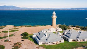
Montague Island Nature Reserve is home to hundreds of seals and more than 90 bird species. Enjoy a stay in a heritage lighthouse keeper’s cottage.

Montague Island Lighthouse
Photo:Stuart Cohen
Montague Island, New South Wales, Australia, 2546
Get Directions

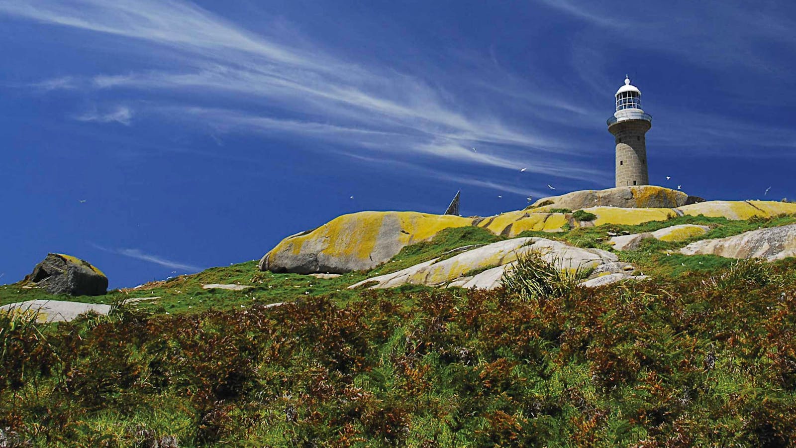
Montague Island Lighthouse is the perfect place to get in touch with history while seeing dramatic views, amazing birds and marine wildlife. Let your inner

7
Glasshouse Rocks - Surf Beach NaroomaGlasshouse Rocks

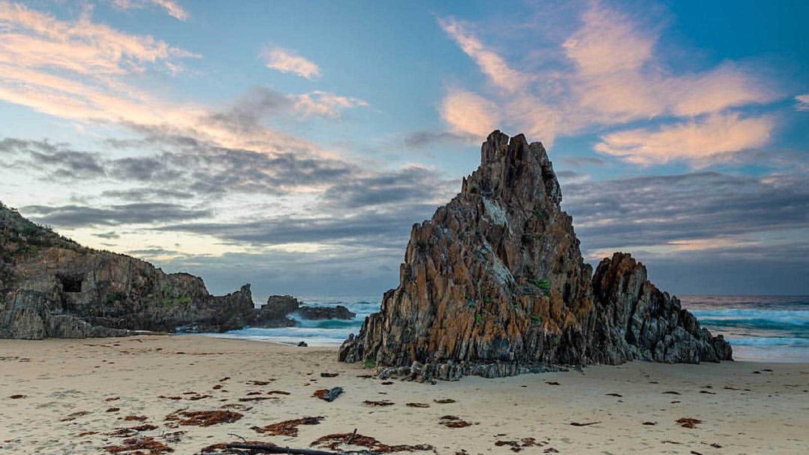
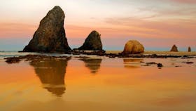
Glasshouse Rocks are possibly the most photographed rocks along the Eurobodalla coastline.

Open in mobile
Get Directions
Surf Beach, Narooma has two sites of geological significance and beauty at either end of the sandy beach, which is approximately 1km in length and looks out to Montague Island. At the southern end lie the imposing Glasshouse Rocks – which are possibly the most photographed rocks along the Eurobodalla coastline and have been recognised by the geological sites and monuments subcommittee of the Geological Society of Australia. The Glasshouse Rocks are Narooma Chert, which is a mix of sedimentary chert and shale, and are part of the Cambrian/Ordovician Wagonga Group, dating between 510-440 million years old.
It’s easy to see the aesthetic chevron folds in a number of the rocks, where the sedimentary layers have been squeezed into zig zag patterns. Although interpretations of ancient tectonics are far from unanimous, many geologists consider that these rocks came together as part of a subduction zone, with an ancient Pacific plate thrust under the eastern edge of the Gondwana plate. At the northern end of Surf Beach there is a display of igneous pillow lava, which formed through the lava flow of a submarine volcano or hot spot also in the ancient Pacific Ocean, and made its way to the edge of the continent in the subduction process.
How to get there: The Glasshouse Rocks begin at the southern headland at the end of Surf Beach. This headland is also home to Narooma’s cemetery. At low tide you can walk round the headland to Glasshouse Rocks North Beach and see more of the rocks, which are impressive in their stature. The pillow lava display is easily accessed along the beach approximately only 300 metres north of the Surf Beach car park and amenities. To get to Surf Beach turn off the Princes Highway, south Narooma, into Willcocks Avenue, follow this road down to Surf Beach. (Note Willcocks Avenue turns into Ballingalla Street.) Magnificent views of Glasshouse Rocks may be enjoyed from Narooma Golf Club and the rise above Surf Beach.
What to do: Have a coffee and something to eat; swim; surf; walk to Glasshouse Rocks and explore the cemetery; take photos of the mysterious light that comes from the rocks and check out the beautiful colour, texture and patterns in the pillow lava at the northern end of the beach.
Narooma Surf Beach
Ballingalla Street, Narooma, New South Wales, Australia, 2546
1800 802 528
info@eurobodalla.com.au
Get Directions
Free Entry
Public Toilet, Picnic Area
Picnic Area, Cafe
Public Toilet
Surfing, Swimming
Parking

Only minutes from the centre of Narooma, this picturesque beach looks out to Montague Island.

Glasshouse Rocks and Pillow Lava
Willcocks Avenue, Narooma, New South Wales, Australia, 2546
1800 802 528
info@eurobodalla.com.au
Get Directions
Free Entry
Birdwatching, Hiking, Scenic Drives, Walks
Parking

Surf Beach, Narooma has two amazing sites of ancient geological significance and beauty at either end of the sandy beach.

8
Mystery Bay Kink Zone

The disappearance of government geologist, Lamont Young, his assistant and three other men in 1880 remains an unsolved mystery to this day.

Open in mobile
Mystery Bay Road, New South Wales, Australia, 2546
Get Directions
Mystery Bay’s name arises because of the mystery surrounding the disappearance of a government geologist, Lamont Young, his assistant and three other men in 1880, whose mission was to inspect new goldfields. The bay and its dramatic rocks that arise from the sea and along the shoreline, with Montague Island the brooding backdrop have also caused locals and tourists to ponder on the mysterious nature of the place itself.
These rocks which are such a dominant feature are chert, black mudstone and slate and date back nearly 500 million years to the Ordovician period. The outcrops lie in what is called in geological terms a kink zone, which means they’ve been subjected to great pressure during the moving of tectonic plates. A feature called foliation, which has formed during movement at high pressure and which has enabled further deformation, is apparent in the kinks and breaks in the angular brittle rocks, which makes these rocks look as if they could have been pieced together one by one. Kinks zones are widely developed, but are particularly well shown in this area of Eurobodalla’s coastline.
How to get there: Mystery Bay is 15km south of Narooma, and 70km south of Batemans Bay. It is a short 2km from the Princes Highway. From the highway turn left on to Mystery Bay Road. Follow Mystery Bay Road into Mystery Bay. There is car parking at both the northern and southern end of the beach. The car park opposite Lamont Young Drive as you come into Mystery Bay (where you will find a memorial plaque to the lost geologist and his party) is a good place to access the display of kink zone rocks that lie at the northern end of the beach. There are toilets at the primitive camping ground site on the left as you come into Mystery Bay.
What to do: Camp, swim, surf, fish, walk around the village and along the beach, explore the rock pools, bushwalk in Eurobodalla National Park, dive and snorkel.
Mystery Bay lookout
Mystery Bay lookout, Mystery Bay, New South Wales, Australia, 2546
1300 072 757
parks.info@environment.nsw.gov.au
Get Directions
Non-smoking
Barbeque
Sailing, Lookouts, Boating Facilities
Parking

Mystery Bay lookout is in the most southern part of Eurobodalla National Park not far from the picturesque hamlet of Mystery Bay. The lookout offers

Mystery Bay to 1080 Beach Walk
Mystery Bay, Mystery Bay, New South Wales, Australia, 2546
1800 802 528
info@eurobodalla.com.au
Get Directions
Walks

A ten minute stroll from the entrance to Eurobodalla National Park will find you at Pooles Beach.

Historic Mystery Bay Velodrome
Mystery Bay Road, Mystery Bay, New South Wales, Australia, 2546
1800 802 528
info@eurobodalla.com.au
Get Directions
Free Entry
Public Toilet, Picnic Area
Picnic Area, Barbeque
Public Toilet
Mountain Biking, Birdwatching, Camping, Cycling, Walks
Parking

A scenic track takes you on a loop from Mystery Bay, through the camping ground, and to the historic Velodrome.

Mystery Bay Camping Area
Mystery Bay Road, Mystery Bay, New South Wales, Australia, 2546
0428 622 357
mysterybay@belgraviapro.com.au
Get Directions
500 rooms
Fireplace
$15 ~ $25 AUD*
* Subject to change and availability

Mystery Bay campground fronts the ocean and is one of the few natural camping areas remaining on the New South Wales South Coast.

Mystery Bay Short Walk
Mystery Bay Campground, Mystery Bay, New South Wales, Australia, 2546
1800 802 528
info@eurobodalla.com.au
Get Directions

From Mystery Bay camping area follow the bush track north to Billy's Beach, an important Aboriginal site and great for families.

9
Gulaga Mountain

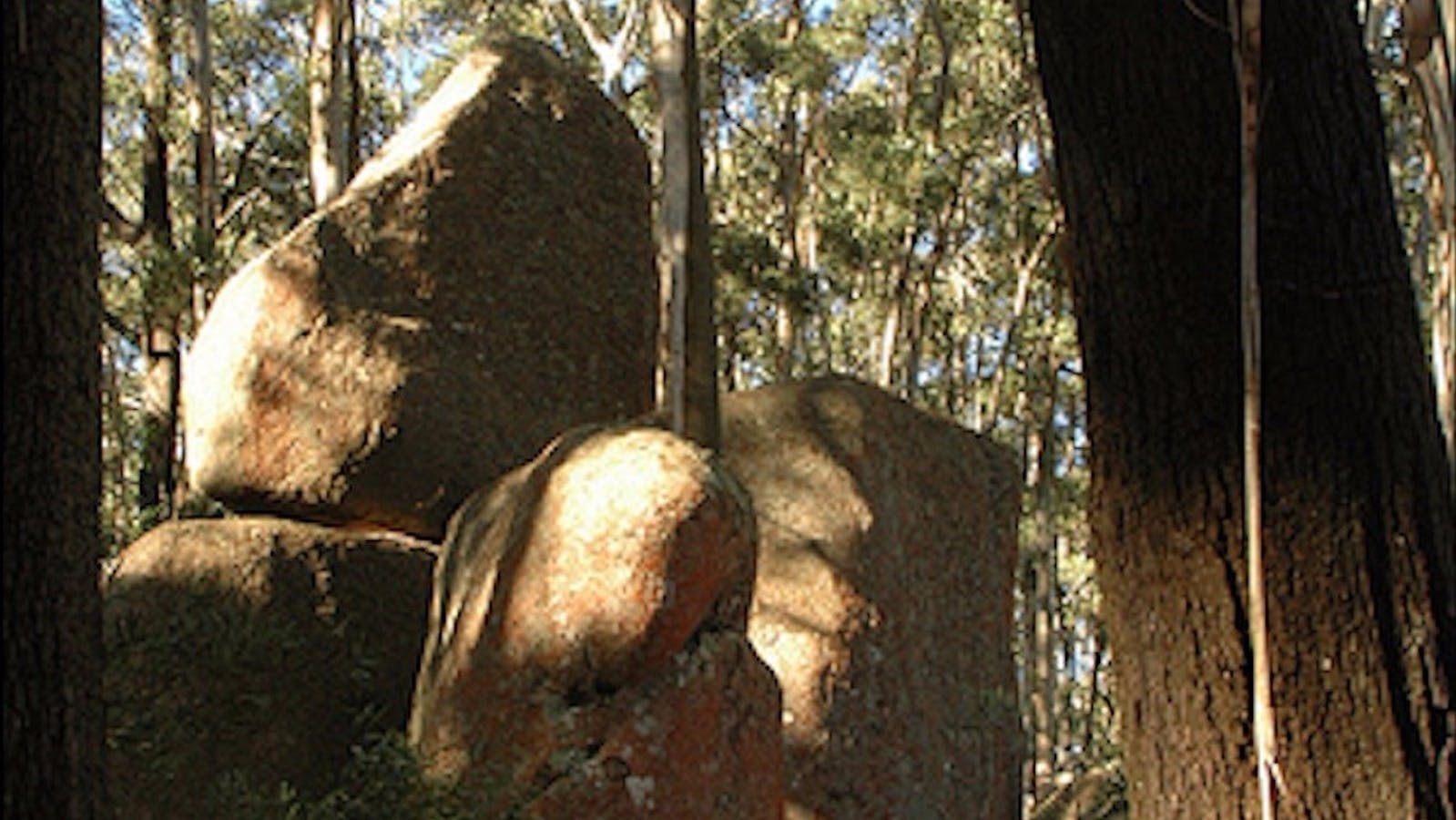
The magnificent granite tors at the summit of Gulaga are of great spiritual and cultural significance to the Yuin Aboriginal people.

Open in mobile
New South Wales, Australia, 2546
Get Directions
The forested ancient volcano that is Gulaga, also known as Mt Dromedary, can be seen from Tathra to Moruya, and hides near its summit magnificent granite tors that are of great spiritual and cultural significance to the Yuin Aboriginal people of the south coast. There have been a number of volcanic eruptions from Gulaga, the first about 95 million years ago during the Cretaceous period when dinosaurs were still at the top of the food chain.
The volcano has had a significant impact on the surrounding environment with both Little Dromedary (Najanuka) to the east and Montague Island (Baranguba) formed through the volcano’s activity. Gulaga, which is now about 800 metres above sea level, would have originally been close to two thousand metres higher, and its foothills would have extended to Tuross. The mountain that you see today is basically the inner core of the original volcano. The volcano has been dormant since the Cretaceous - which ended 65 million years ago.
How to get there: The NSW National Parks and Wildlife Service and the Gulaga Board of Management consisting of a majority of Yuin Aboriginal owners are responsible for the management of Gulaga National Park and encourage all visitors to enjoy the walk to the summit. This is approximately an 11km, 5 hour return trip that is steep in parts. The walk begins on the path behind Pam’s General Store at Tilba Tilba. There are two turn offs to Tilba Tilba from the Princes Highway, approximately 18 and 16kms south of Narooma. The first will take you through heritage-listed Central Tilba and then on to Tilba Tilba which is three kilometres from the highway. The second turn off will take you straight to Tilba Tilba 1km from the highway.
What to do: Walking, photography. Take a light picnic in your pack as you walk the path up to the top of the mountain. Enjoy the changes in the surrounding vegetation and bird life as you go from the lowlands up the mountain, through pockets of misty rainforest near the summit.
Bellbrook Farm Loop Walk
Eurobodalla Shire Council
Station Street, Central Tilba, New South Wales, Australia, 2546
info@eurobodalla.com.au
Get Directions
Picnic Area
Picnic Area

A scenic 2km walk around the foothills of Gulaga (Mount Dromedary). Start the walk at the end of Station Street, which runs off Bate Street

Bellbird Scenic Drive Tilba
Corkhill Road, Tilba Tilba, New South Wales, Australia, 2546
1800 802 528
info@eurobodalla.com.au
Get Directions
Free Entry

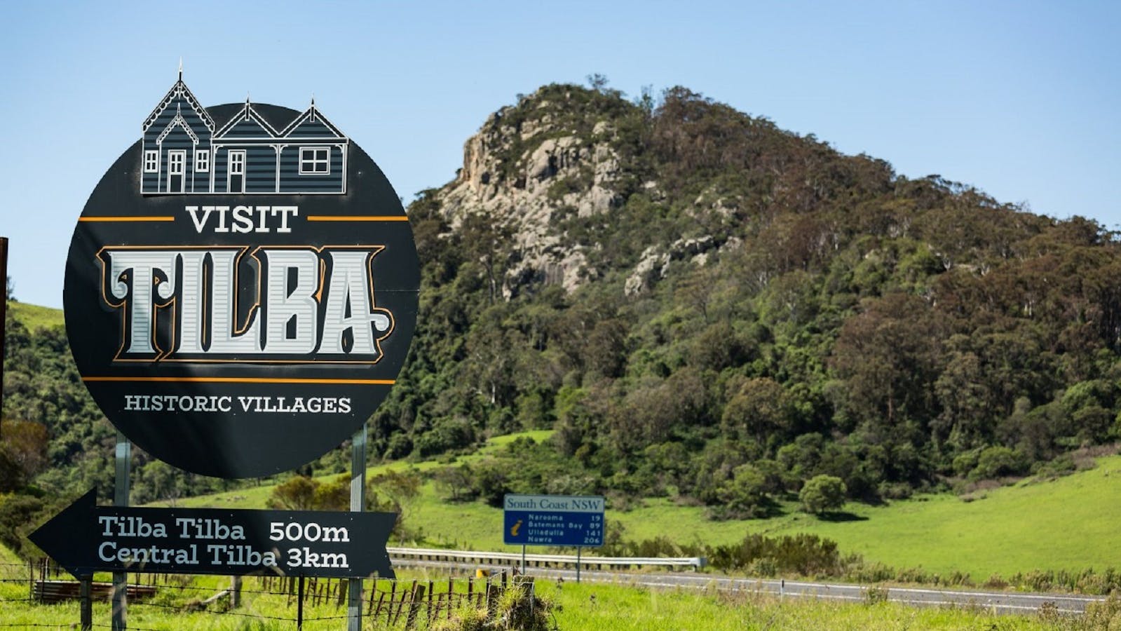
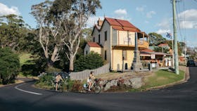
The drive begins at the village of Tilba Tilba. Here you can visit the wonderful Foxglove Spire Gardens and specialty shops.

The Tilba District Heritage Areas
The District Heritage Areas, Tilba, Central Tilba, New South Wales, Australia, 2546
1800 802 528
info@eurobodalla.com.au
Get Directions

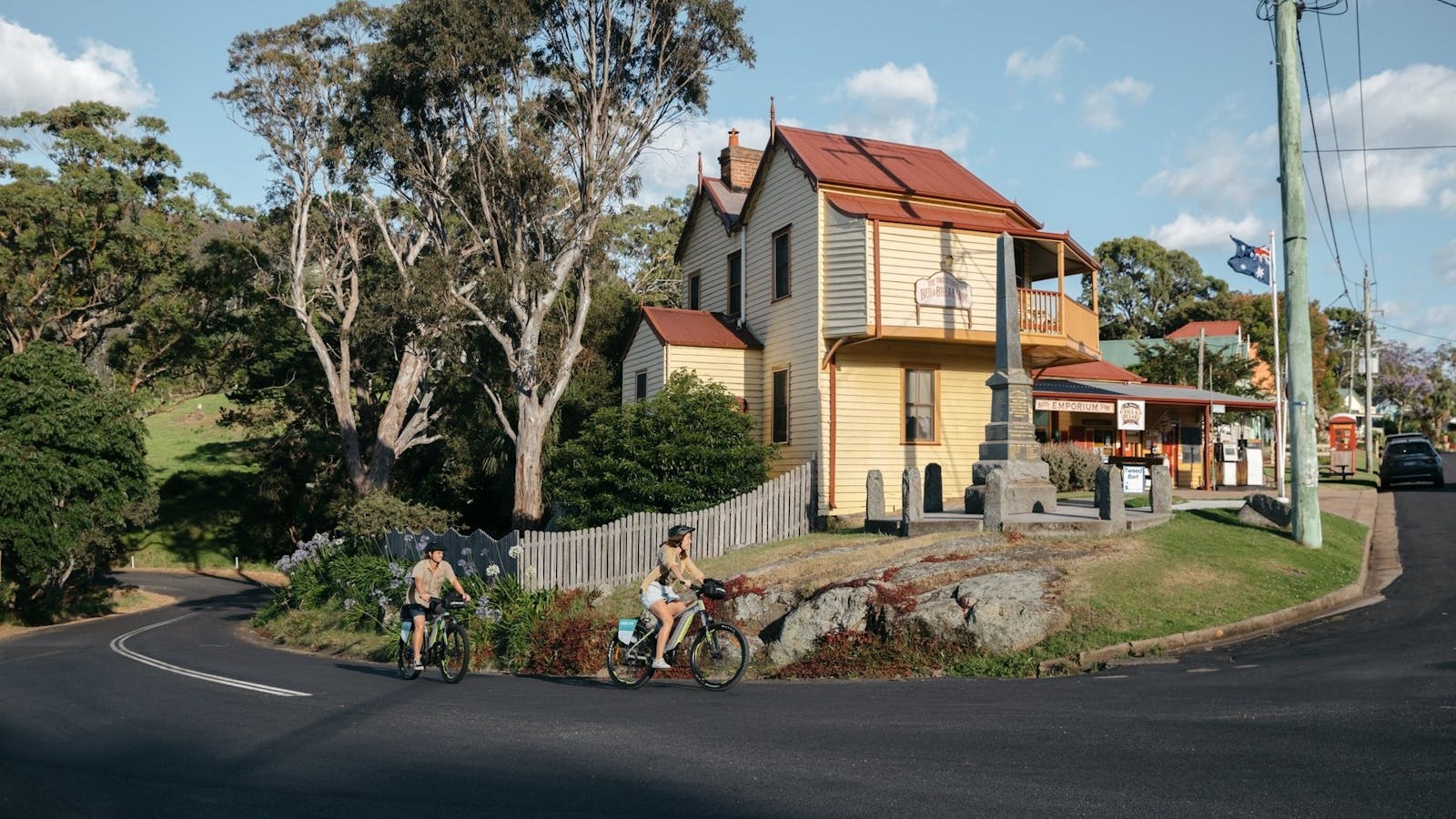
The Tilba Conservation Area was listed by the National Trust in 1974. Gulaga, formerly Mt Dromedary, is sacred to the people of the Yuin nation.

Gulaga National Park
Gulaga National Park, Tilba Tilba, New South Wales, Australia, 2546
(02) 4476 0800
Get Directions
Free Entry
Birdwatching, Walks
Parking

Gulaga National Park was created in January 2001. It covers an area of 4673ha. Gulaga (Mount Dromedary) and the surrounding landscape have great spiritual significance

Using QR Codes

Open your Camera App or download a QR reader

Point your camera at the QR Code which will launch the correct app

Access websites and features such as maps and directions

Optional Downloads

GPX File

For use in apps such as GPS Navigation and wearable devices

KML File

For use in offline mapping products, such as maps.me and Google Maps

PDF File

A link to this document

Build your own itineraries

Alpaca provides a way for you to build your own itineraries. Visit https://alpaca.travel

Terms of Service and Attribution

Copyright Alpaca.travel, Mapbox.com and OpenStreetMaps openstreetmaps.com.
Terms of Service https://alpaca.travel/terms